Our next stop was at Antelope Canyon. Page, Arizona is home to some of the most spectacular geological marvels you’ll ever see. Upper Antelope Canyon is possibly the most famous slot canyon on the planet, and the most-photographed slot canyon in the world. This canyon is a special work of art created by nature. A maze of curving walls with incredible colors was formed mainly by erosion of the sandstone caused by flash flooding.
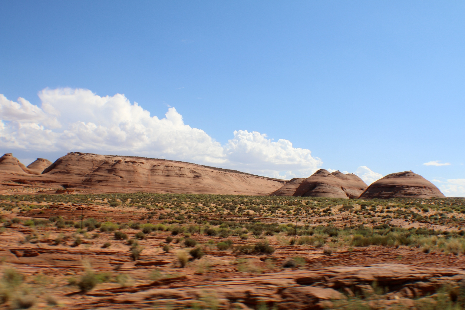
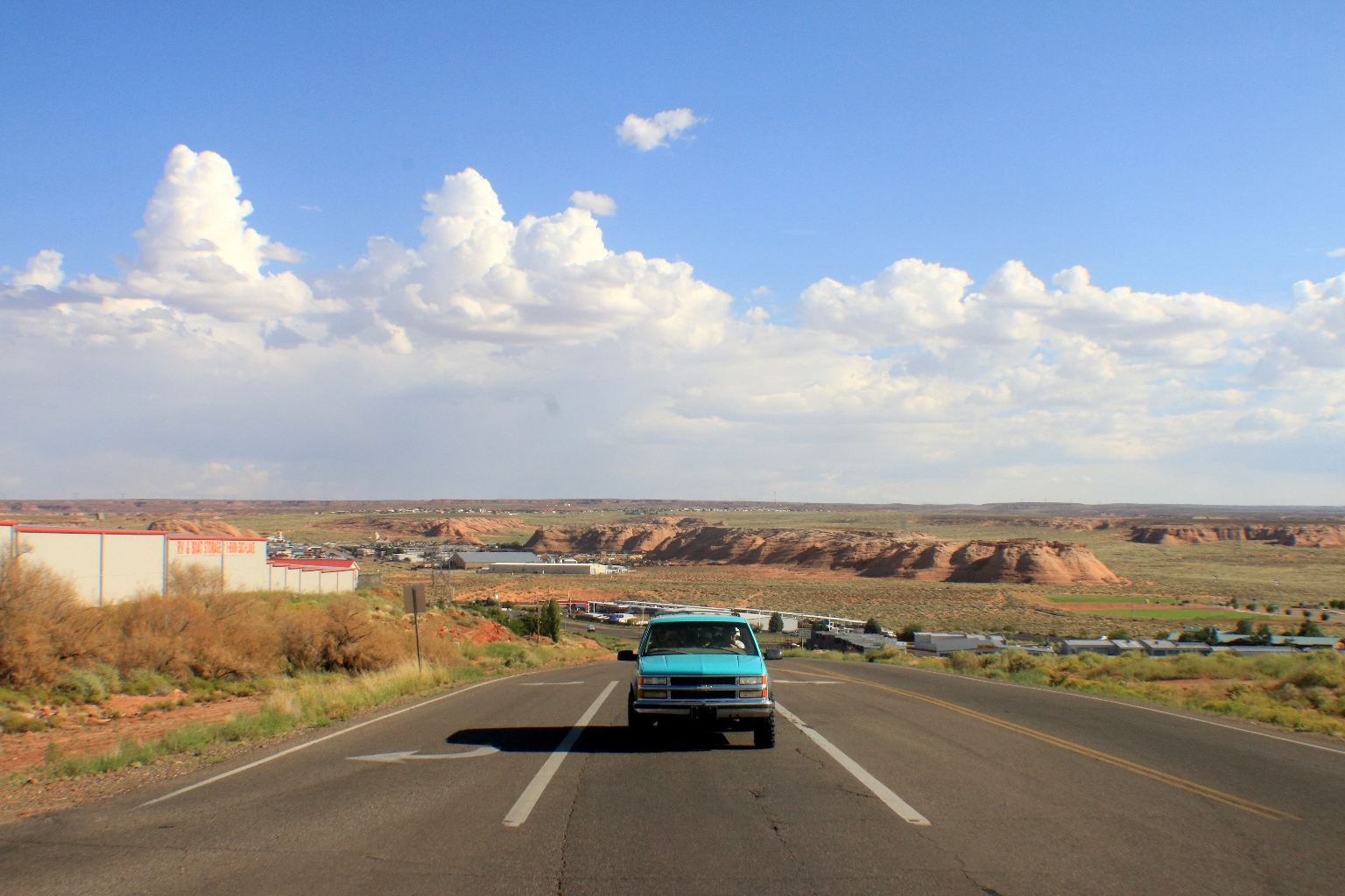
From the Grand Canyon we spent about 2.5 hours driving to Page city in Arizona. This state looks so different that any other states I’ve visited before. Driving through the desert, we had a chance to observe some interesting cliff formations called The Echo Cliffs. Here are some pictures taken from the car.
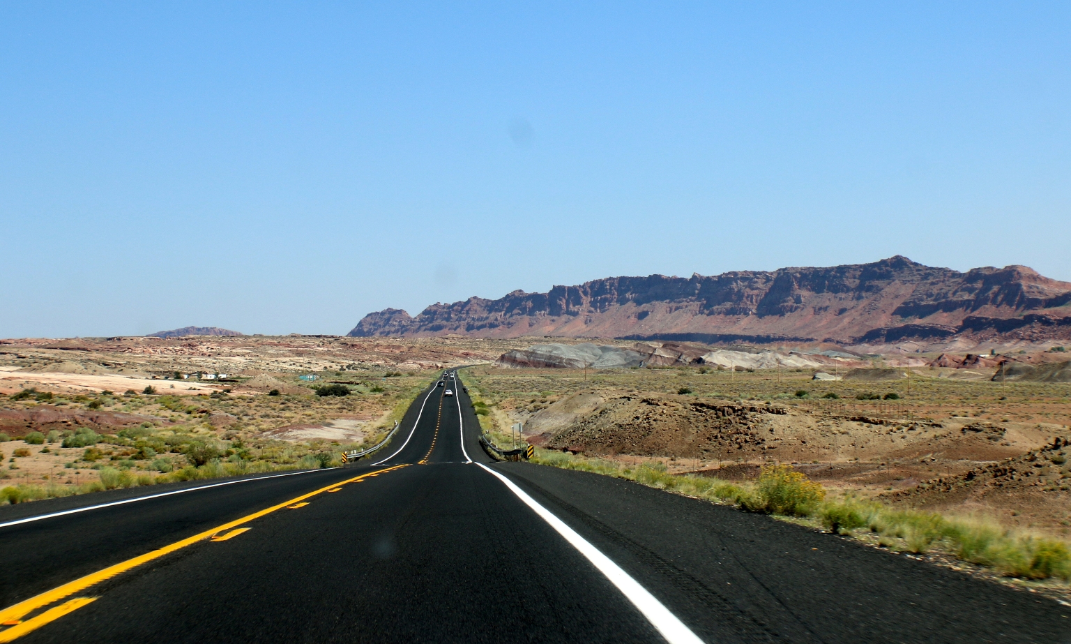
The Echo Cliffs run along the east and west sides of Route 89, named by John Wesley Powell in 1895. He was a former US soldier of the Civil War, geologist and explorer of the Southwest.
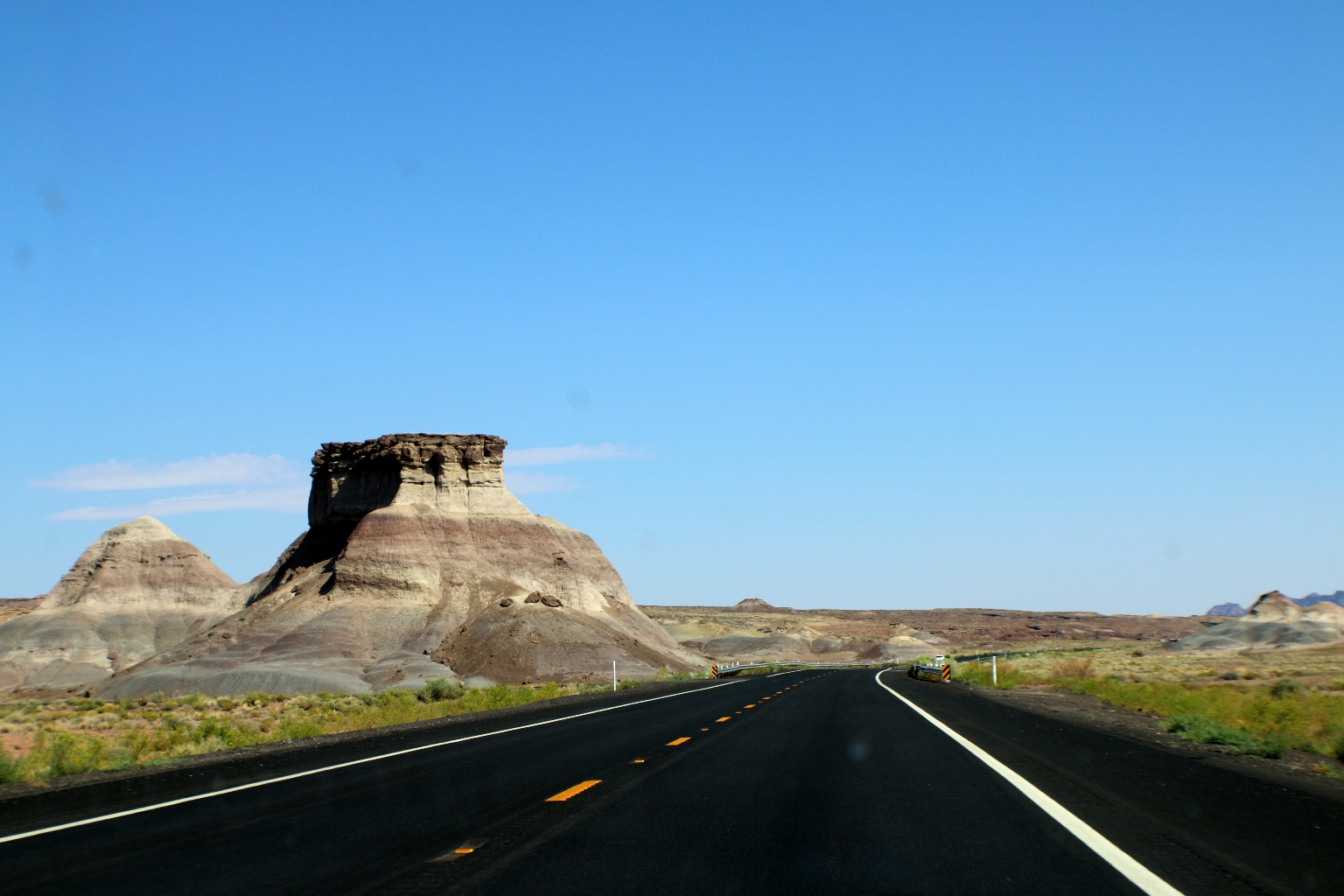
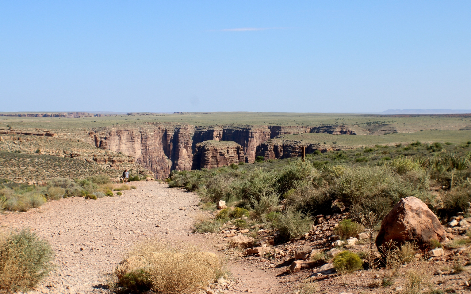
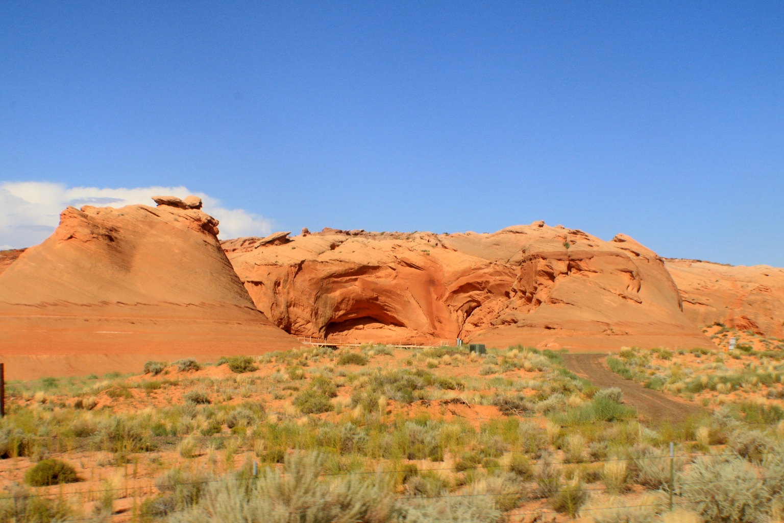
Arizona is the canyon land indeed. While driving, we noticed signs to different canyons and stopped at the one of them to check it out. We didn’t go inside the canyon, just looked around.
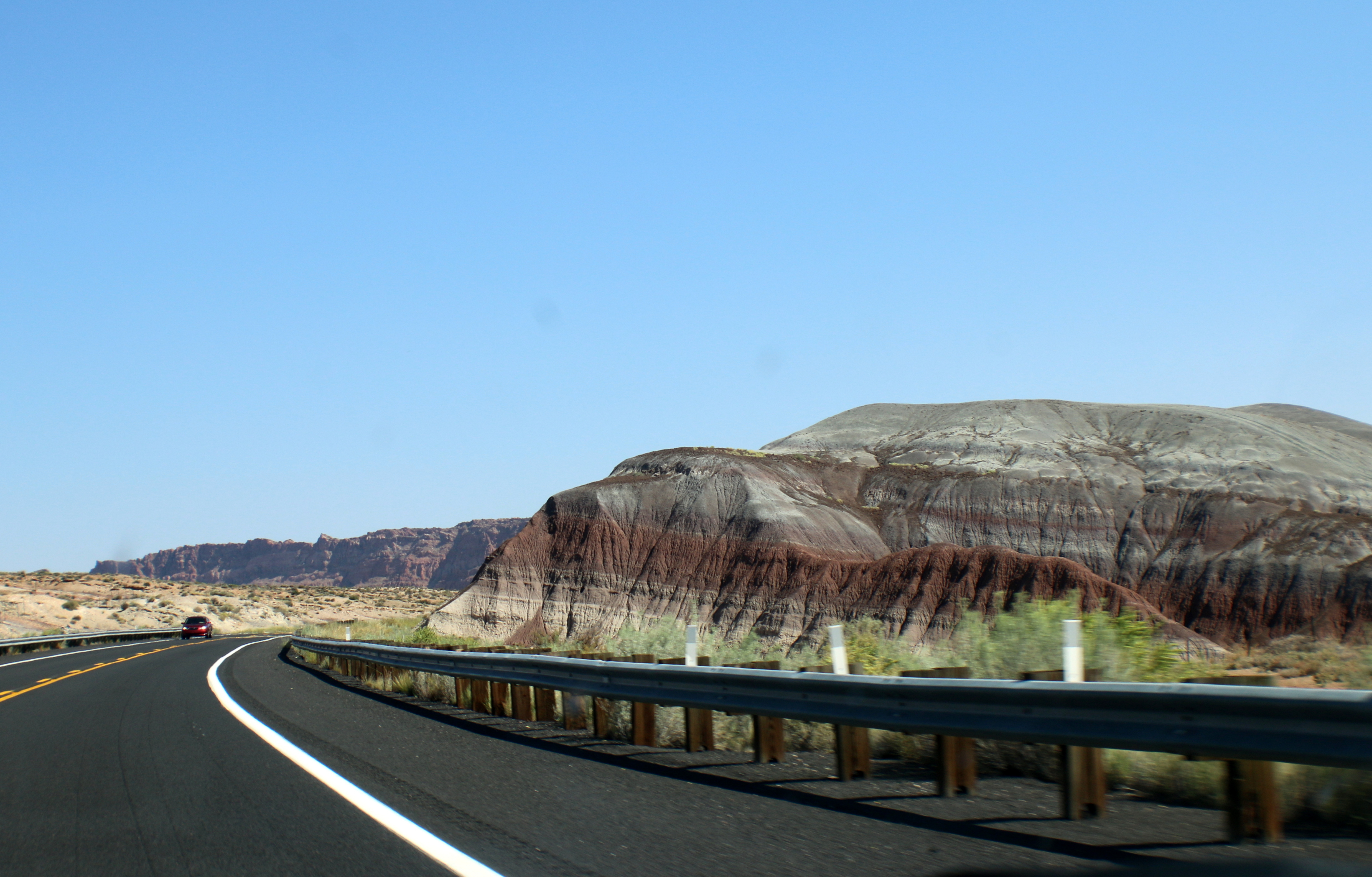
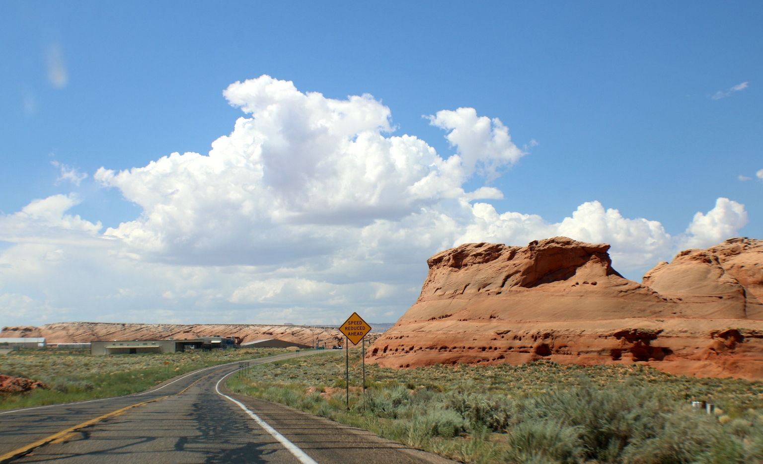
These multicolored-layered cliffs we saw pretty often along the road.
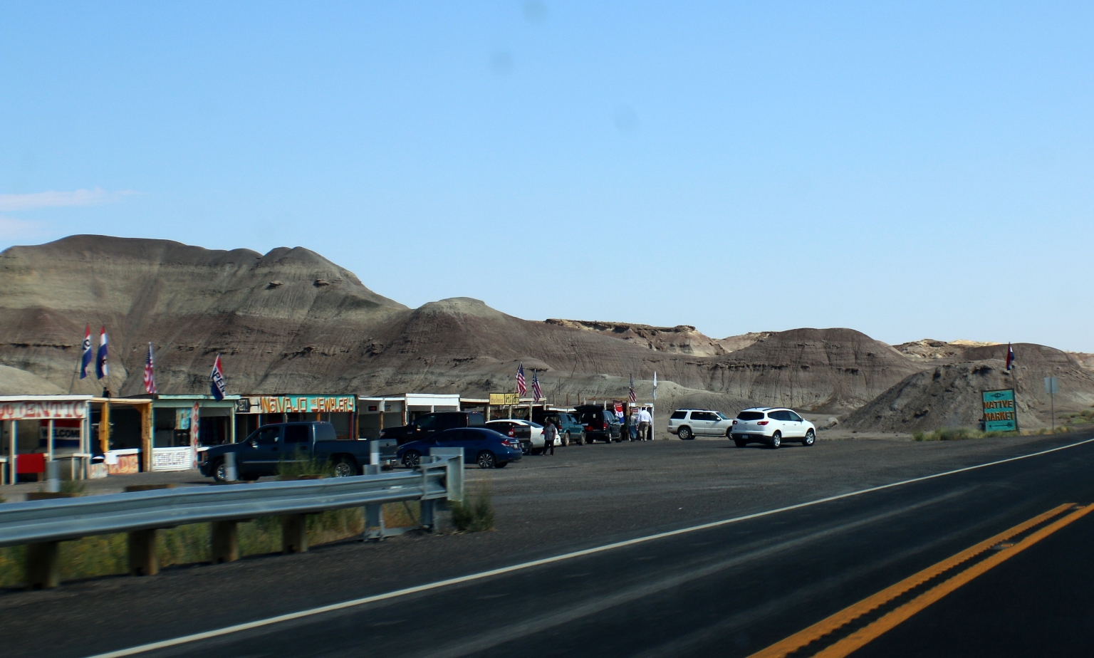
We stopped at a small Indian Market. They were selling mostly handmade jewelry and souvenirs there.
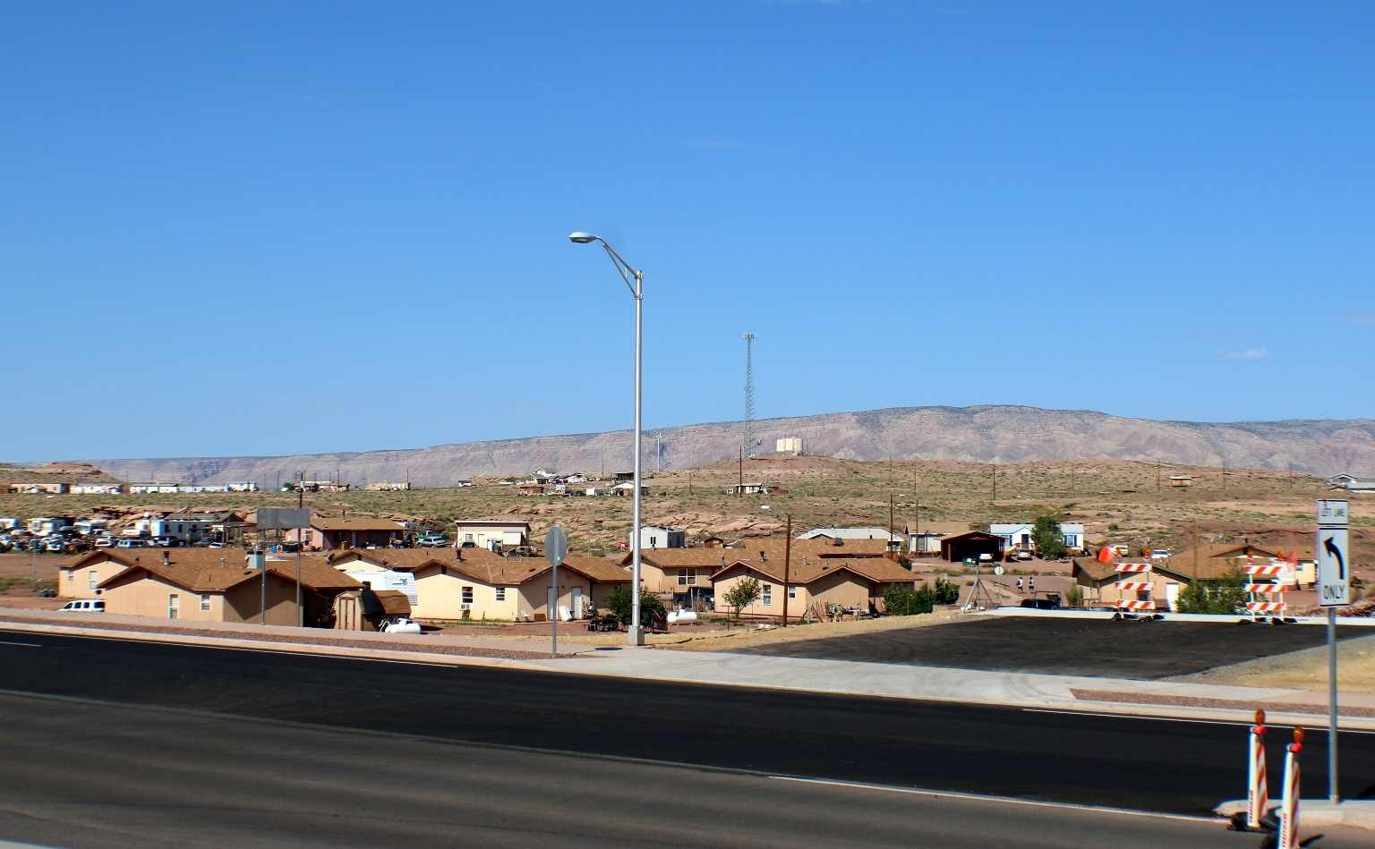
Sometimes we saw settlings like this one across the street from the gas station, where we stopped on our way to Page. Even houses are colored in sandy colors.
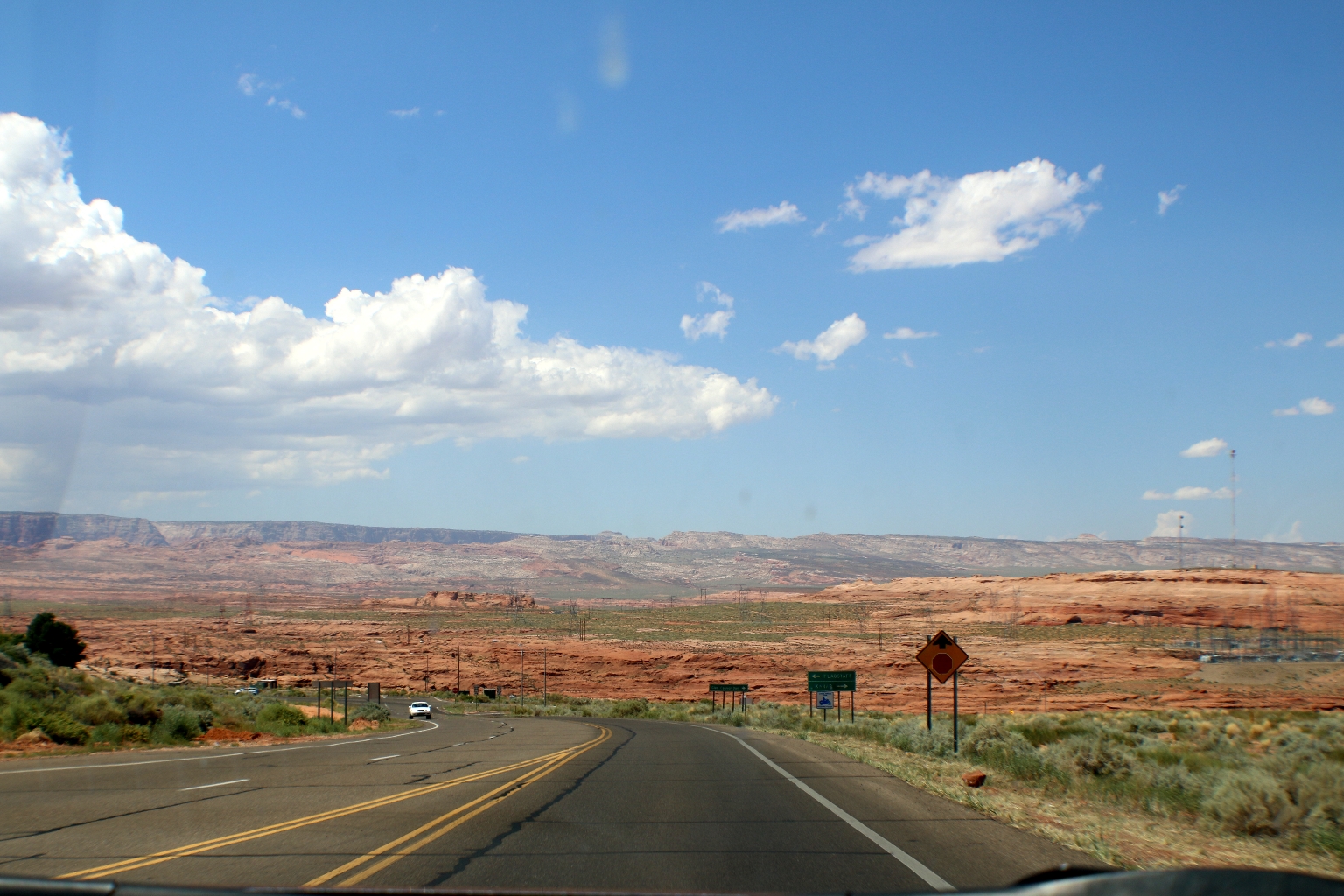
This orange landscape we observed the most frequently during our drive.
Approaching the very first buildings of Page. We didn’t notice anything special about the city itself, but its location is favorable because of the close proximity to nearby attractions such as: Antelope Canyon, Horseshoe Bend and Lake Powell.
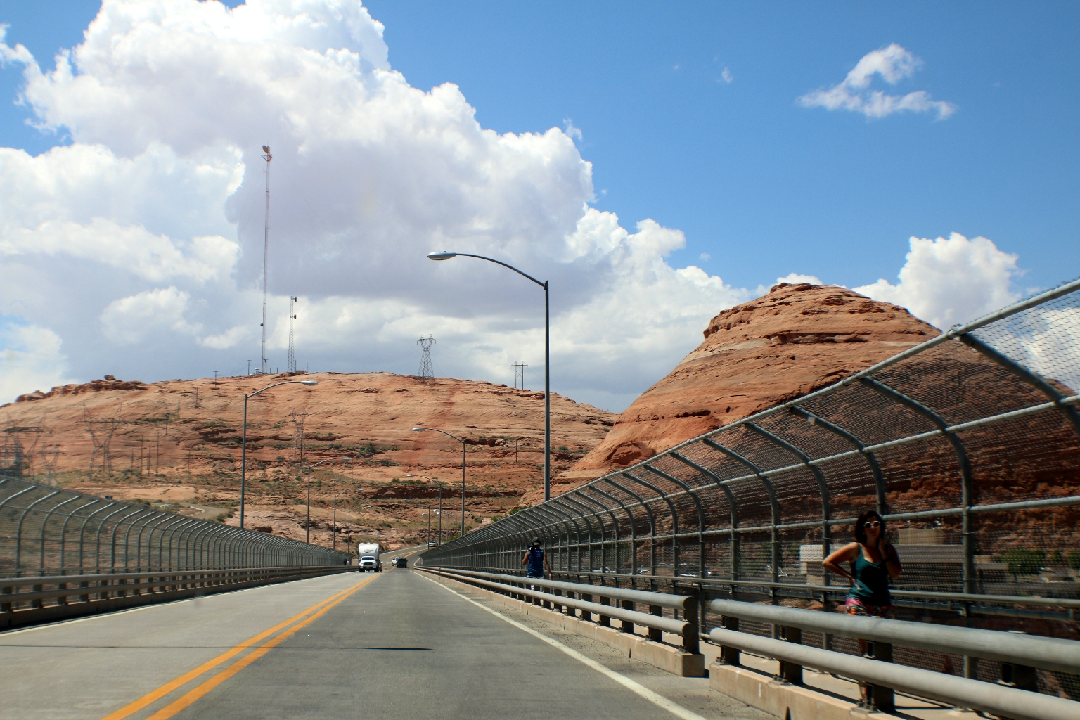
In Page we had to stop at our agency for the tour confirmation. Originally, we planned to visit both the Upper and Lower Antelope Canyons. We scheduled the Lower Canyon photography tour with Ken’s Tours first and the Upper Canyon tour after that. It turned out that we had only half an hour between the tours, which was not enough time to drive to a different canyon location across the highway. Therefore, we cancelled Ken’s tour and decided to take only the 3 o’clock Upper Canyon tour. We had a quick lunch in Page and headed to our hotel on Lake Powell, passing the bridge over the Colorado River on our way there.
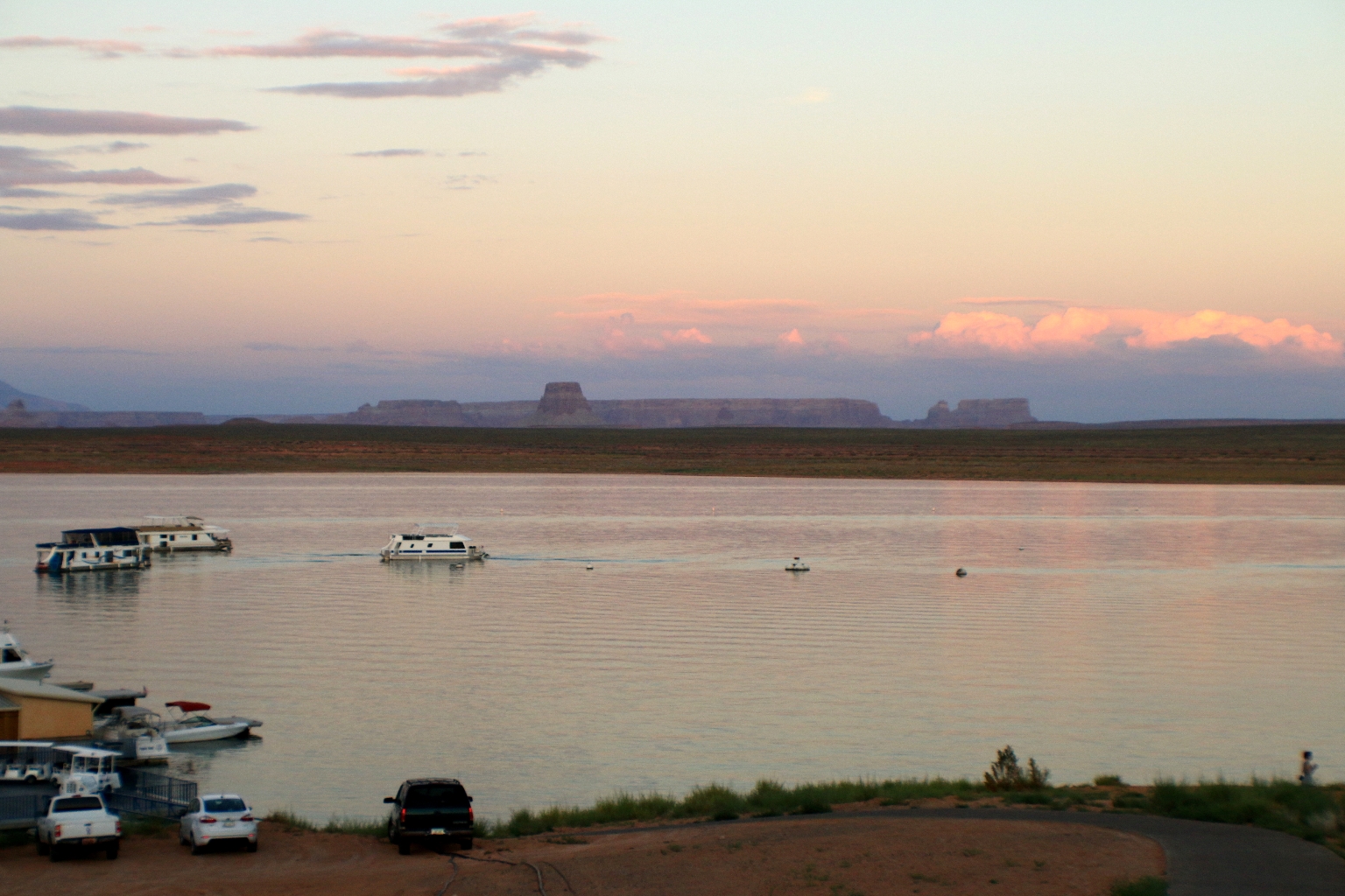
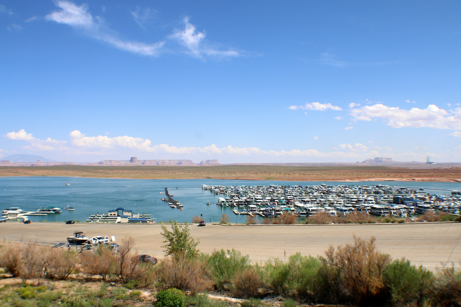
Lake Powell as seen for the first time from our car on the way to the resort.
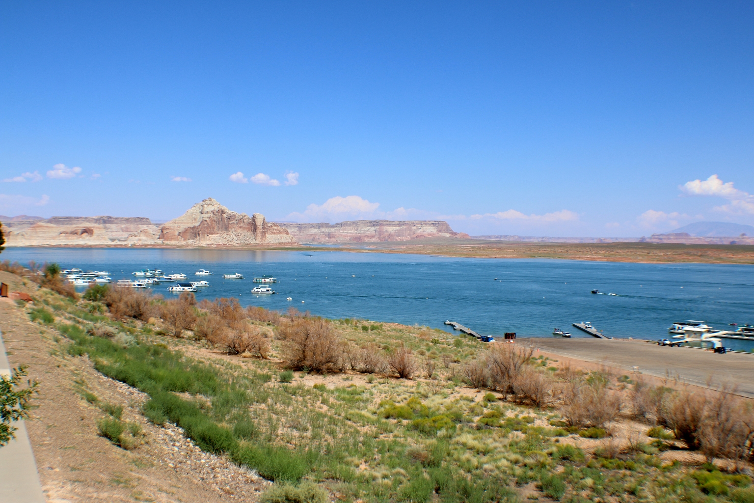
We booked a marina view room at the Lake Powell Resort at Wahweap Marina.
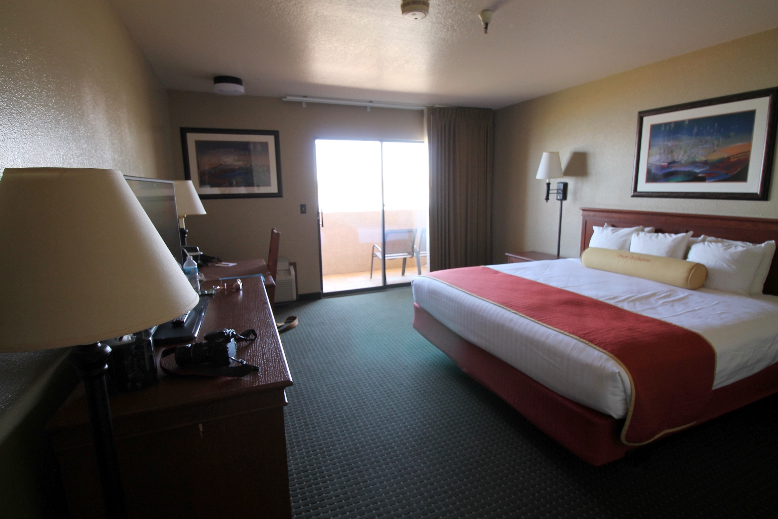
The hotel is pretty nice and it offers a beautiful view of the marina from the balcony.
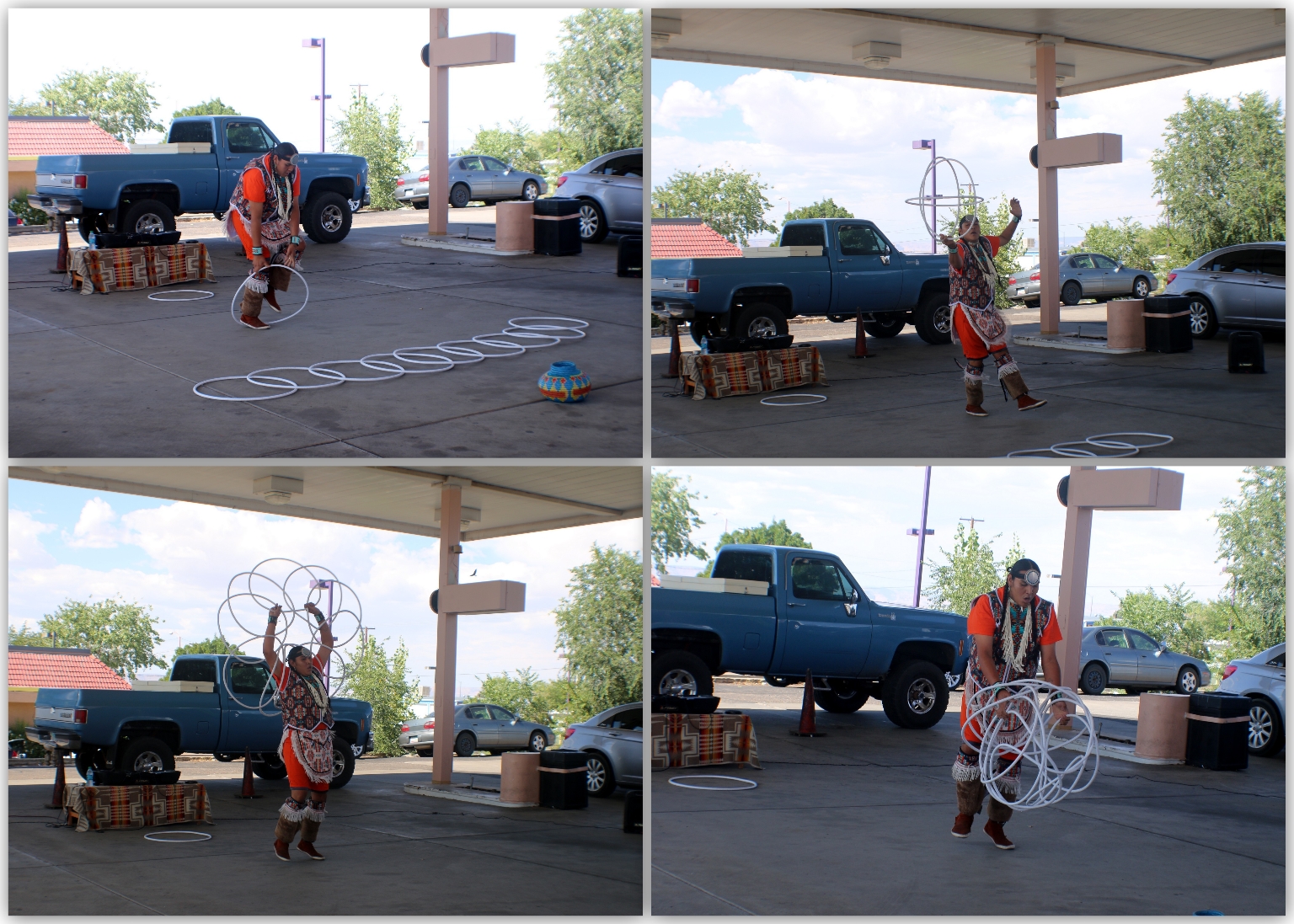
For the Upper Antelope Canyon tour, we gathered at the specified tour company gift shop first. Then, we were told to take shelter under the cover where a hoop dance performance by a native American will be shown.
He did a really good job with that Hoop. The performer informed us that there’s an annual World Hoop Dance Championship that happens at Heard Museum in Phoenix, Arizona. This year, the event celebrated its 25th year, and more importantly, our hoop dancer was going to participate in it. Good Luck to him!
These 4-WD trucks were ready to take us to the Upper Antelope Canyon.
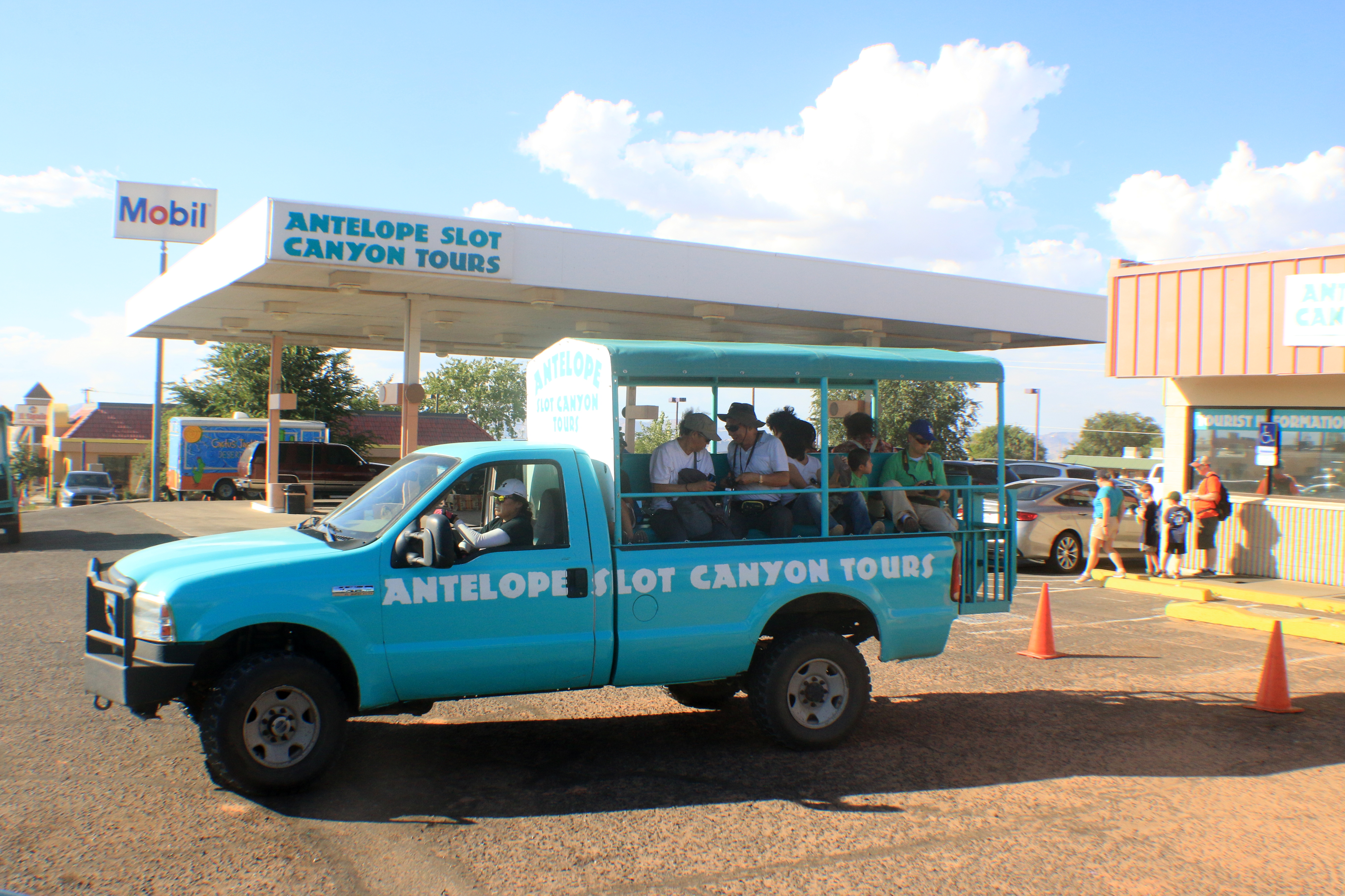
The ride was really bumpy with a sandy wind. I am glad it took only 20 minutes or so to get to the canyon. We still got to enjoy beautiful views during our ride.
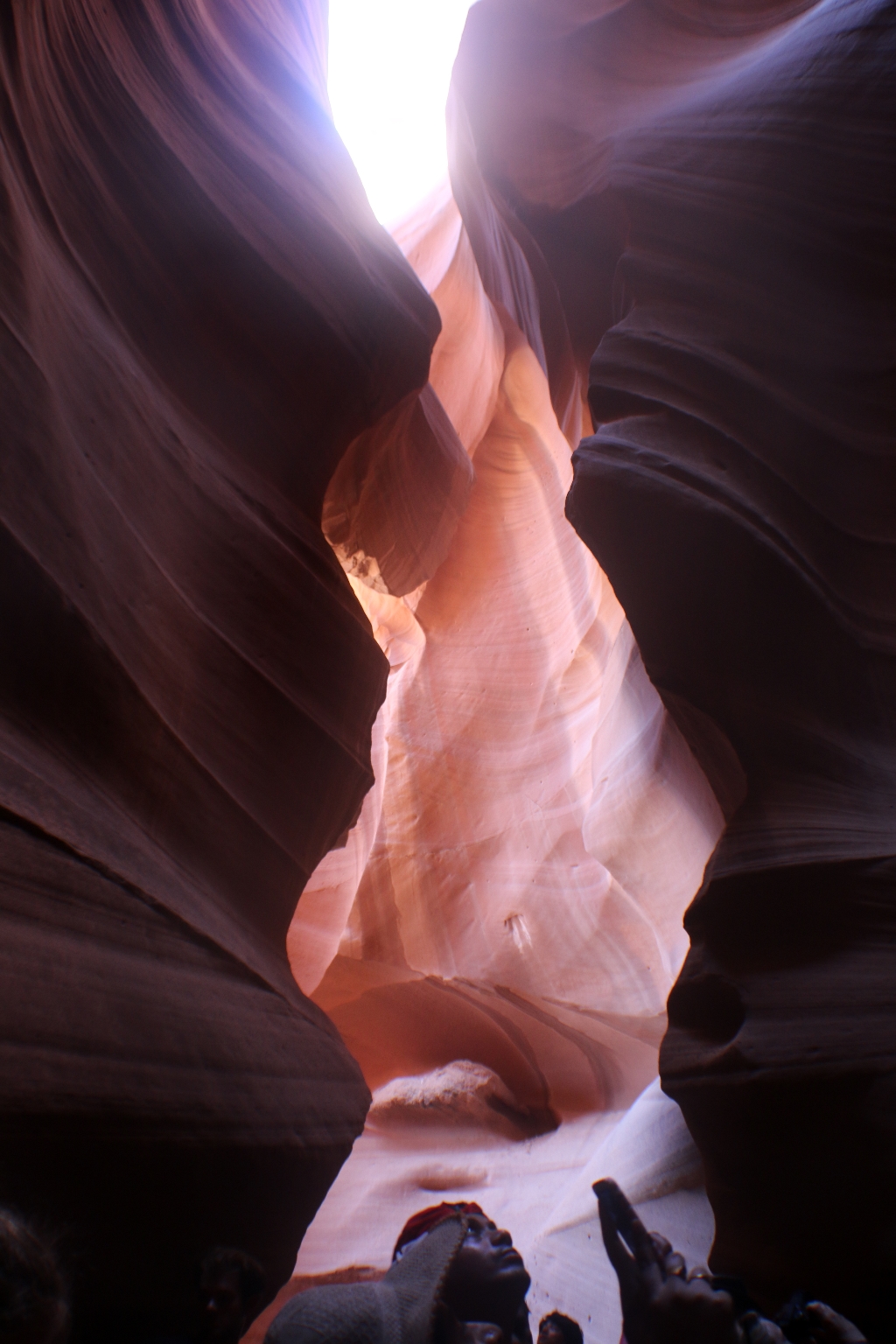
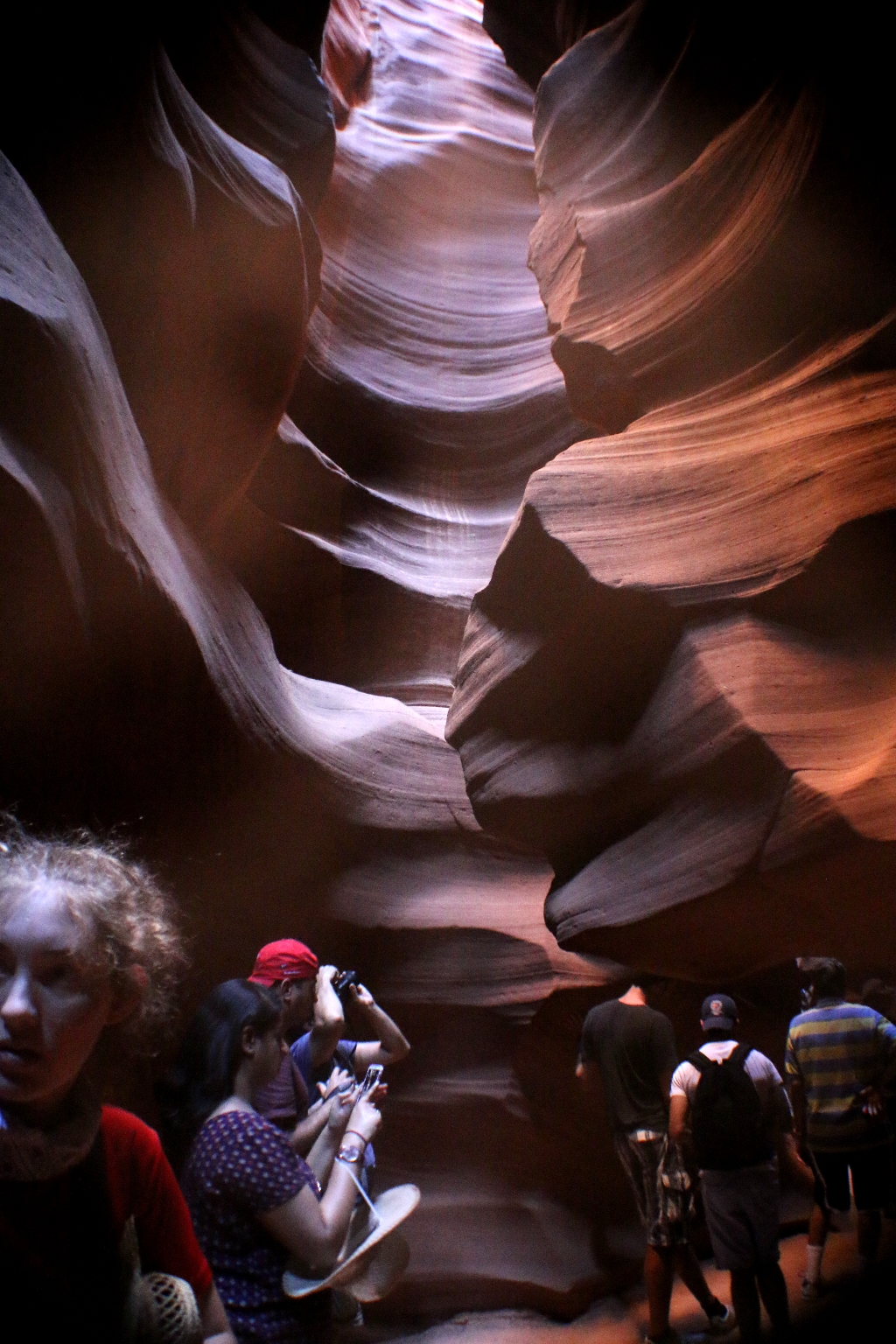
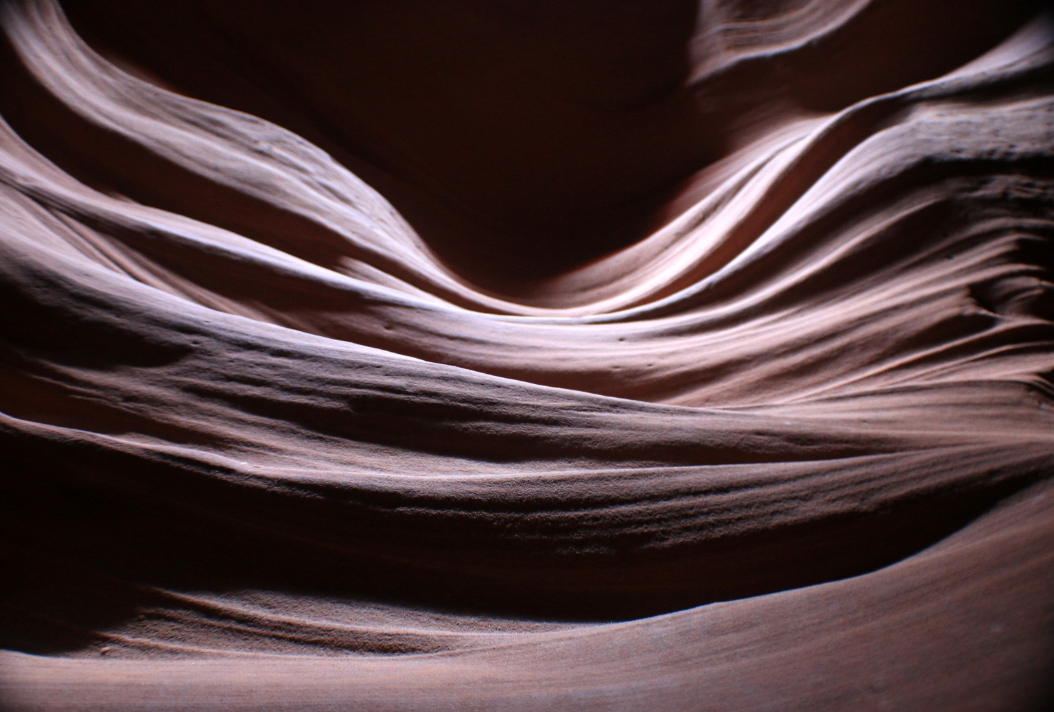
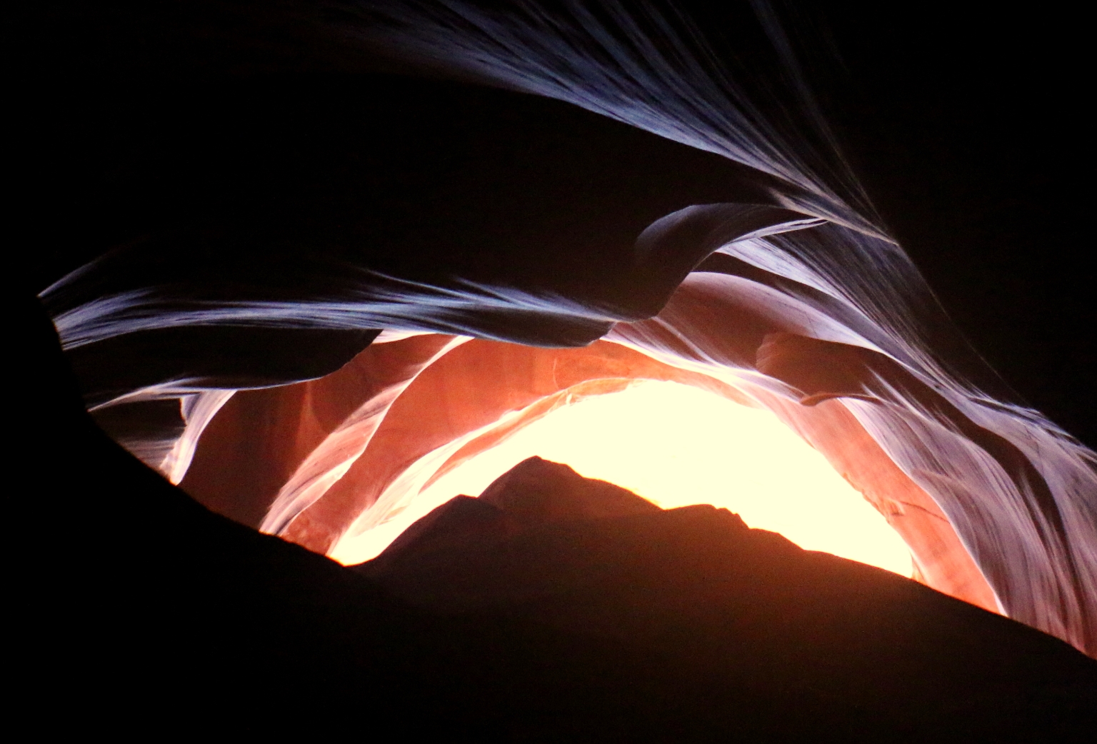
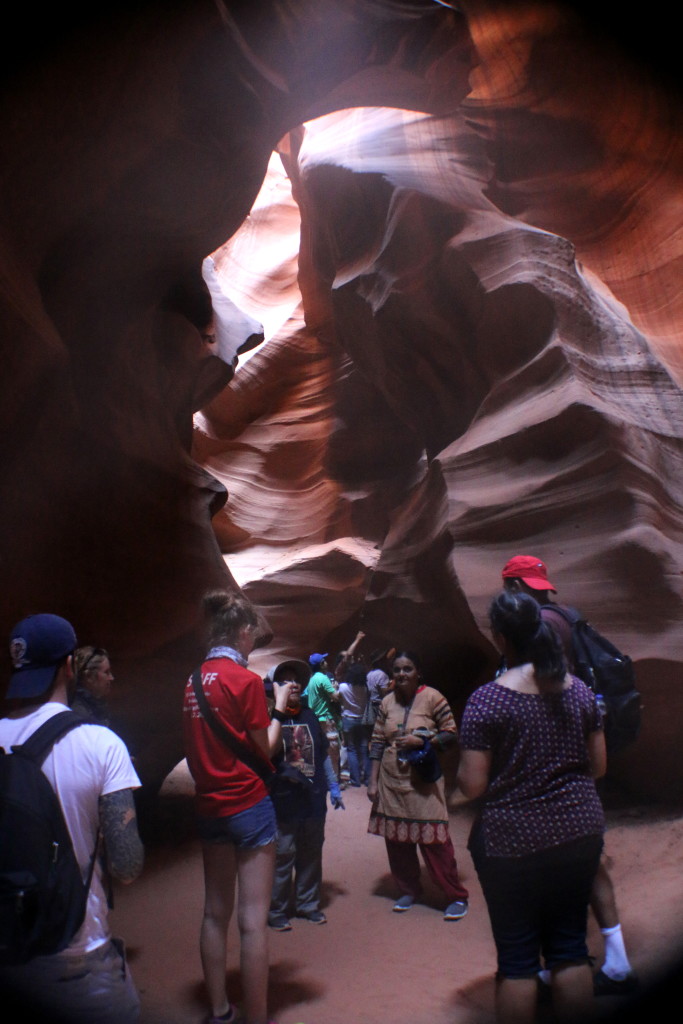
We entered the Navajo Park where Antelope canyon is located. The fee was already included in our tour tickets, so we didn’t have to deal with that at the entrance to the park. The Canyon is a narrow curved slit in the cliffs only a few feet wide.
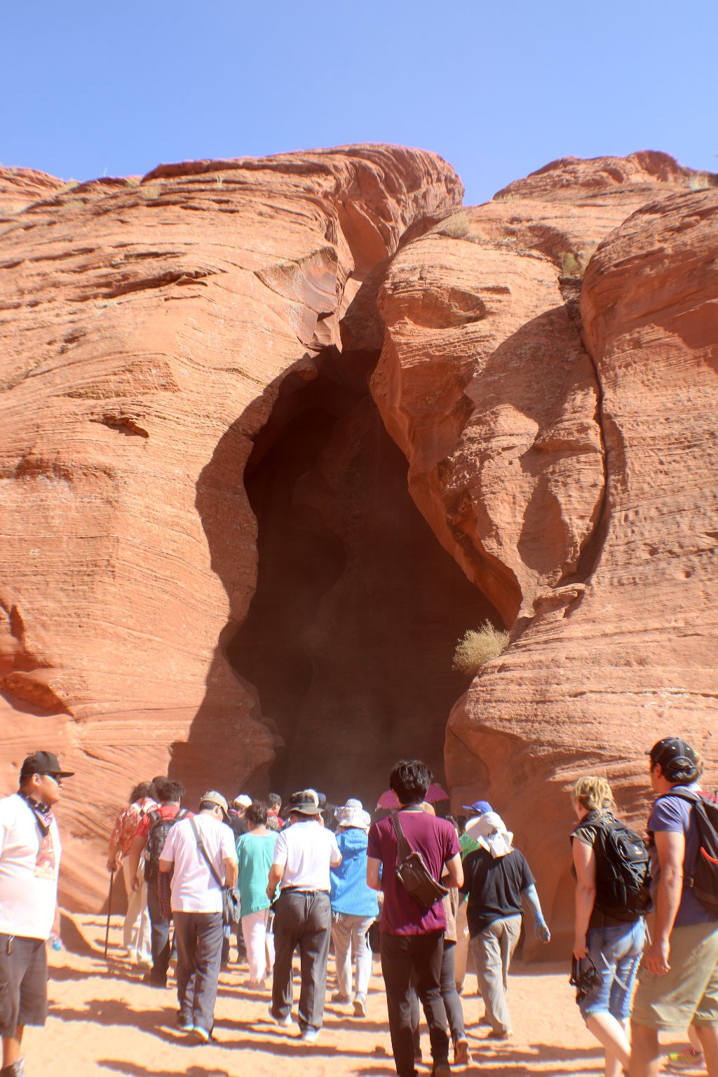
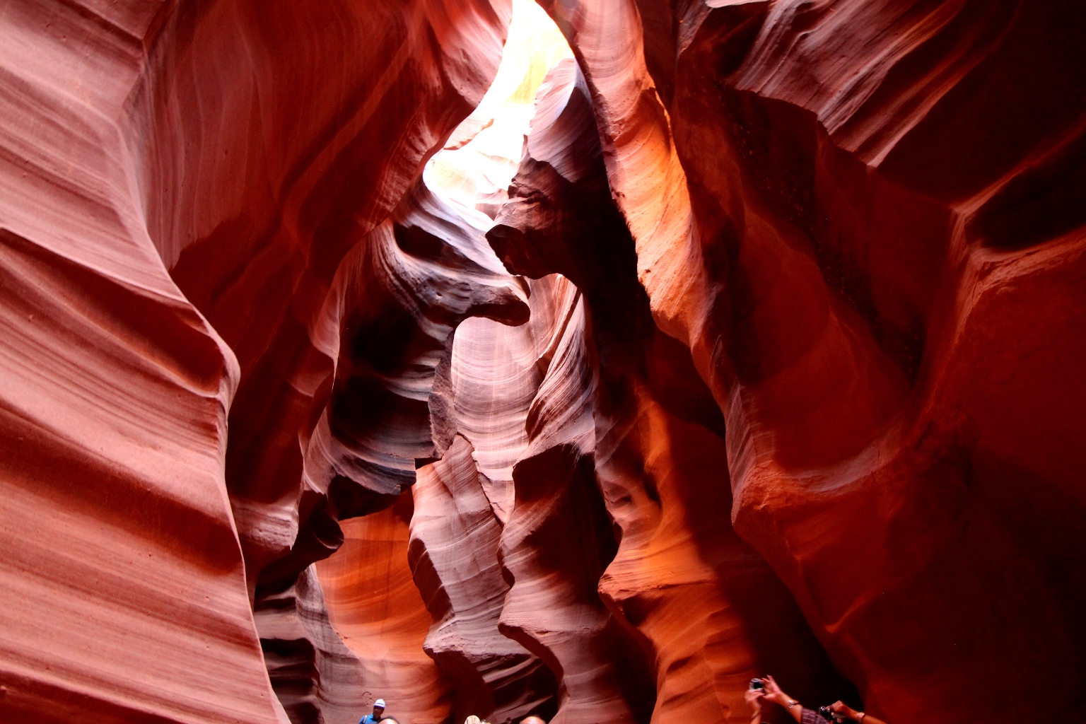
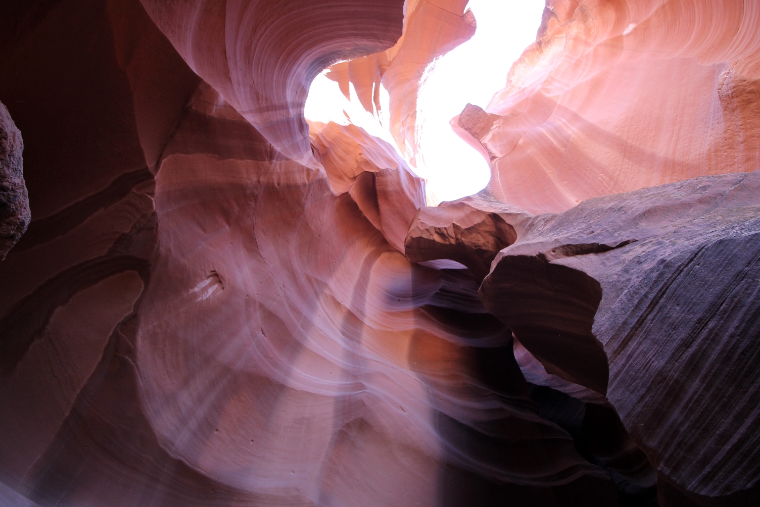
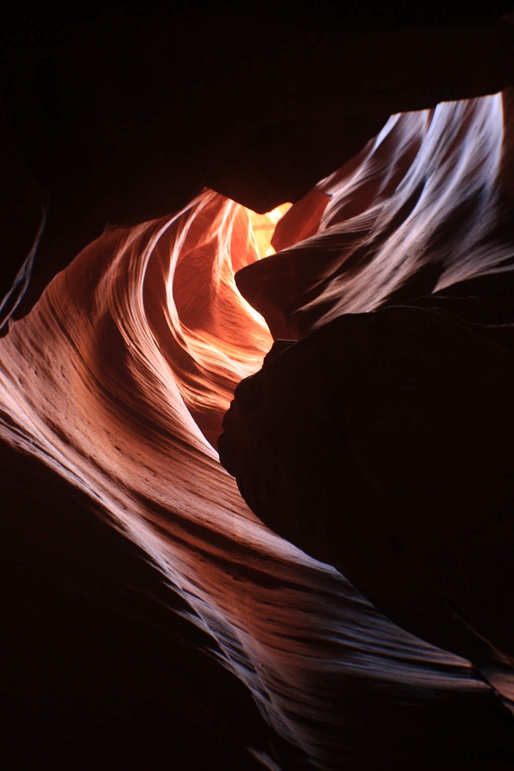
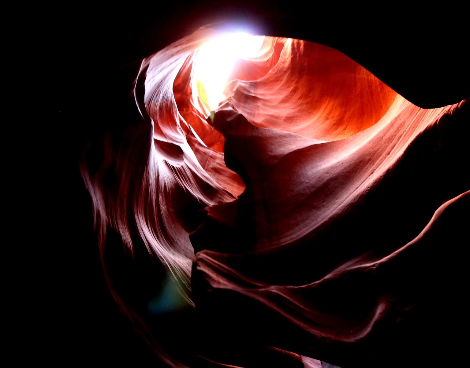
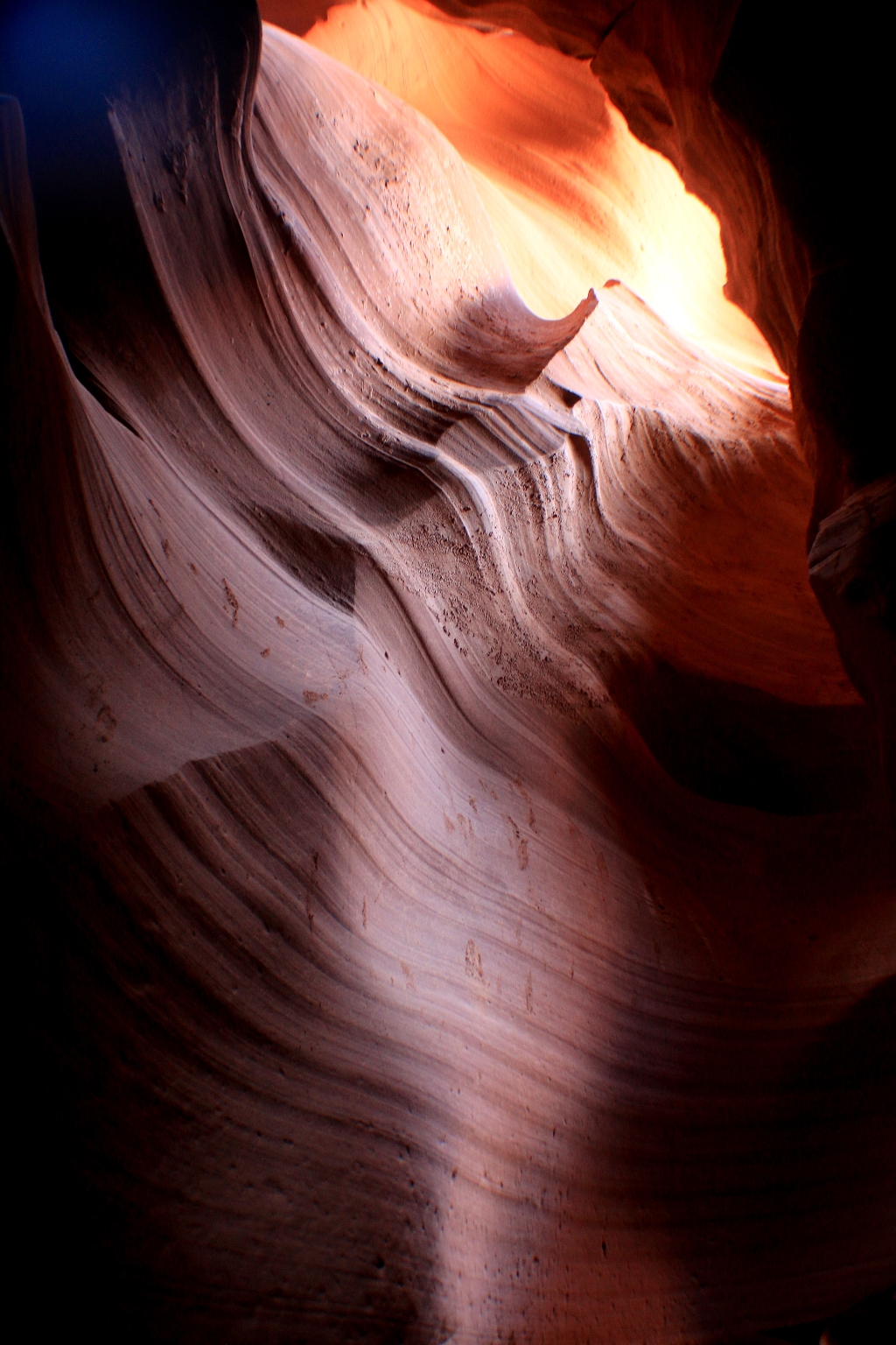
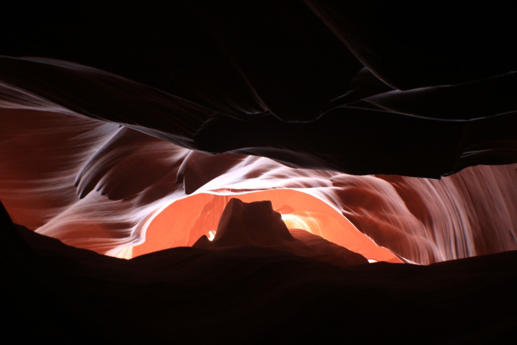
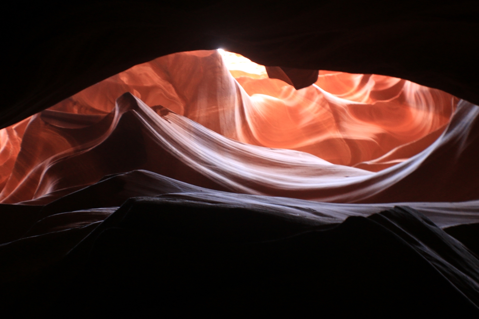
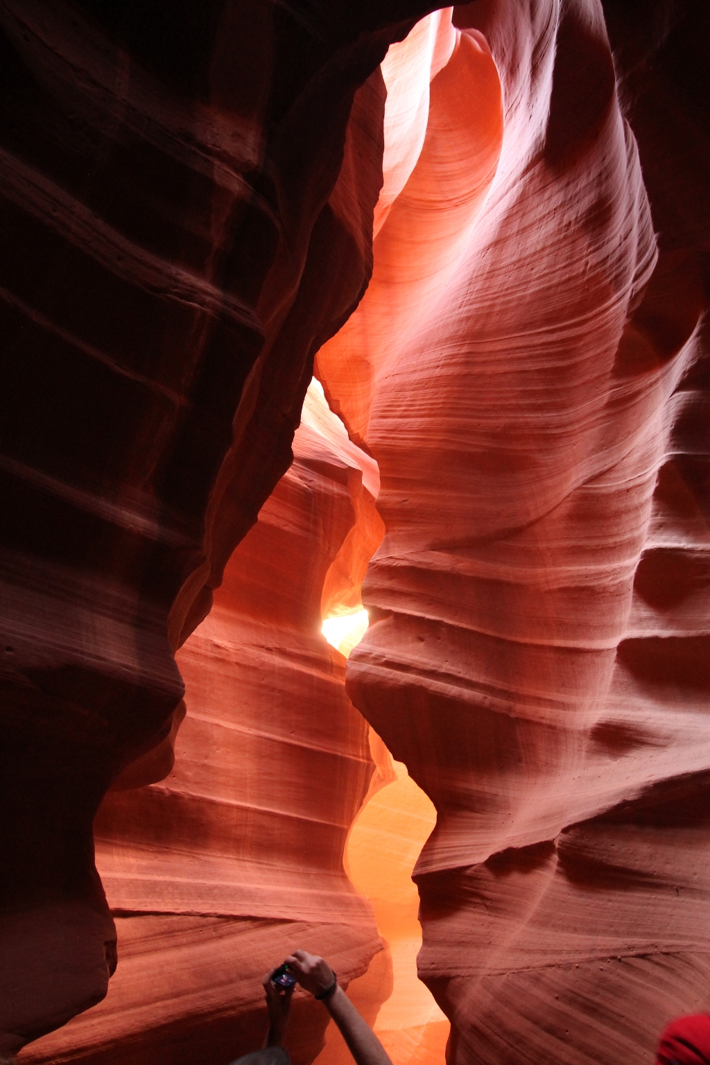
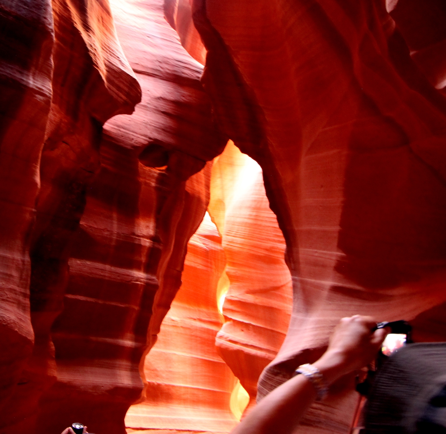
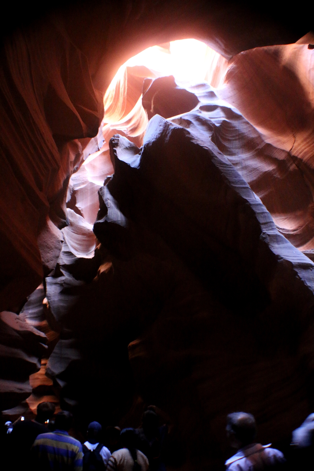
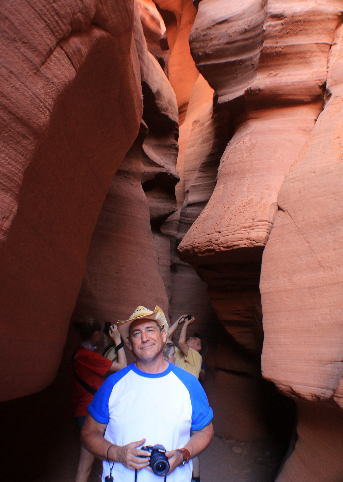
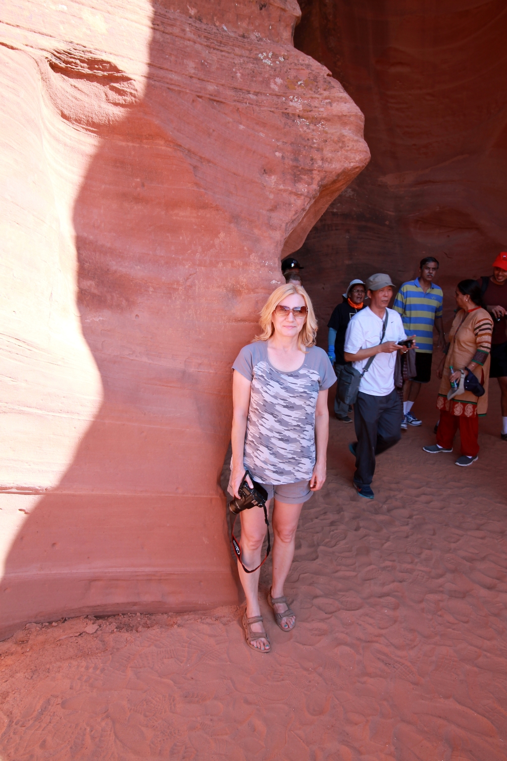
Our Antelope Canyon tour started at 3 P.M. The tour took about 45 minutes and it was an amazing experience for both of us. It was a bright sunny day and the sunlight inside the slot canyon was changing patterns and shadows of the sandstone walls in many incredible colors.
Once inside, the temperature drops as much as 20 degrees. The guides did a great job of pointing out all of the perfect shots. They even suggested the camera settings before we went in. Our tour guide was very helpful and took several incredible pictures with our camera.
The canyon is owned by the Navajo reservation. Our tour guide said that one of the reasons the Native Americans made Antelope Canyon a Navajo Tribal Park was because people were mistreating it, including engravings in the sandstone.
The other reason is a danger of getting caught in new floods. According to arizona-leisure.com website, during rain storms on the Navajo Indian Reservation, rain-runoffs slowly converge to form quick-moving flash floods. But guides and management carefully watch weather patterns carefully. When poor weather and potential rain storms are predicted, the canyons will be closed and entry is prohibited. That is why visits to the canyons are prohibited without being accompanied by an approved guide.
The tour guide pointed out some marks in the wall, like in the picture below, which were caused by National Geographic. When the NG team visited the canyon, they drilled holes into the wall to mount their equipment. Before they were able to come back to gather their cameras, a flash flood washed their equipment away, rendering them without any material to be published. I thing that NG should know better.
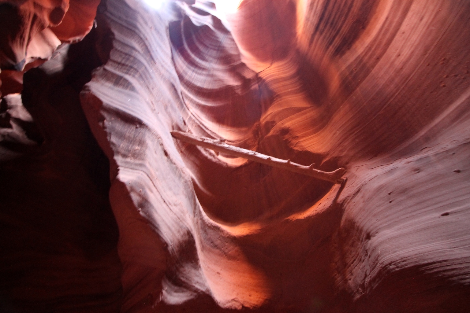
There was some debris left in the canyon after the flash-floods. Cliff Face with Log.
Our tour guide pointed out features in the canyon that looked like certain people, animals, or places. This formation resembles the President Lincoln’s profile.
This formation resembles a heart tuned to the left. Inside the heart, one could see George Washington’s profile turned to the left. I am not sure about George Washington, but it seemed like someone was looking down on us.
These overhangs from the wall resemble George Washington’s profile.
Another Heart of the Canyon.
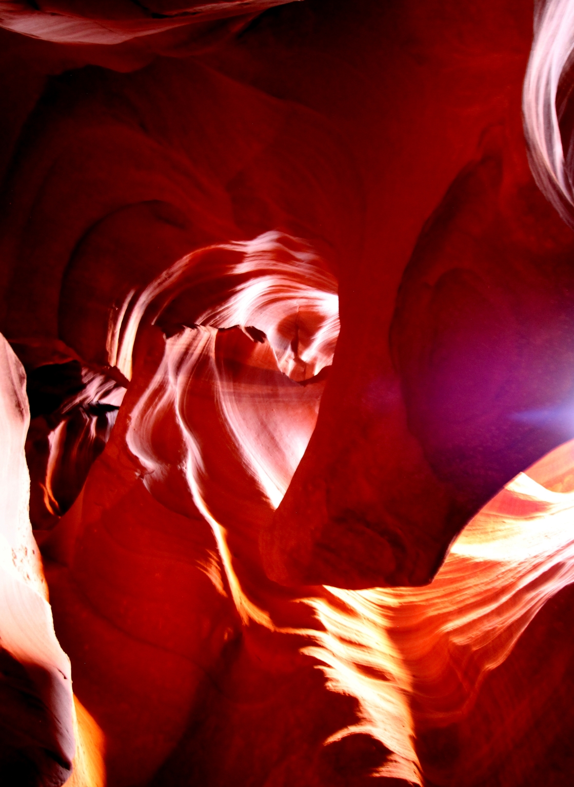
Sandstone is very strong, but the wind and water can make compressed sand look very delicate. Waves of sandstone.
We took the same picture as the famous National Geographic photo.
Our guide called this “Monument Valley” because the shape of the sandstone reminds that of a mitten.
A Rocky Mountain sunrise.
And an early morning Arizona sunrise.
This is Antelope Canyon Candle Path. Can you see the lit candle with the flame?
There were also places where the light and curved rocks together make an illusion of a bear. This passage is called “Rising/Standing Bear”.
Another Bear.
It looks like an Indian silhouette.
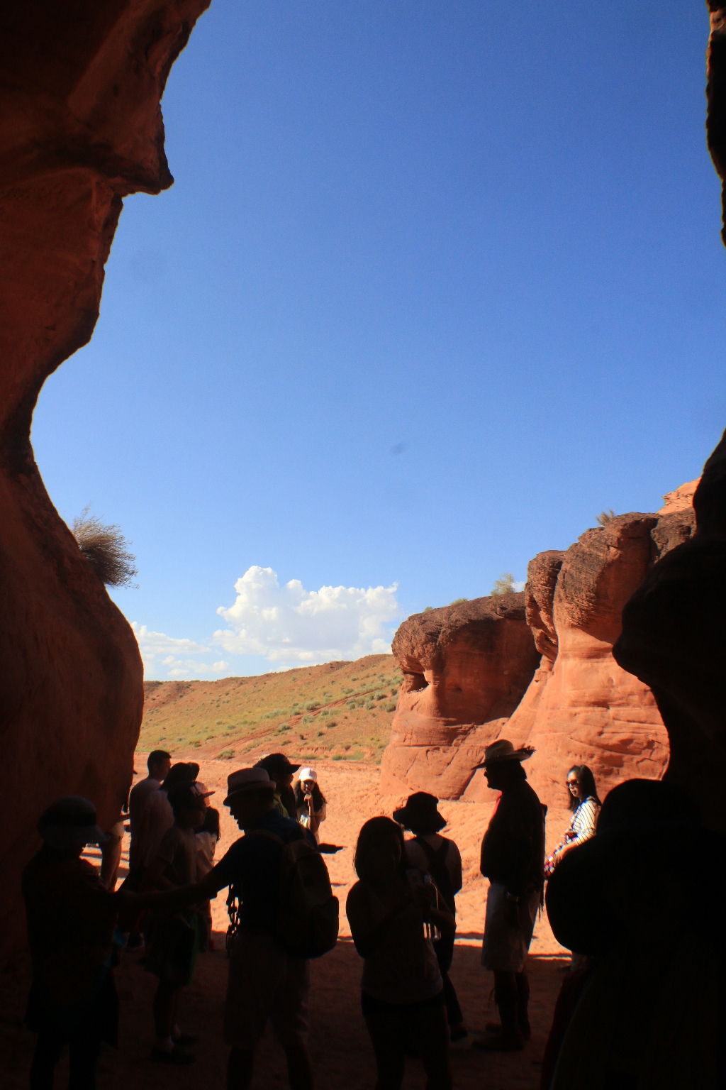
The upper canyon ends at a wash, which was the end of our tour. There were huge sandstone columns at the end. All visitors must walk back to the entrance to exit. Our tour guide gathered our group and we went back to the entrance.
Here are couple more pictures at the entrance.
Here we are driving through Page back to the Antelope Slot Canyon Tours gift shop, where we started.
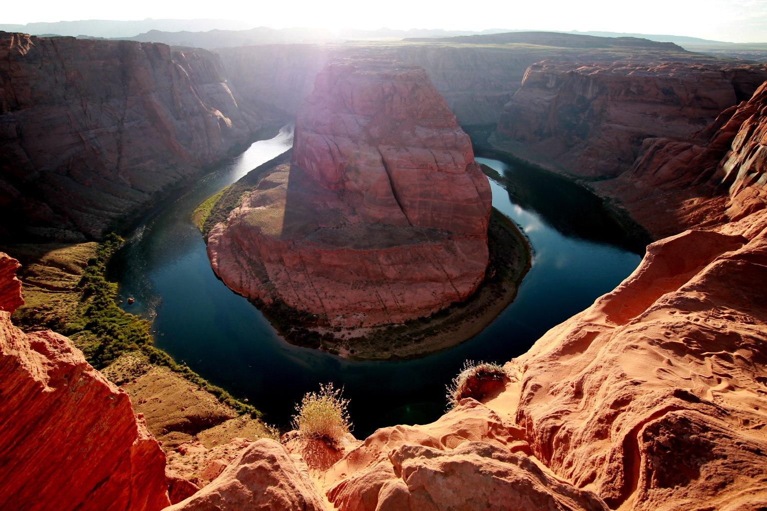
After our arrival at the gift shop, we got in our car and drove to Horseshoe Bend, which was located not far from Page. To see Horseshoe Band, we had to take about 3/4 mile (1.2 km) hike from the Horseshoe Bend parking lot. We walked along the plateau, suddenly arriving at an abyss that opened up before our eyes.
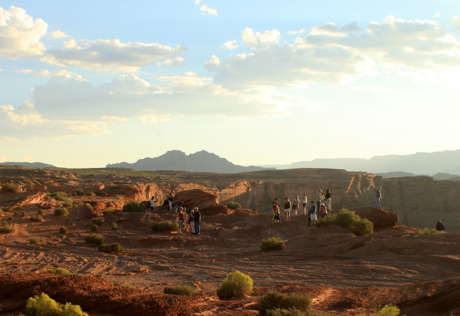
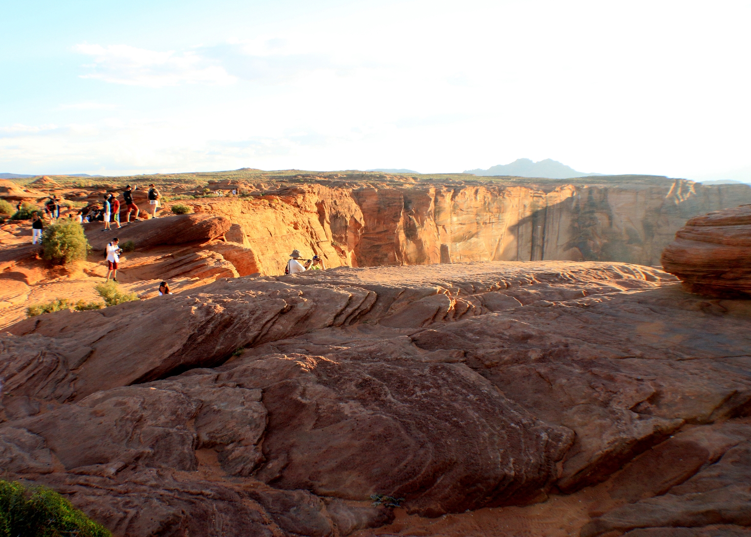
It is so named by the shape of the meandering Colorado River below as it flows one way and then makes a quick “horseshoe” turn as it continues on its path through Lees Ferry and its journey through the Grand Canyon. This is a spectacular overlook where you look down 1,000 feet into the Colorado River as it makes a horseshoe bend. The sunset was beautiful, but it was hard to take good pictures – too much sun, which blinds you, and it gets dark inside the bend quickly. We decided to visit this place the next day again before leaving for Bryce.
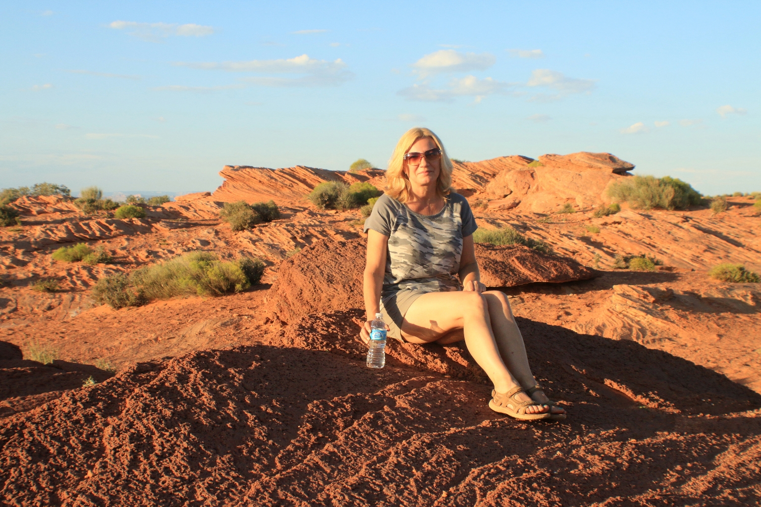
Sitting on a boulder.
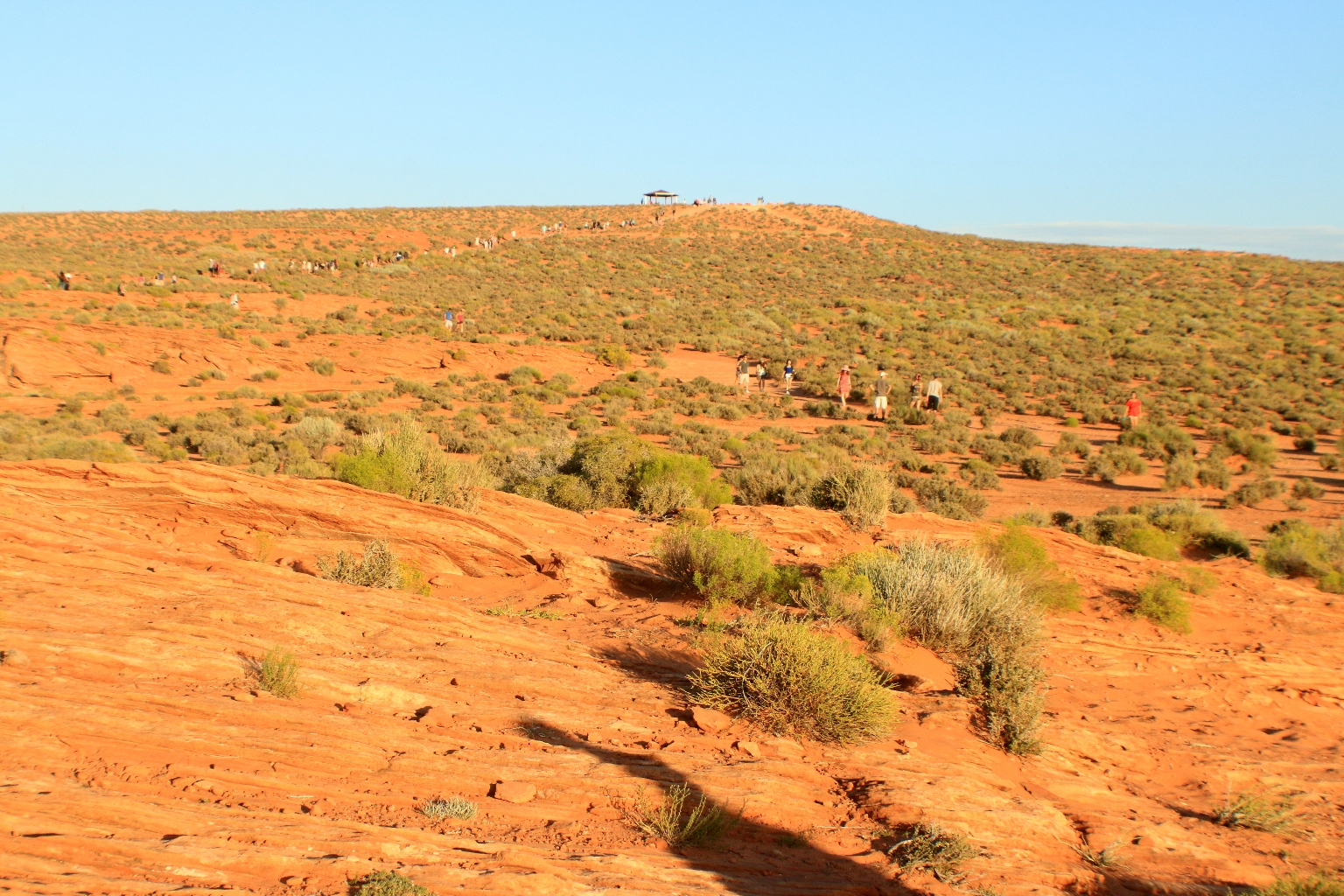
Hiking back to the parking lot.
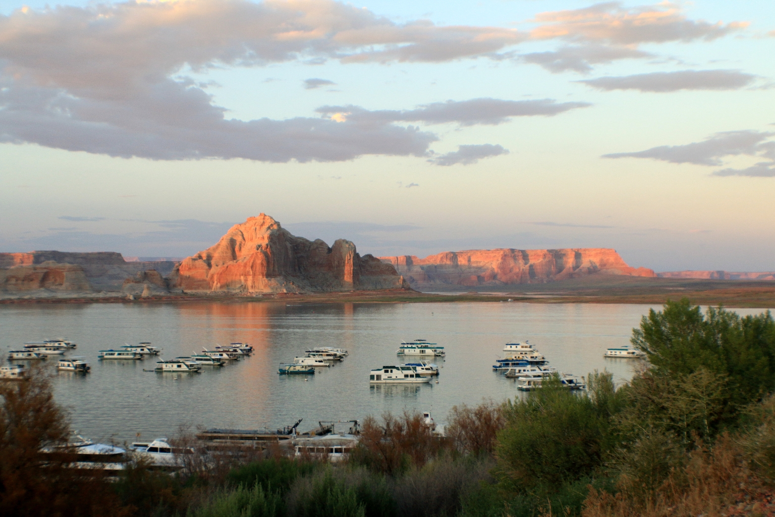
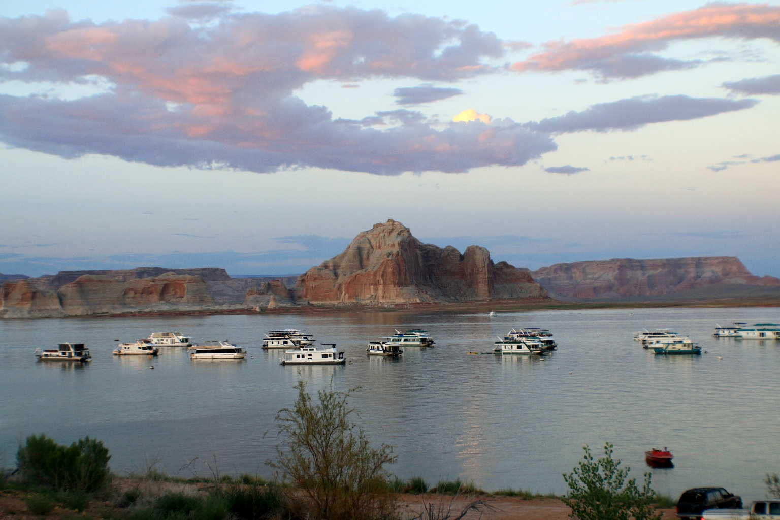
After the Horseshoe Bend hike, we got back to the resort and walked down to the lake to watch the end of the amazing sunset. Incredibly beautiful and massive Lake Powell is the second-largest man-made lake in America. Lake Powell has almost 2,000 miles of shoreline which rivals the total coastline of the Pacific Coast states.