We started our last day in Moab with a trip to the beautiful Arches National Park and left for Monument Valley around noon. This was the main reason for visiting the park today – Landscape Arch.
Landscape Arch is located at the Devil’s Garden area of the park. It is about a 30 minute drive from the park’s entrance. We got there fairly early in the morning after breakfast and hotel check out, but the place was pretty crowded already.
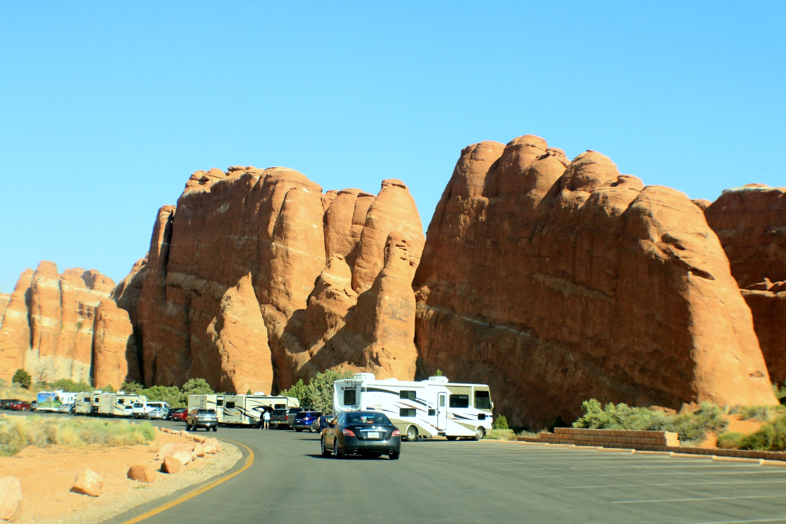
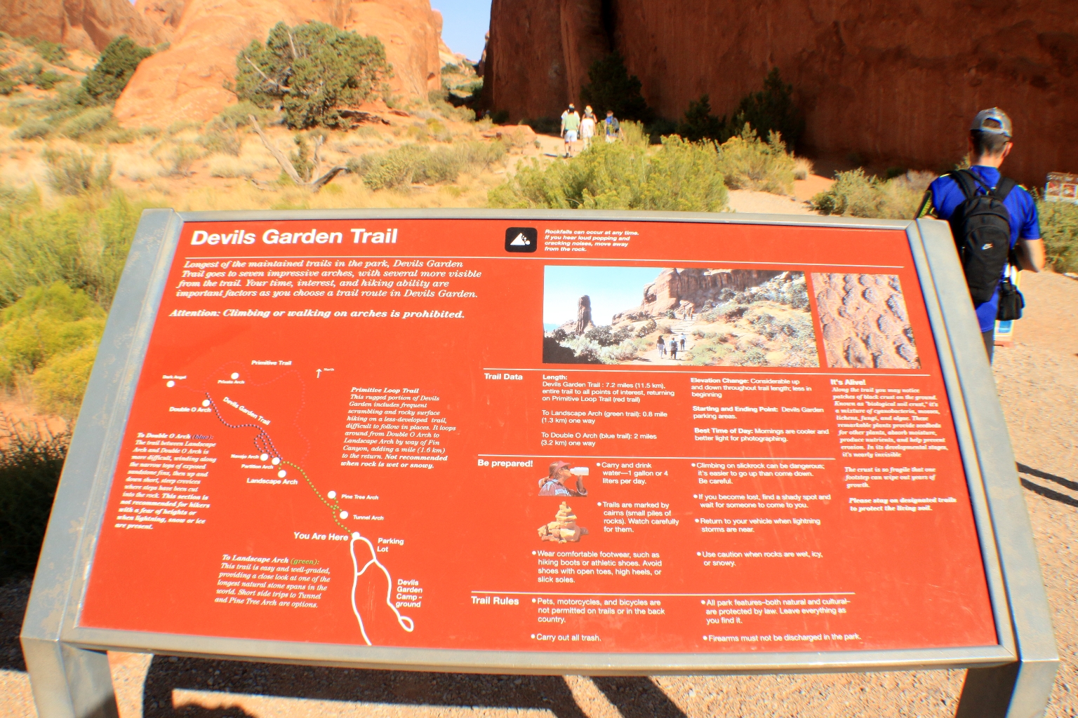
We started at the Devil’s Garden trailhead located at the end of the main road in Arches National Park and features a series of awesome arches and other natural sculptures. Devil’s Garden Trail is a 7.6 mile heavily trafficked loop trail and features 8 Arches. We only hiked to 3 of them: Tunnel Arch, Pine Tree Arch and Landscape Arch.
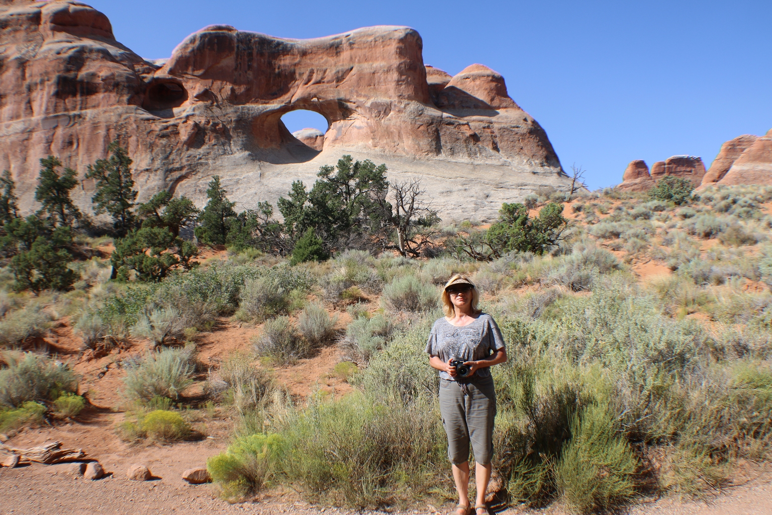
The first spur trail took us to Tunnel Arch and Pine Tree Arch, which are located within a short 0.5 mile hike from each other. Tunnel Arch is actually a double arch comprised of a larger hole towards the center of the fin, and a smaller hole on the upper-left. The fin in which this arch was formed is relatively thick, which creates the illusion that it is more of a tunnel than an arch, hence the name. Here is a view of Tunnel Arch.
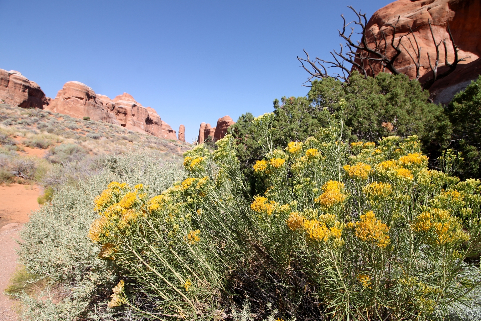
The vegetation growing around the sandstone cliffs makes for a very pleasant and enjoyable hike. We enjoyed these yellow wildflowers while walking along the trail.
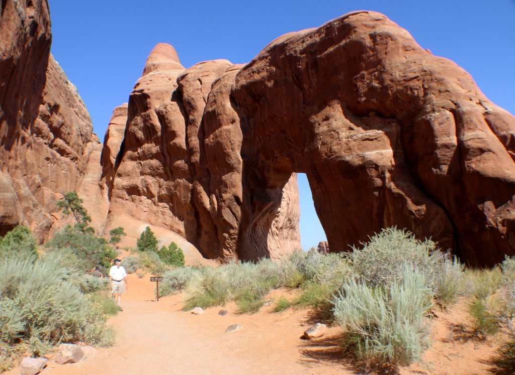
After backtracking to the trail junction, it was about a quarter mile in the other direction to get to Pine Tree Arch.
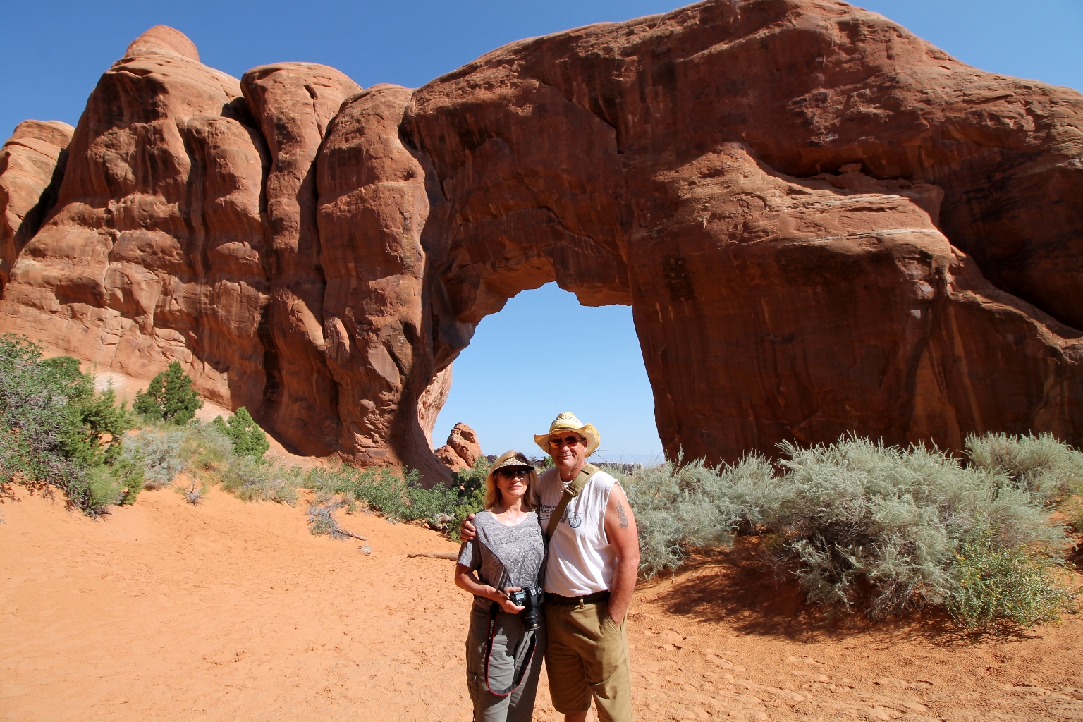
A nice person offered to take a picture of both of us.
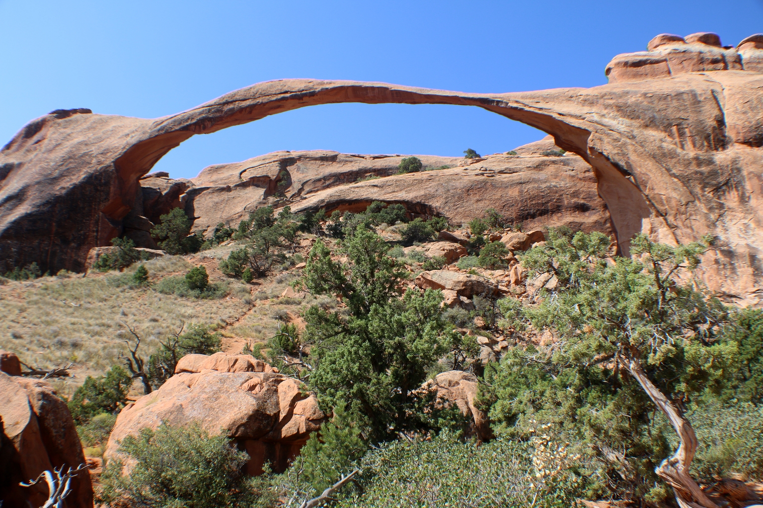
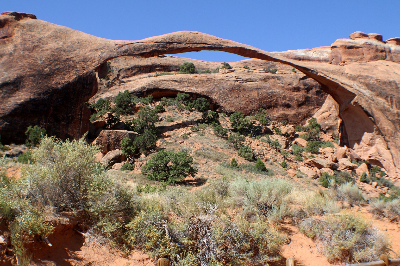
Then, we followed the signs to Landscape Arch. The trail is well maintained and well marked. Although, there are some slight inclines as the trail goes over some fairly hilly terrain.
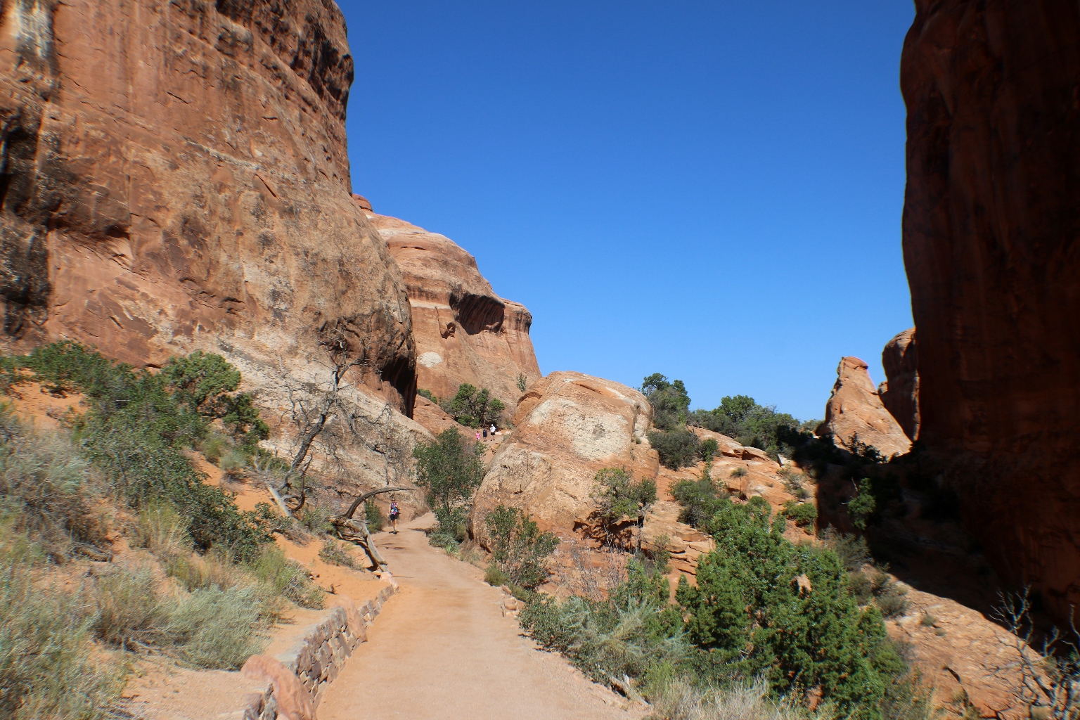
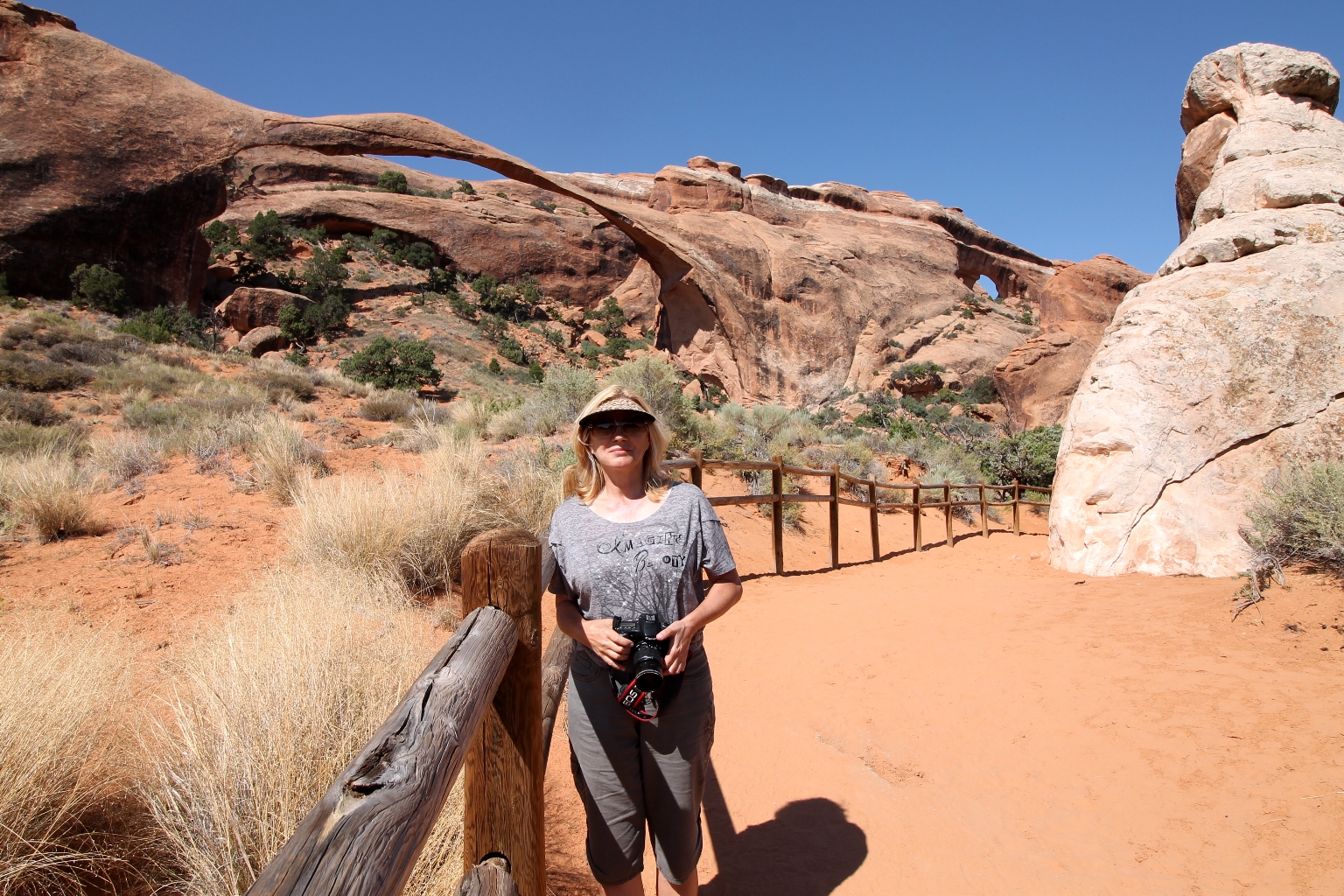
Landscape Arch is located at the end of the manicured Devils Garden Trail and it is rightfully famous. A relatively flat, gravel-surfaced trail leads to a spectacular ribbon of rock, whose span is more than a football field in length. The Arch is amazingly thin, delicate-looking, and photogenic.
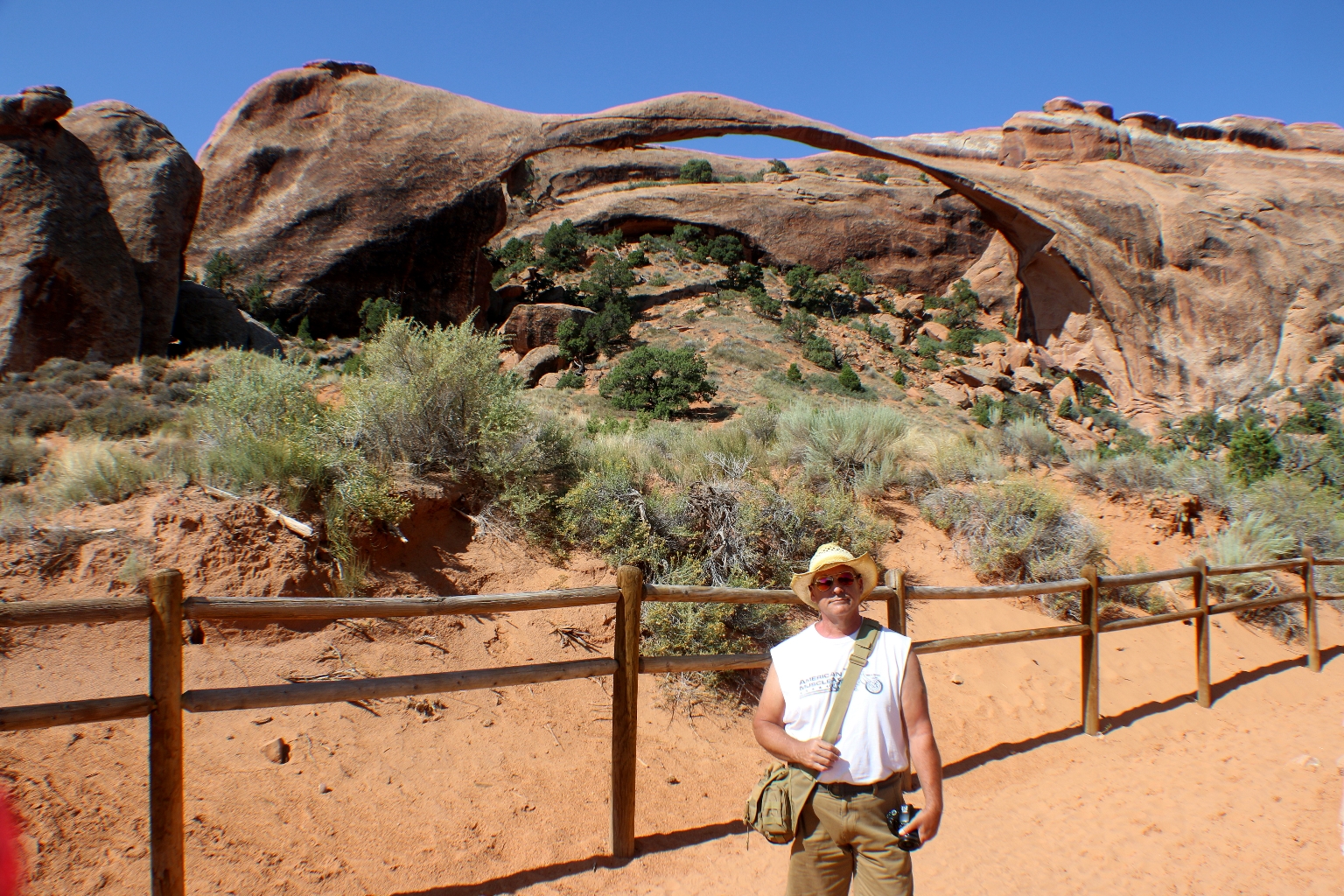
The Natural Arch and Bridge Society (NABS) now considers the Landscape Arch to be the fifth longest natural arch in the world, beating out Zion National Park’s Kolob Arch by a scant 3 feet. Pieces of Landscape Arch have broken off during the past few centuries, some chunks the size of automobiles. Since 1991, three slabs of sandstone have fallen from the thinnest section of Landscape Arch, prompting the Park Service to close the trail that once passed beneath it.
Continue following the trail.
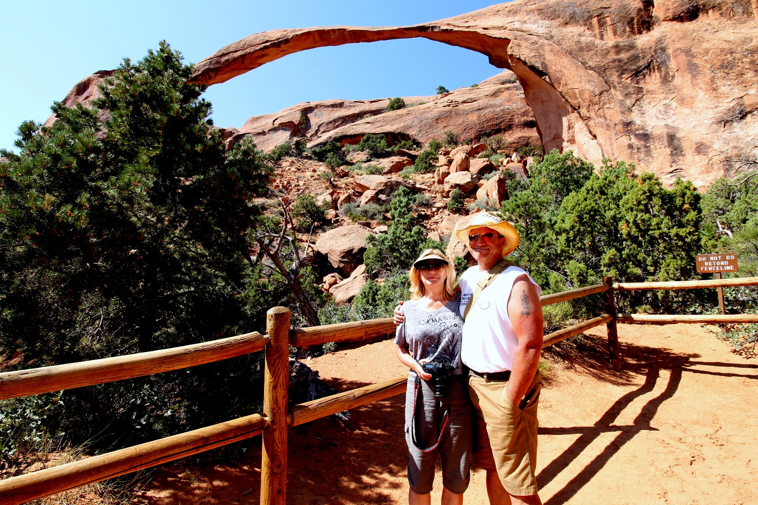
Here is the closest place allowed for the Landscape Arch view.
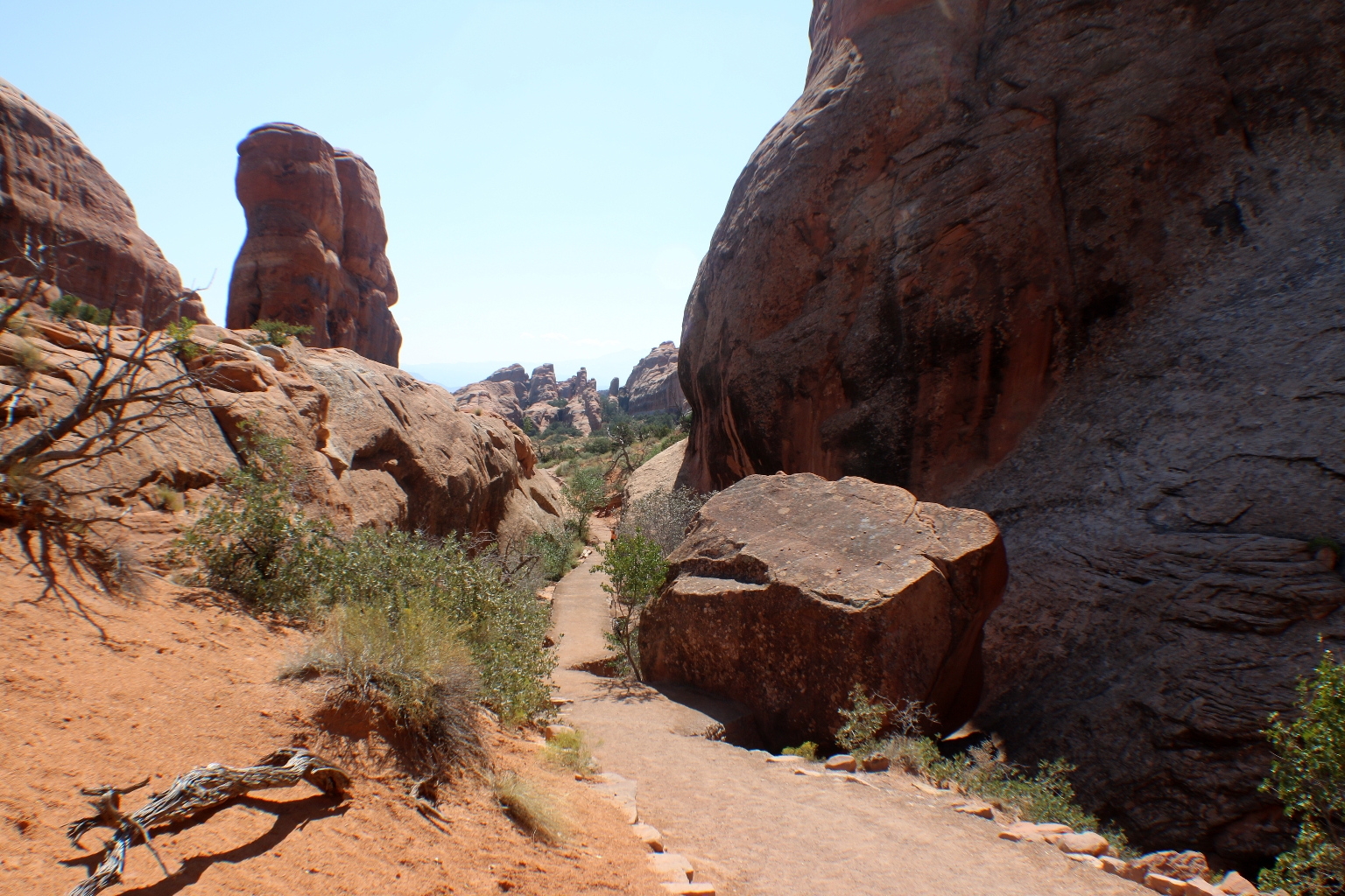
This steep trail takes visitors to other arches and formations along Devil’s Trail. It looked really adventurous, but it was time for us to leave this incredible place and explore another one. We definitely didn’t want to miss the sunset at the Monument Valley.
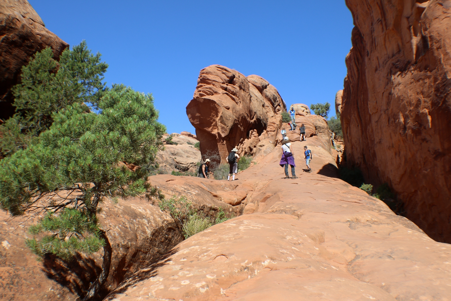
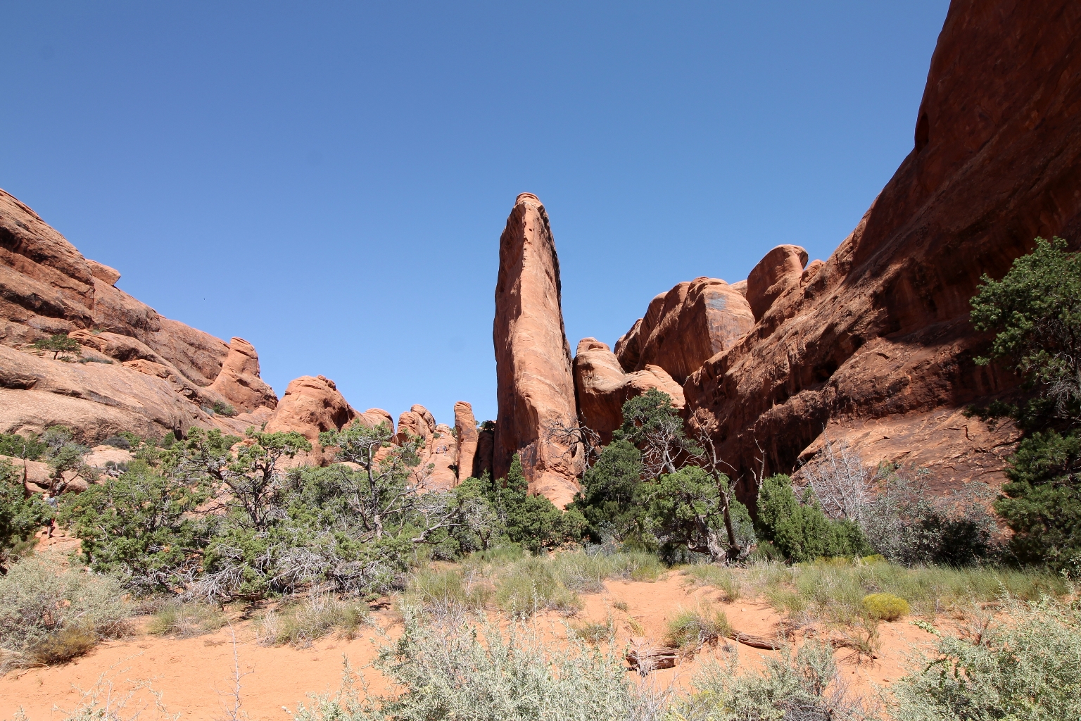
We had some remarkable views of the sandstone “fins” stretching out across the Devil’s trail.
We snapped a few pictures of the familiar attractions along the park’s drive. There are views of the Sheep Rock and a part of Babel Tower. They looked so different in the sunlight. For comparison, take a look at the pictures here.
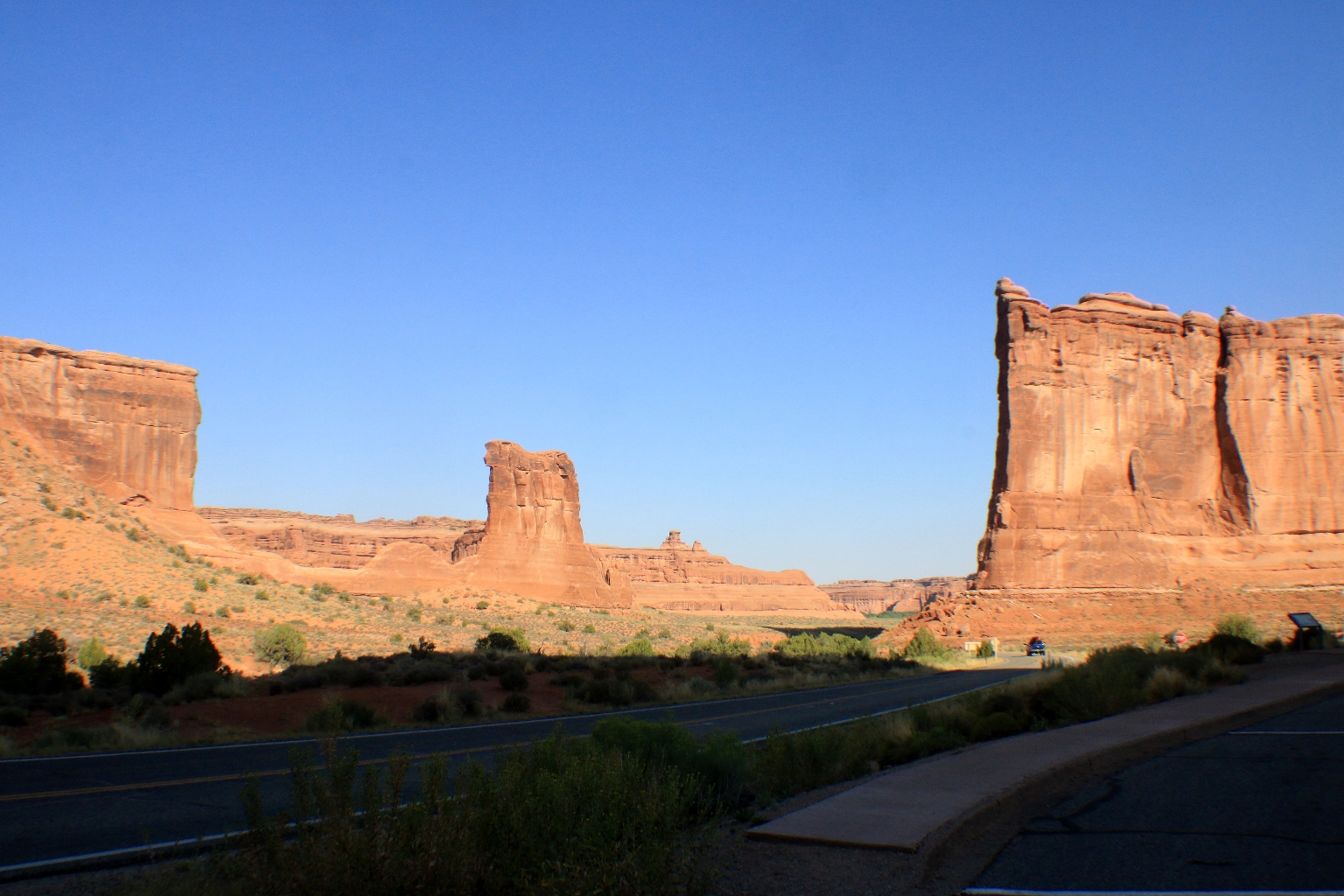
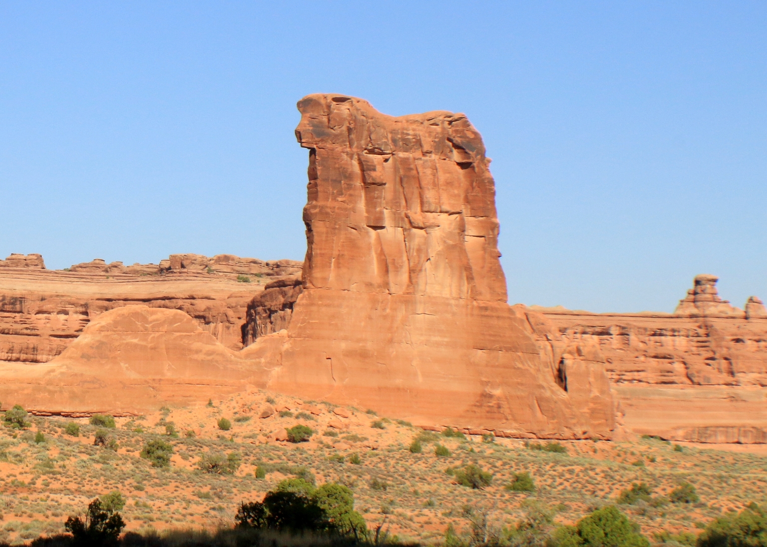
The Sheep Rock close up.
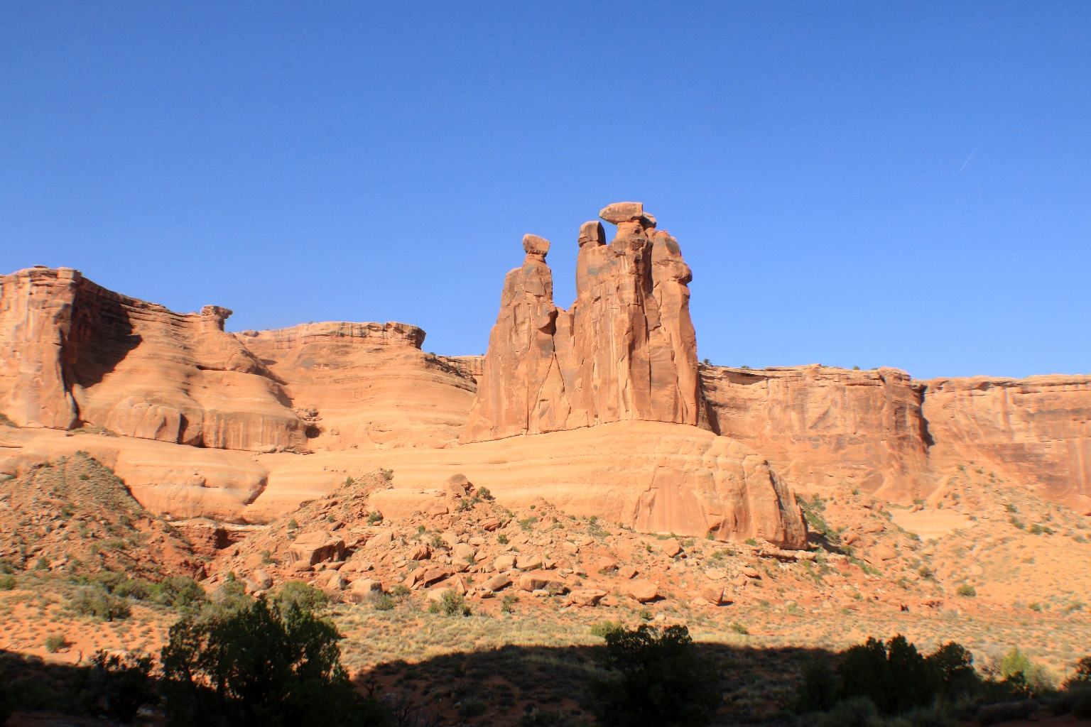
Three Gossips.
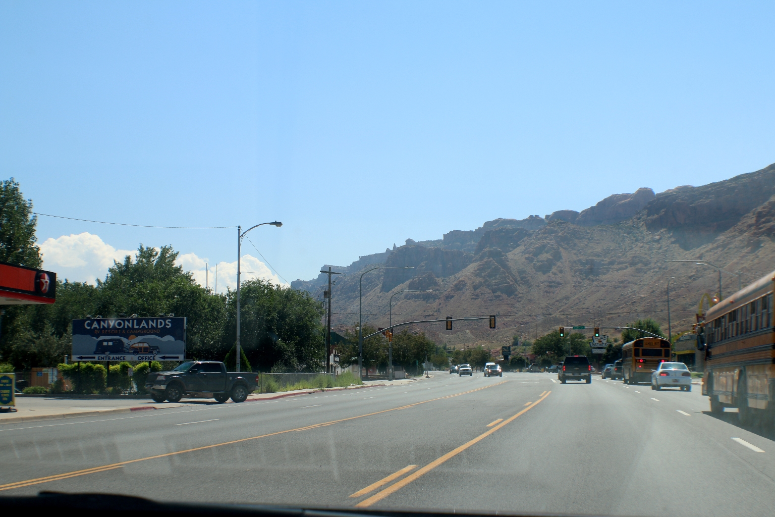
Leaving Arches National Park. We could definitely have spent more time here.
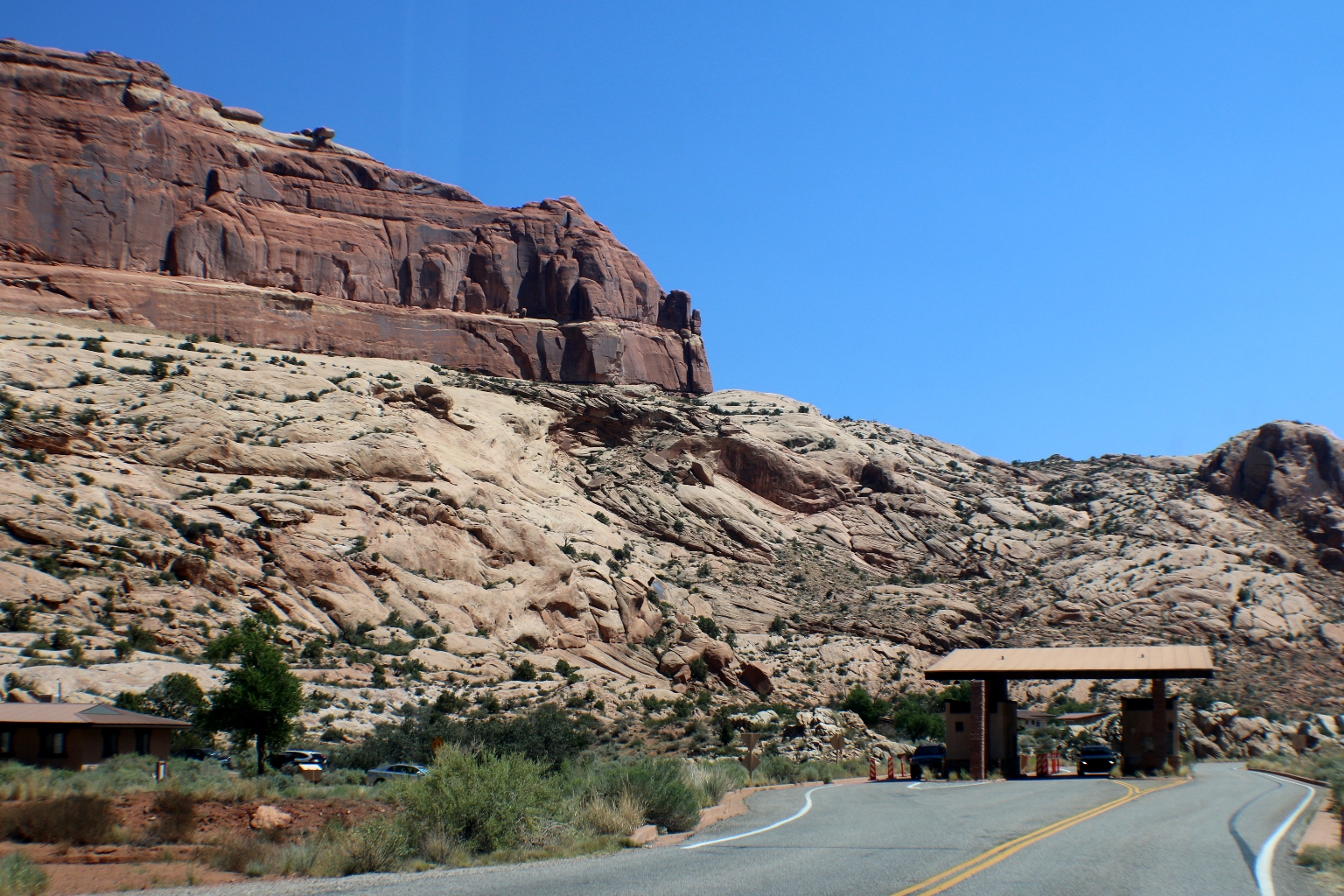
And driving out of Moab on the way to the exciting Monument Valley.
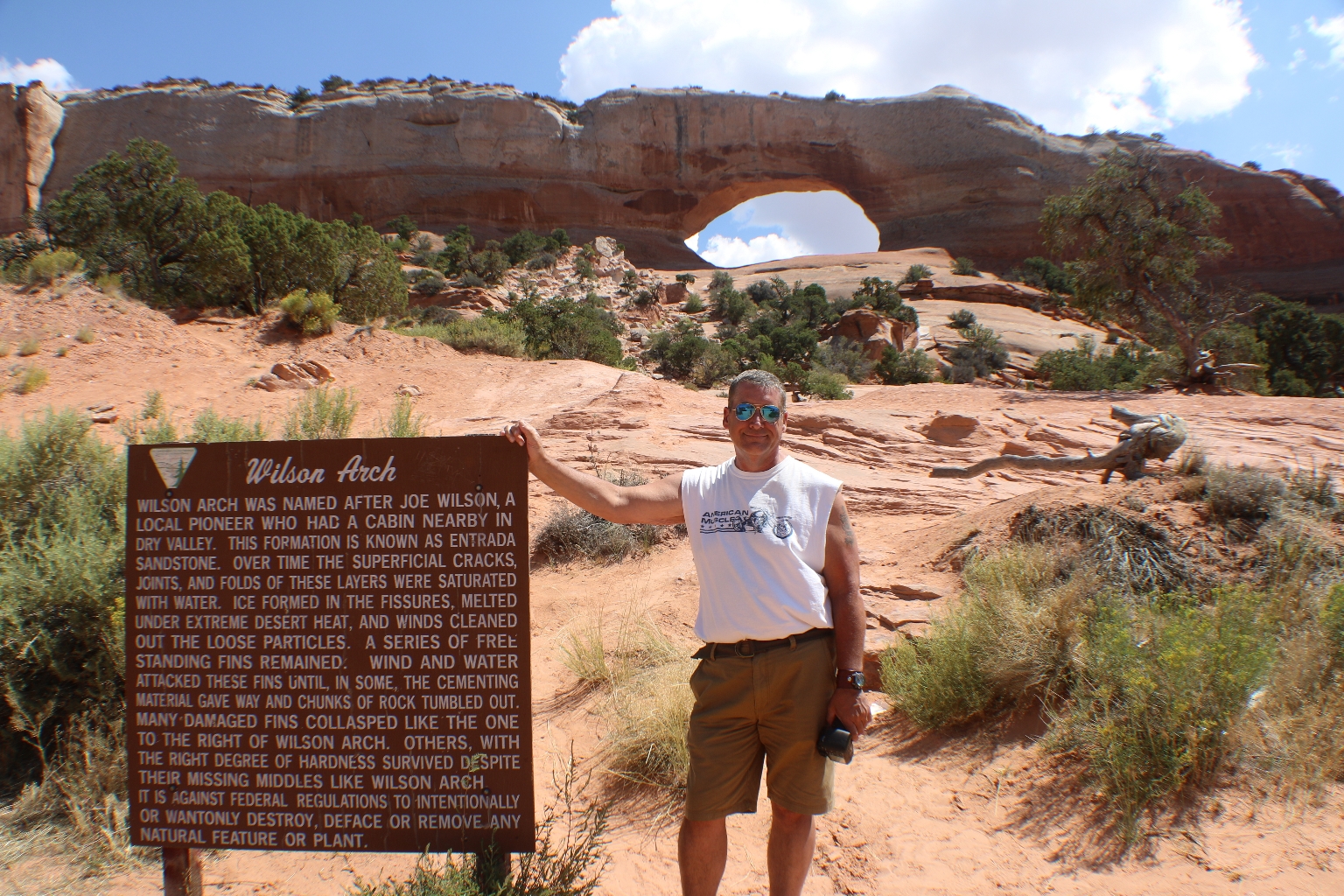
There is so much to see from the road while driving to Monument Valley. Not far from Moab, we stopped at Wilson Arch, which was named after a local pioneer Joe Wilson.
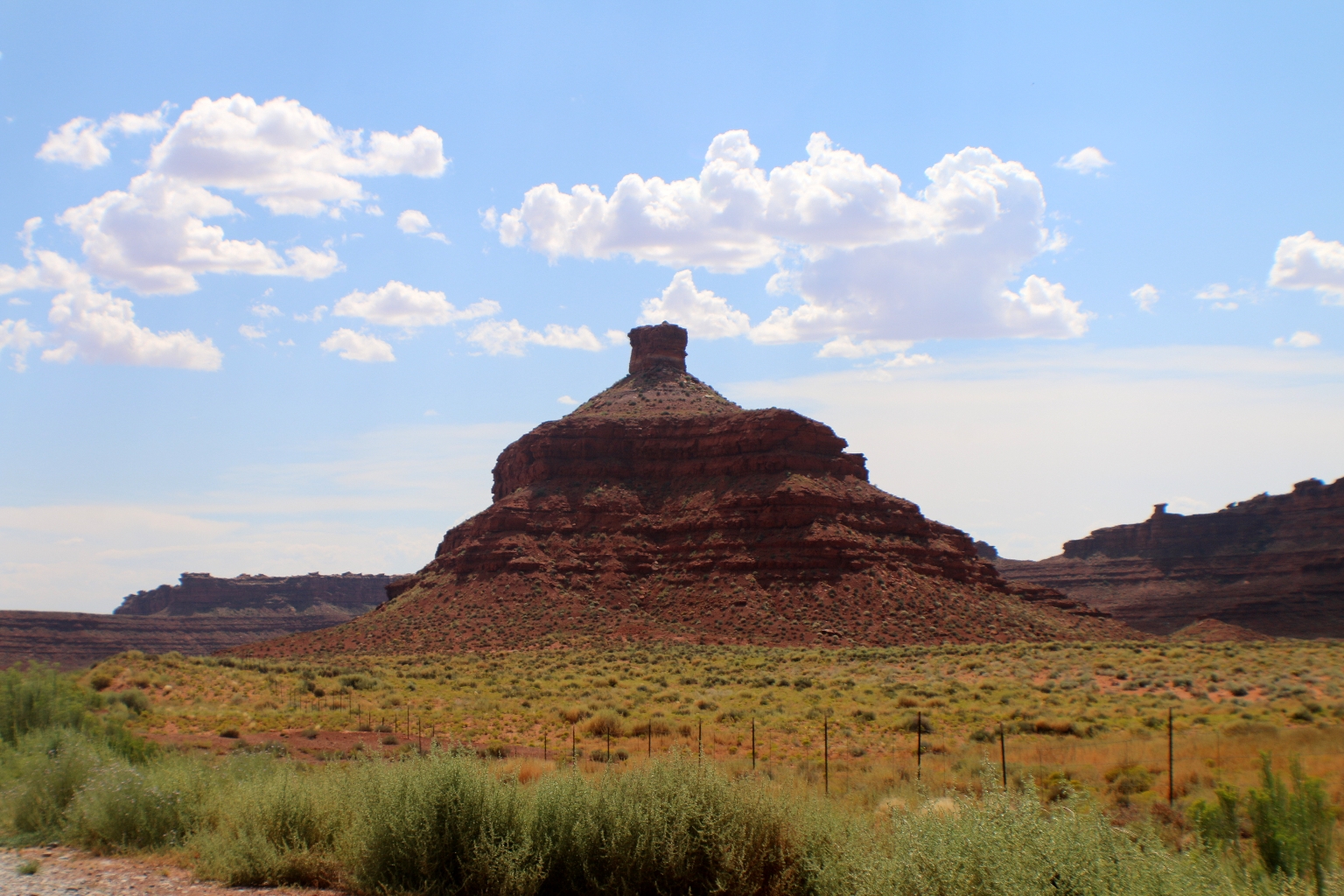
Driving further, we passed Valley of the Gods. Valley of the Gods is a scenic backcountry area is southeastern Utah, near Mexican Hat. It is a hidden gem with scenery similar to that of nearby Monument Valley. We had only a glimpse of this scenic area, but this place is worth visiting in the future.
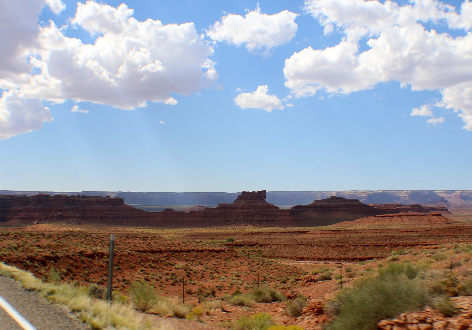
One of the Valley of the Gods buttes.
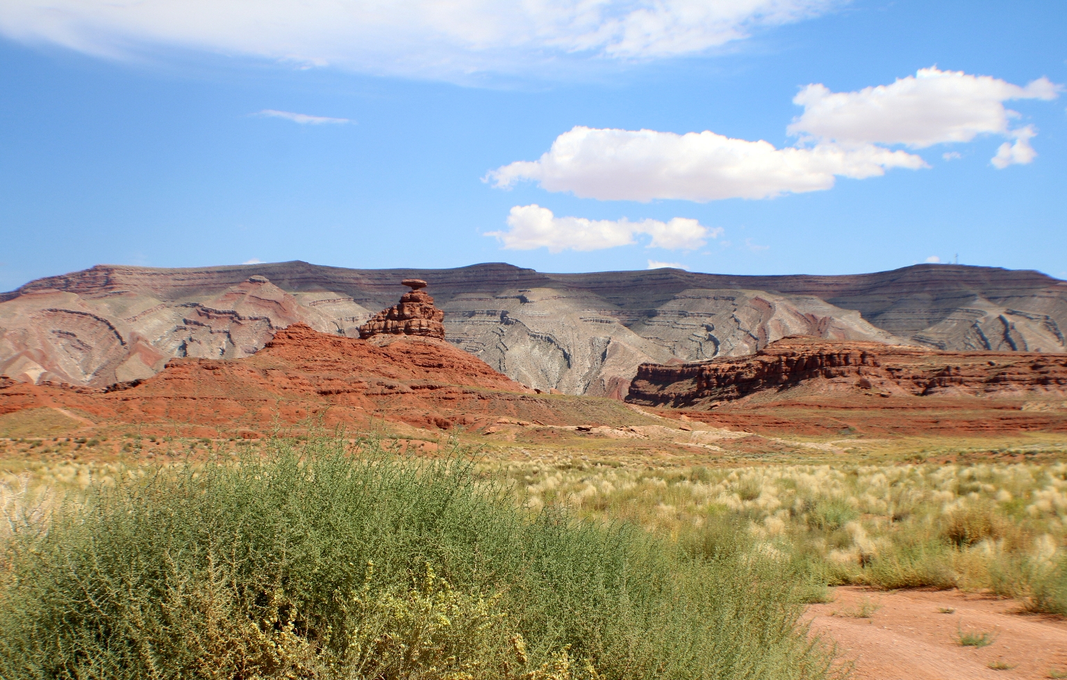
We knew that the Mexican Hat Rock would be on our way. Finally, we noticed the sign and took this dirt road to take a closer look. The name “Mexican Hat” comes from a curiously sombrero-shaped thick rock located on the northeast edge of Mexican Hat town.
Named for the inverted stone sombrero near the town, Mexican Hat boasts a colorful history. Early in the last century over one thousand people at a time descended on this curve of the San Juan River looking for gold, oil, or uranium. Currently, the Mexican Hat settlement consists only of 17 households or 31 person.
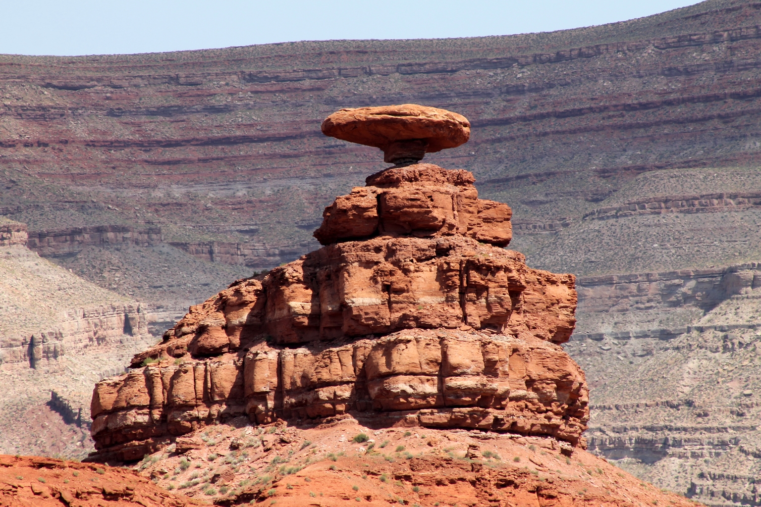
Mexican Hat close up from one side.
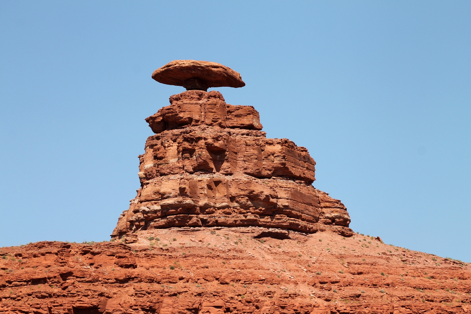
And from the other side.
Approaching Monument Valley via U.S. Route 193 (US-193) South from Moab. Such a beautiful view!
Forest Gump stopped running on this road. 🙂

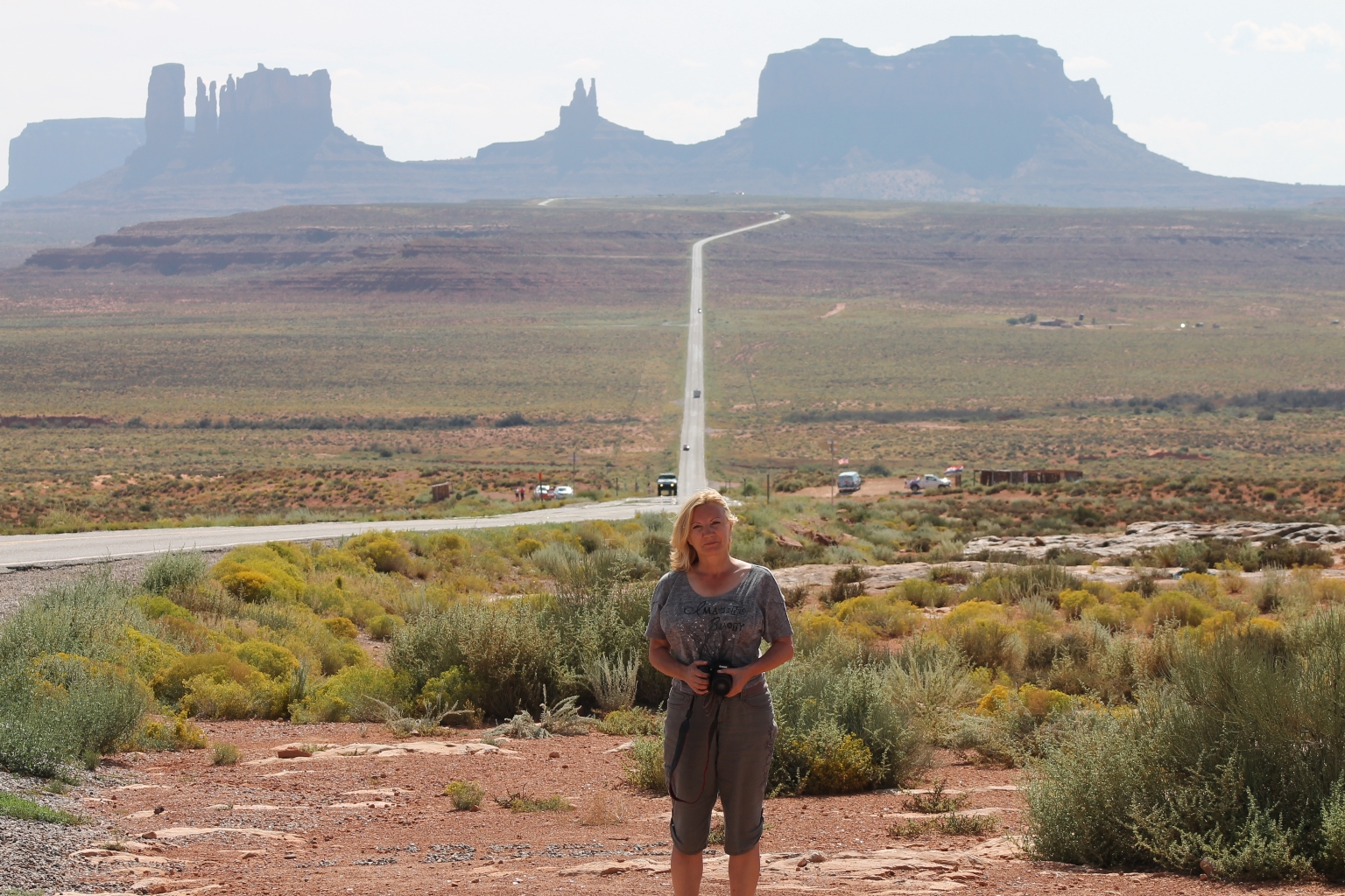
The view got prettier as we were approaching Monument Valley.
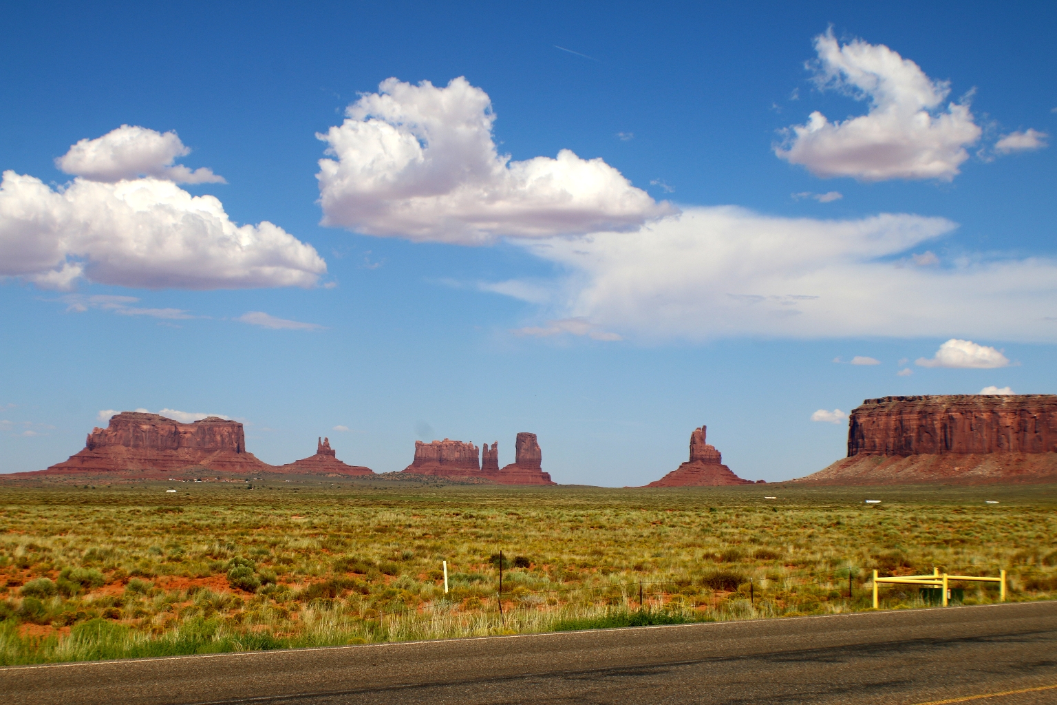
Monument Valley is a Tribal Park located on the Navajo Indian Reservation. The park lies on the Utah/Arizona border, with most of the monuments on the Arizona side. Navajo Indians deem Monument Valley as a sanctuary for nature and spirit and consider it a sacred place. Many Navajo families have lived in Monument Valley for generations. There are still 10-12 families that live in its back country and still adhere to style of dress, traditions, and cultures that have been handed-down over many centuries. They still herd sheep, ride horses, make handmade Navajo blankets and design authentic jewelry.
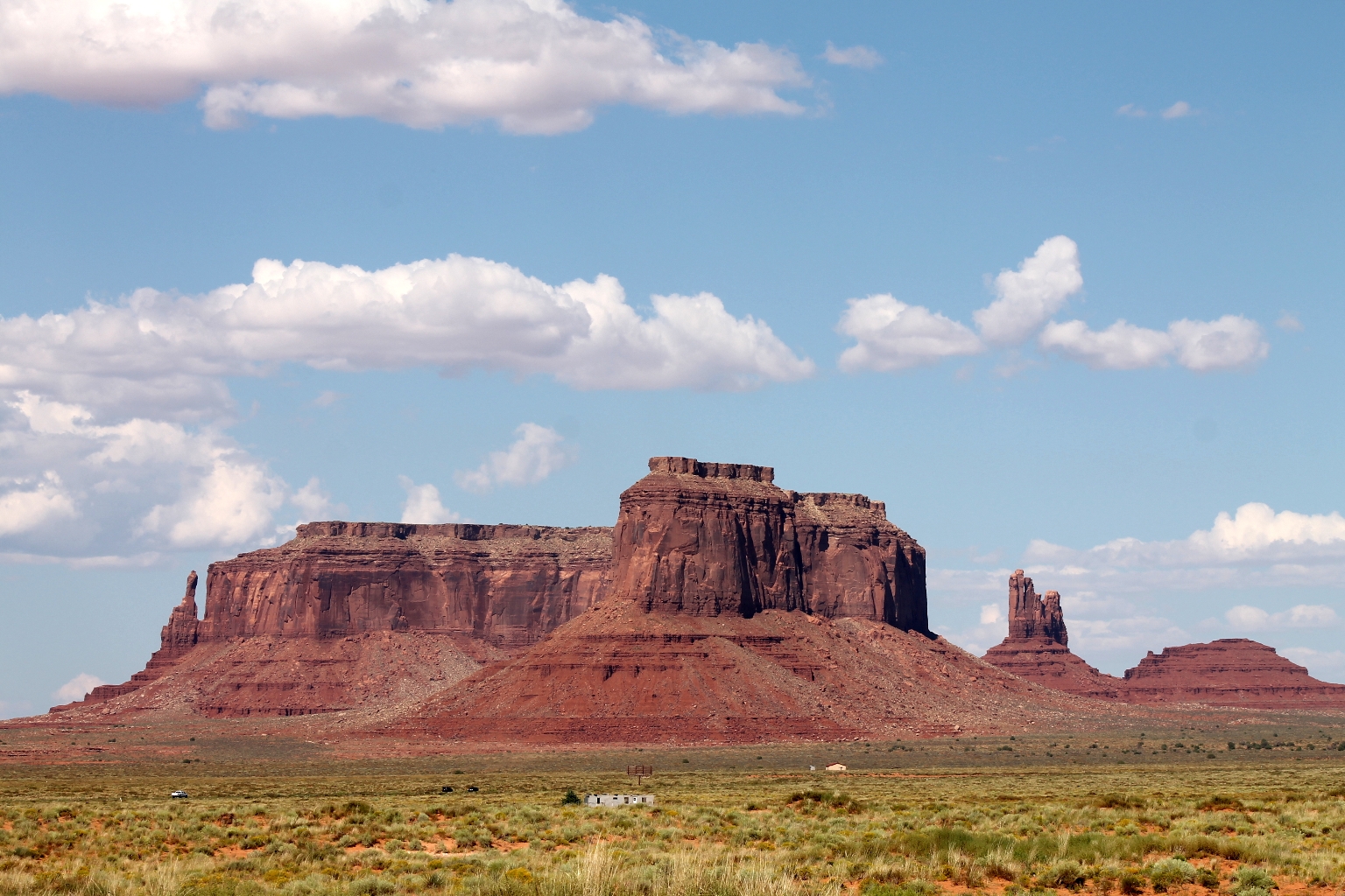
A couple of close ups of these enigmatic Monument Valley rock formations.
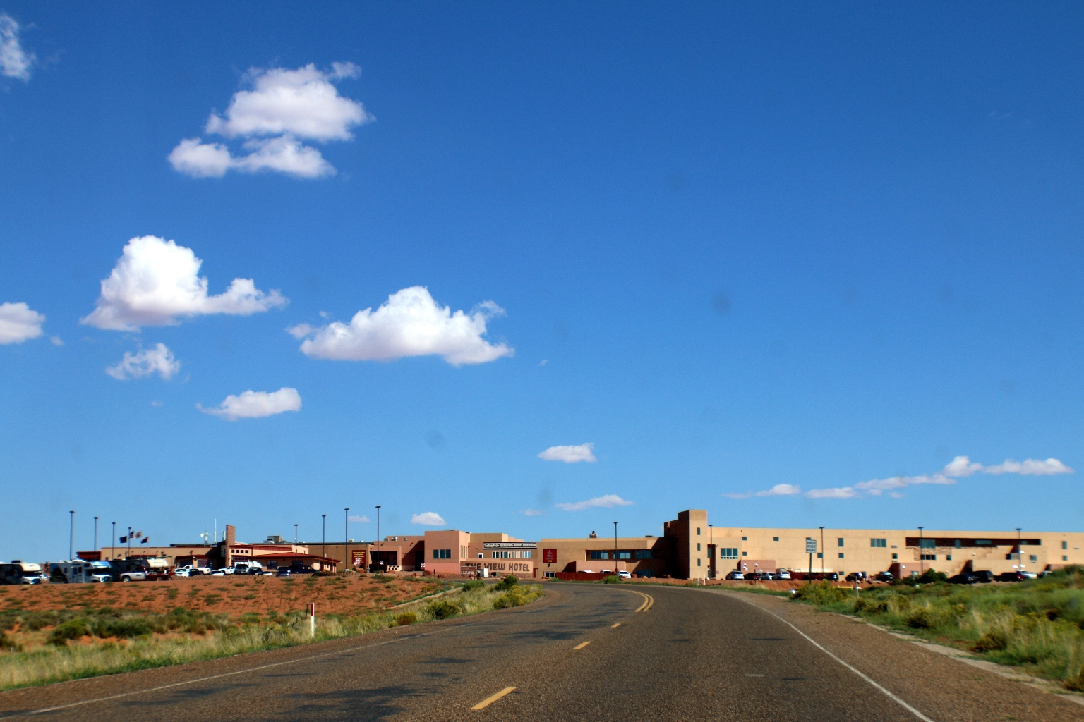
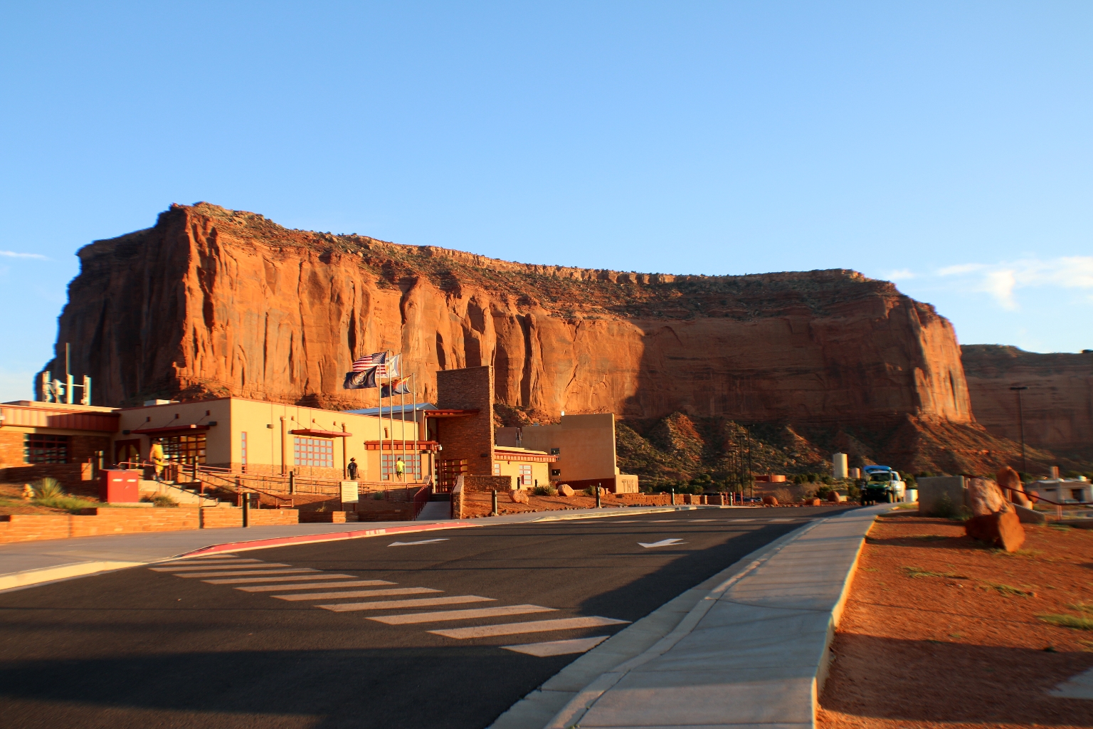
We booked The View Hotel, the only hotel inside the Monument Valley Navajo Tribal Park, situated at the entrance, near the visitors center. It features 90 suite rooms overlooking the entire valley, with amazing views of the famous mittens and other red rock formations. Approaching The View Hotel.
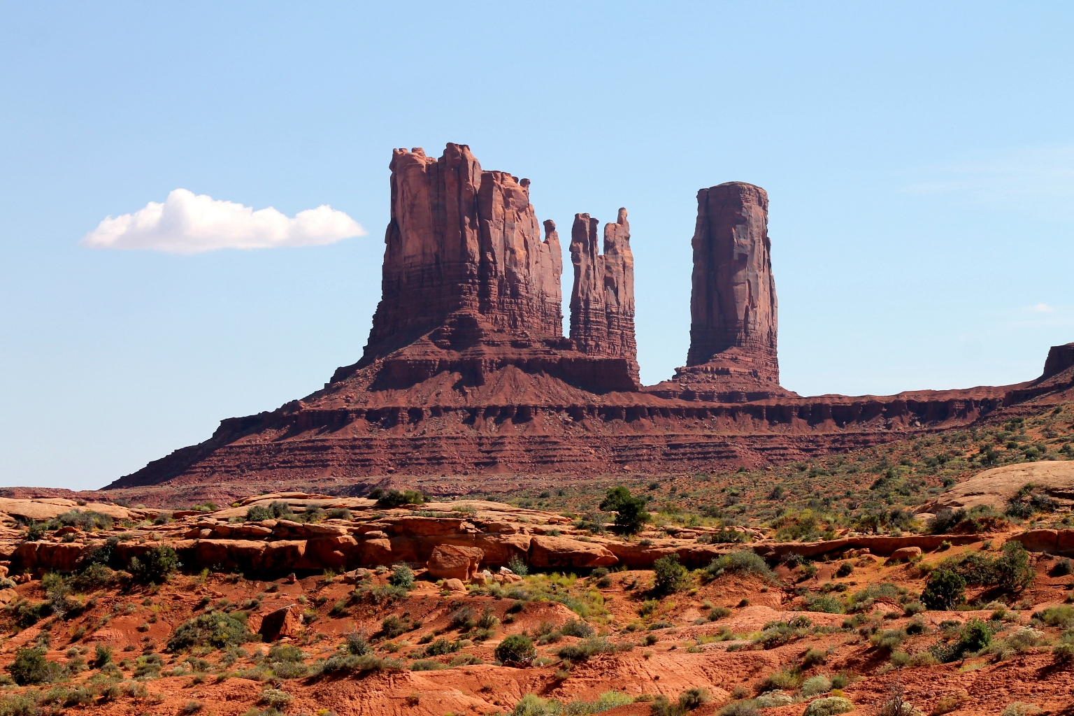
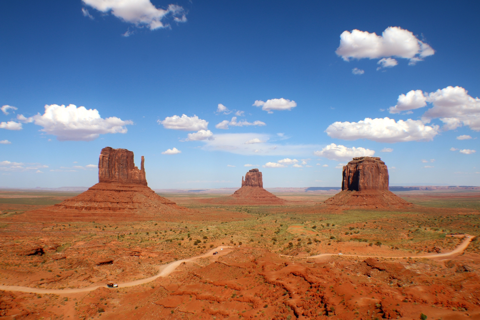
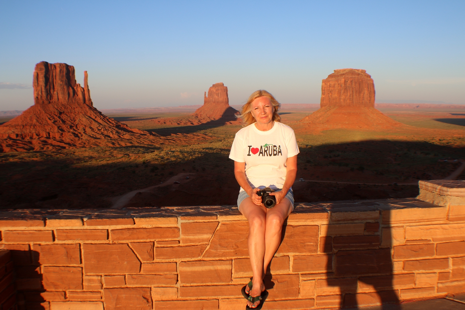
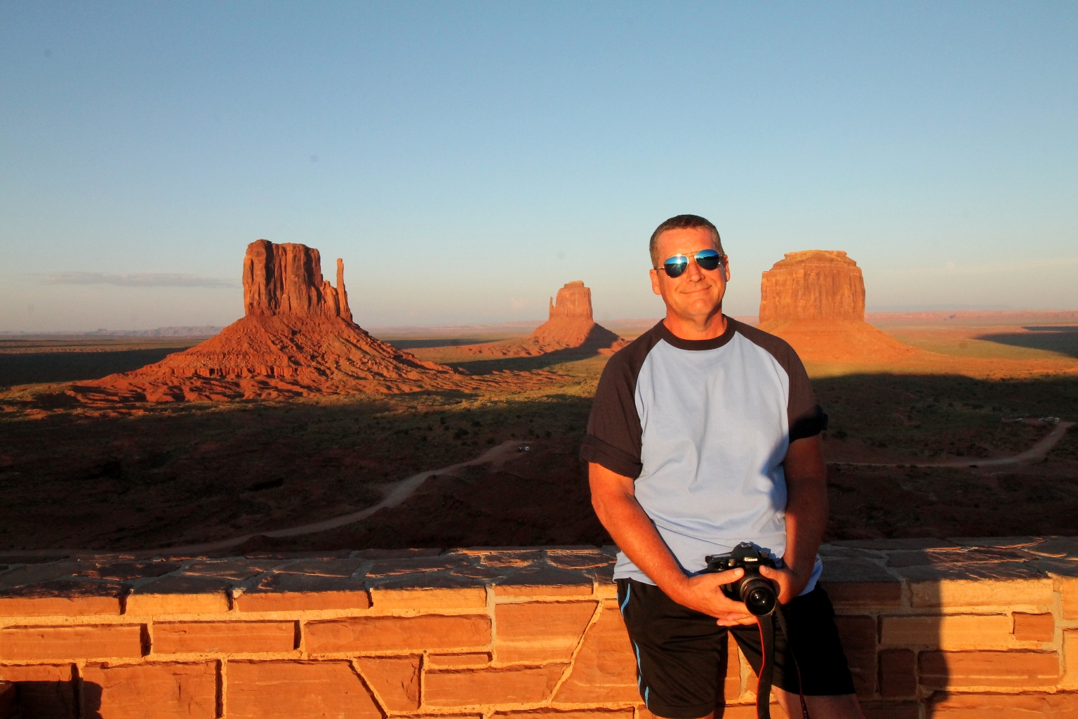
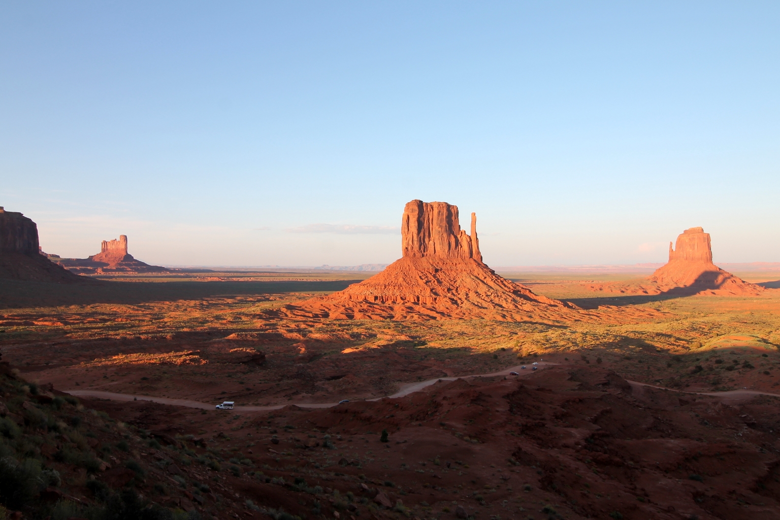
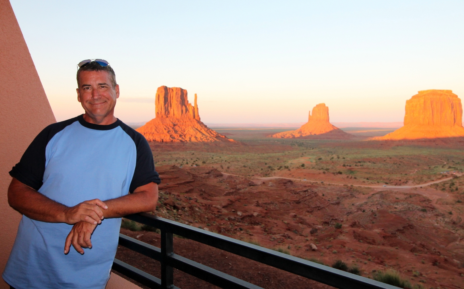
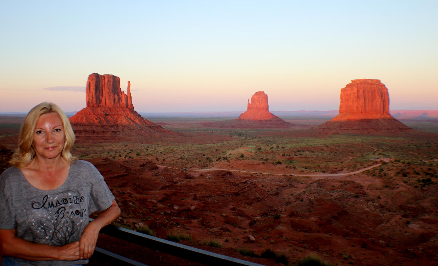
It is a very popular hotel and must be booked well in advance during the tourist season. Dave and I were amazed by the view from our balcony at the hotel. These are The East and West Mitten Buttes, some of the most famous and popular monuments in the park. They resemble a left and right mitten.
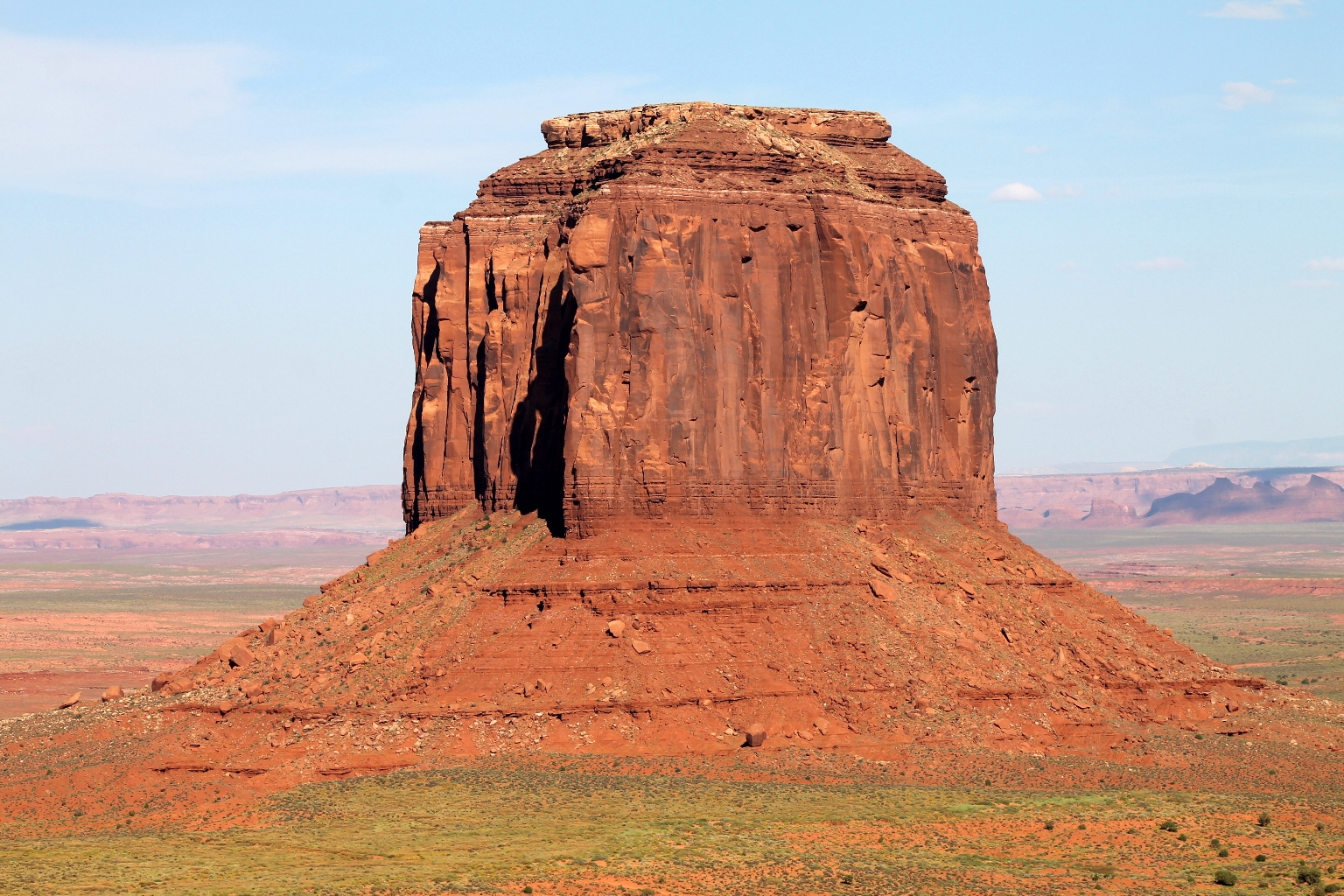
Merrick Butte is in the right side of the picture. Merrick Butte and Mitchel Mesa (adjacent to Three Sisters) are named after two prospectors who discovered silver inside the park. The dirt road viewed in the picture is a scenic 17-mlile drive through the valley.
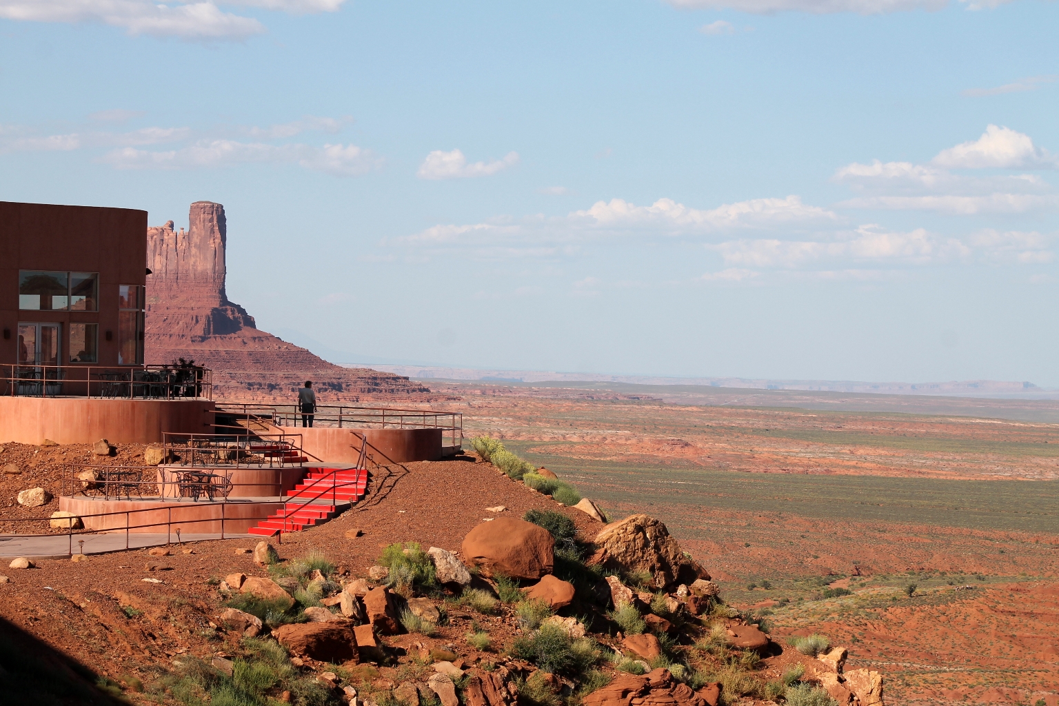
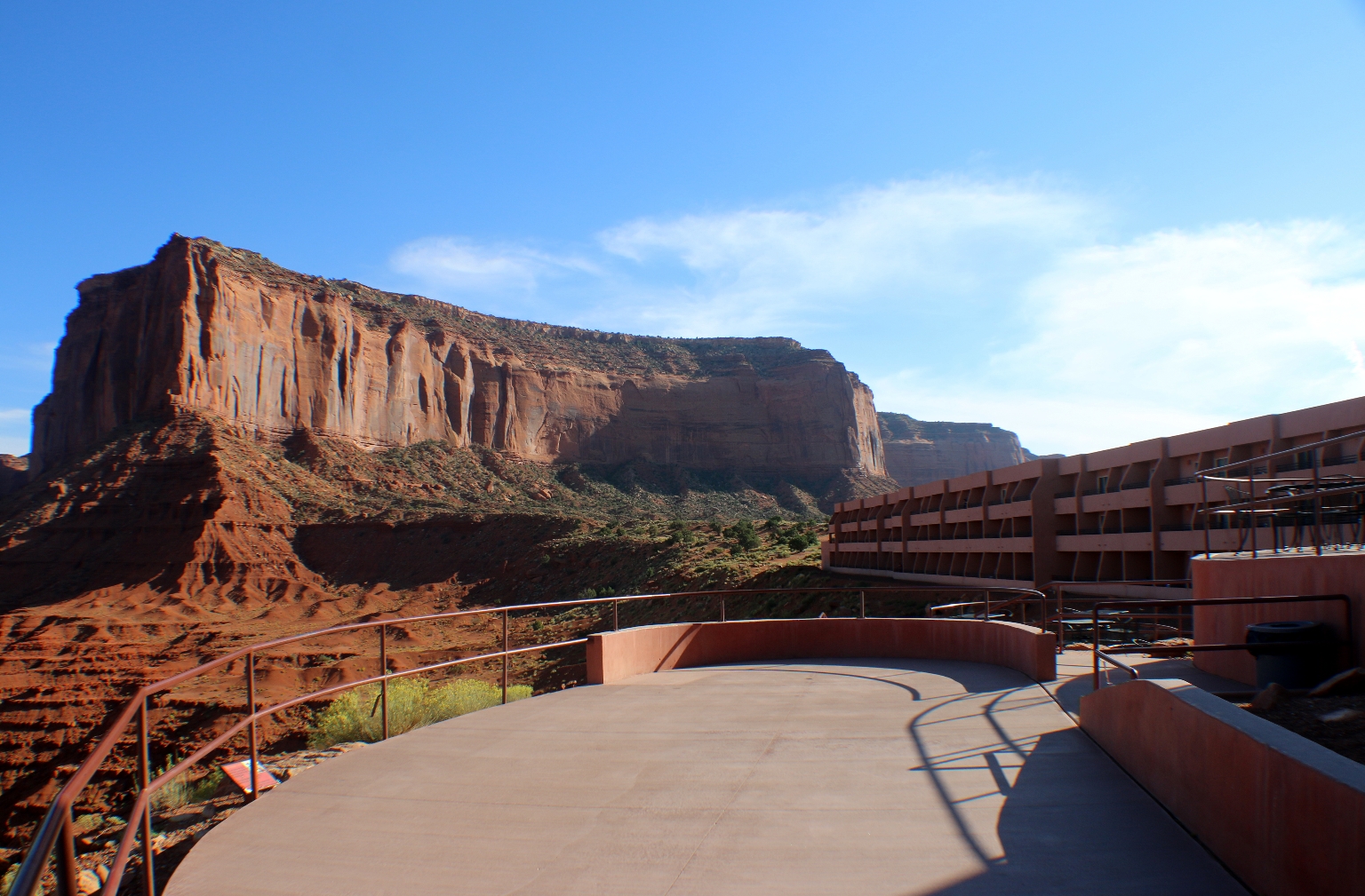
This observation deck we noticed from our balcony. Later on we went there to explore the different views of the Valley.
Here is a close up of the West Mitten Butte.
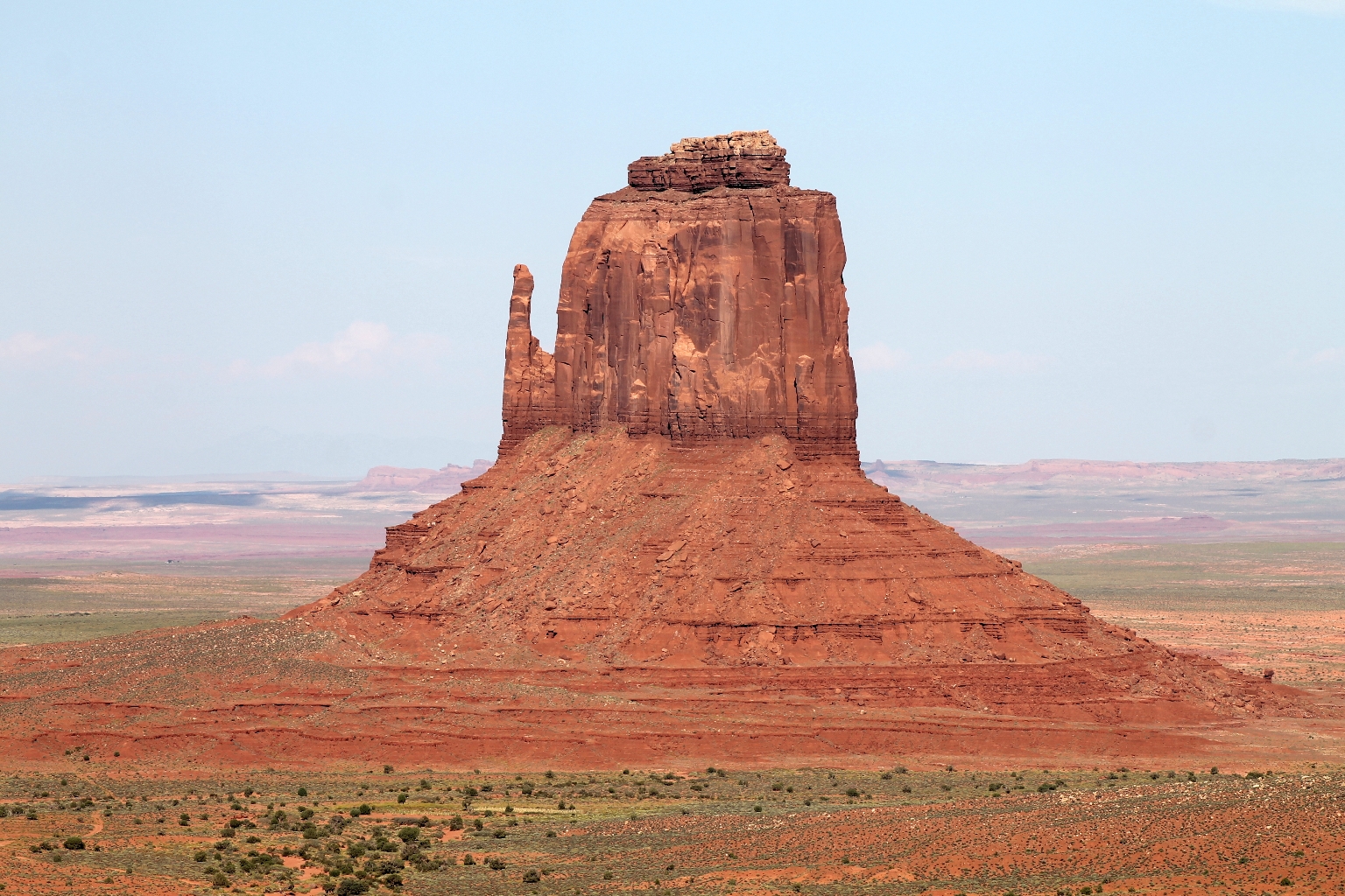
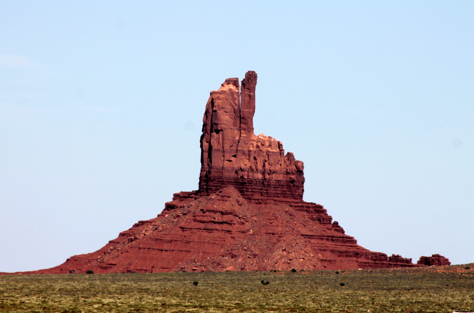
Merrick Butte.
This is a nice view of the hotel from the observation deck. Our room is located in the building at the end.
Here, we walked around the hotel to a different observation deck for a gorgeous sunset view.
The sun made the rock on the other side of the hotel look bright and colorful.
One more view of The East and West Mitten Buttes.
We explored the hotel’s restaurant & trading post earlier; we just enjoyed the sunset from our balcony for the rest of the evening. We had such a nice time!
The sun rays kept painting the valley in incredible colors during the sunset.
The sun has set, but the valley still looked beautiful in these pinkish pastel colors.
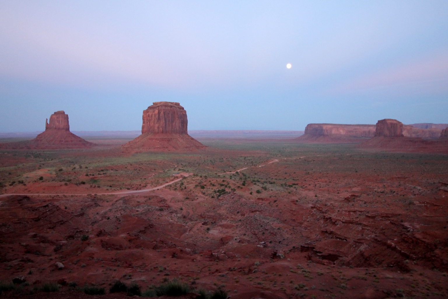
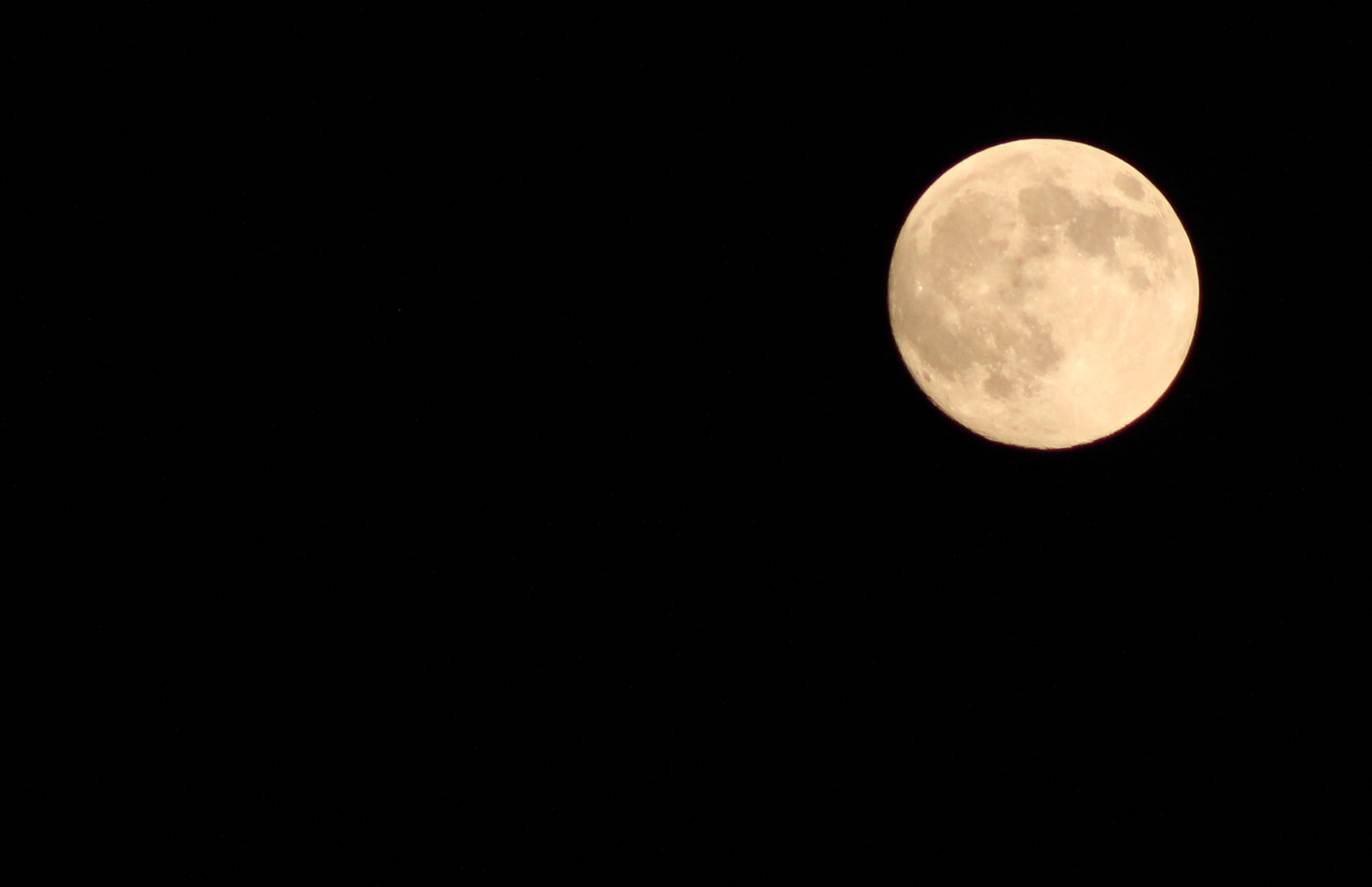
Shortly, it became pitch black outside with the huge bright moon in the sky. Good Night Monument Valley and see you tomorrow! 🙂