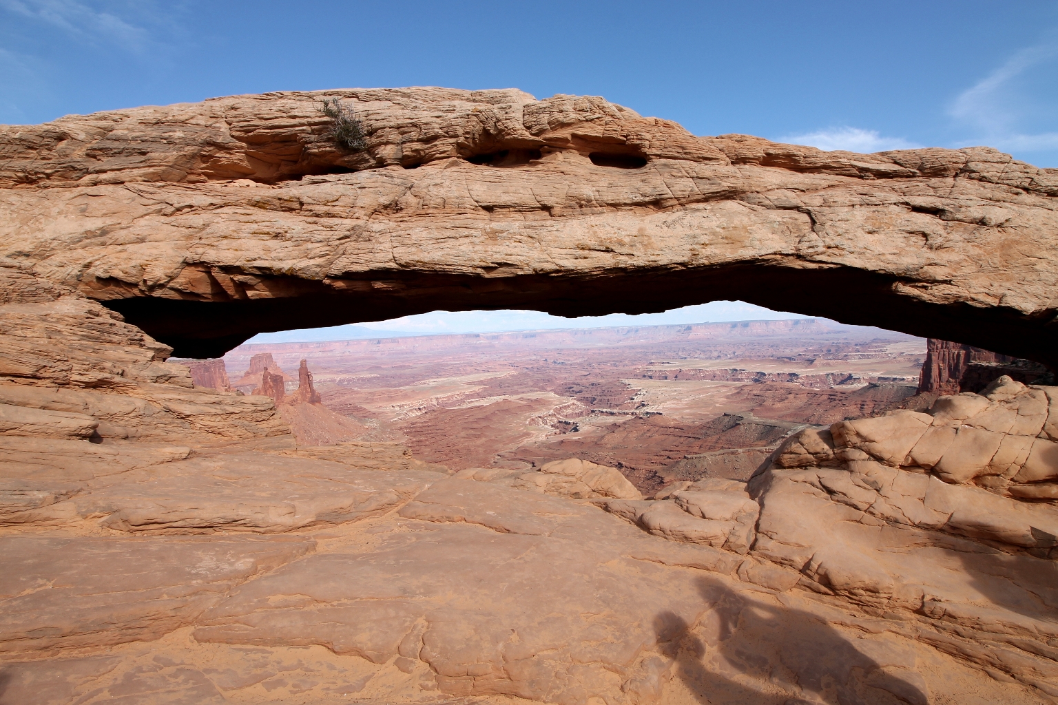
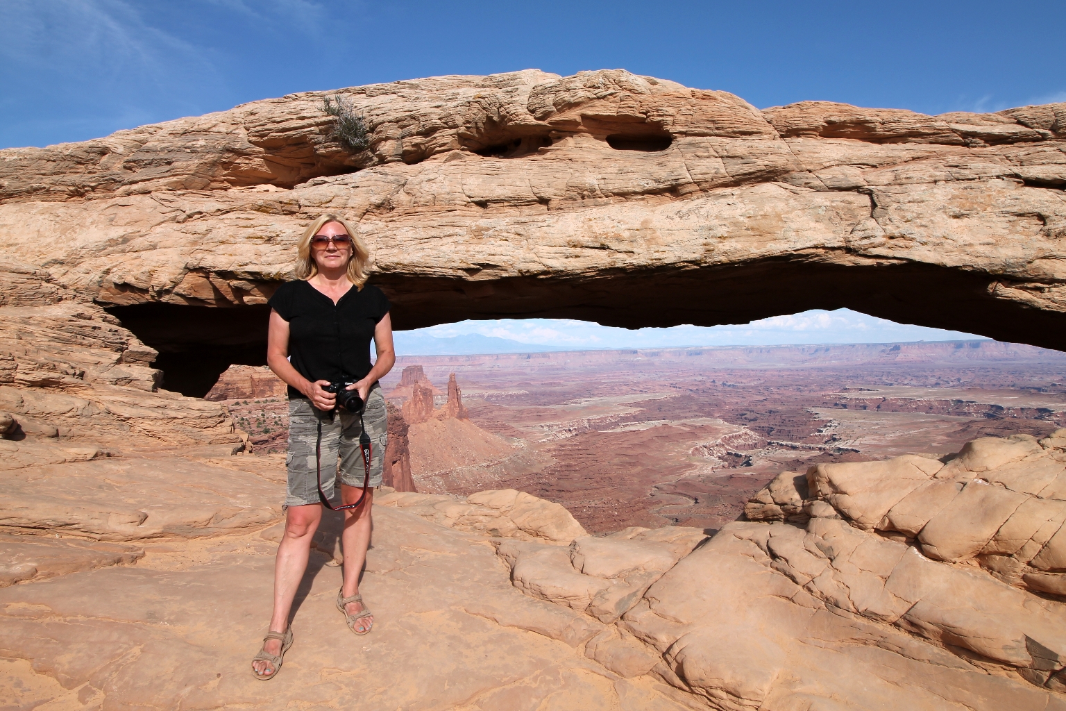
Canyonlands National Park is a massive park with numerous districts, trails and overlooks. The park preserves its natural beauty throughout its four districts, which are divided by the Green and Colorado rivers. The four districts are the Island in the Sky, the Needles, the Maze, and the rivers themselves. Dave and I chose the Island in the Sky district, stopped at a few main overlooks along the road, and took only one trail to the impressive Mesa Arch, which is depicted in the picture below.
Island in the Sky is the most accessible district offering incredible views from many overlooks along the paved scenic drive, several hikes of varying length and a moderate four-wheel-drive route called the White Rim Road. Just to show how large this park is, The Needles is located at the other end of the park (a 2 hour drive from this one) and is accessible only by a different visitor’s center.
The Shafer Canyon Viewpoint is the first stopping point along the road from the Visitor Center, and it was our first stop point as well.
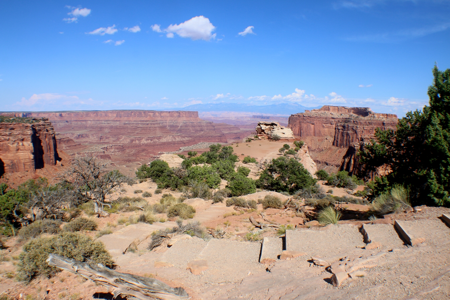
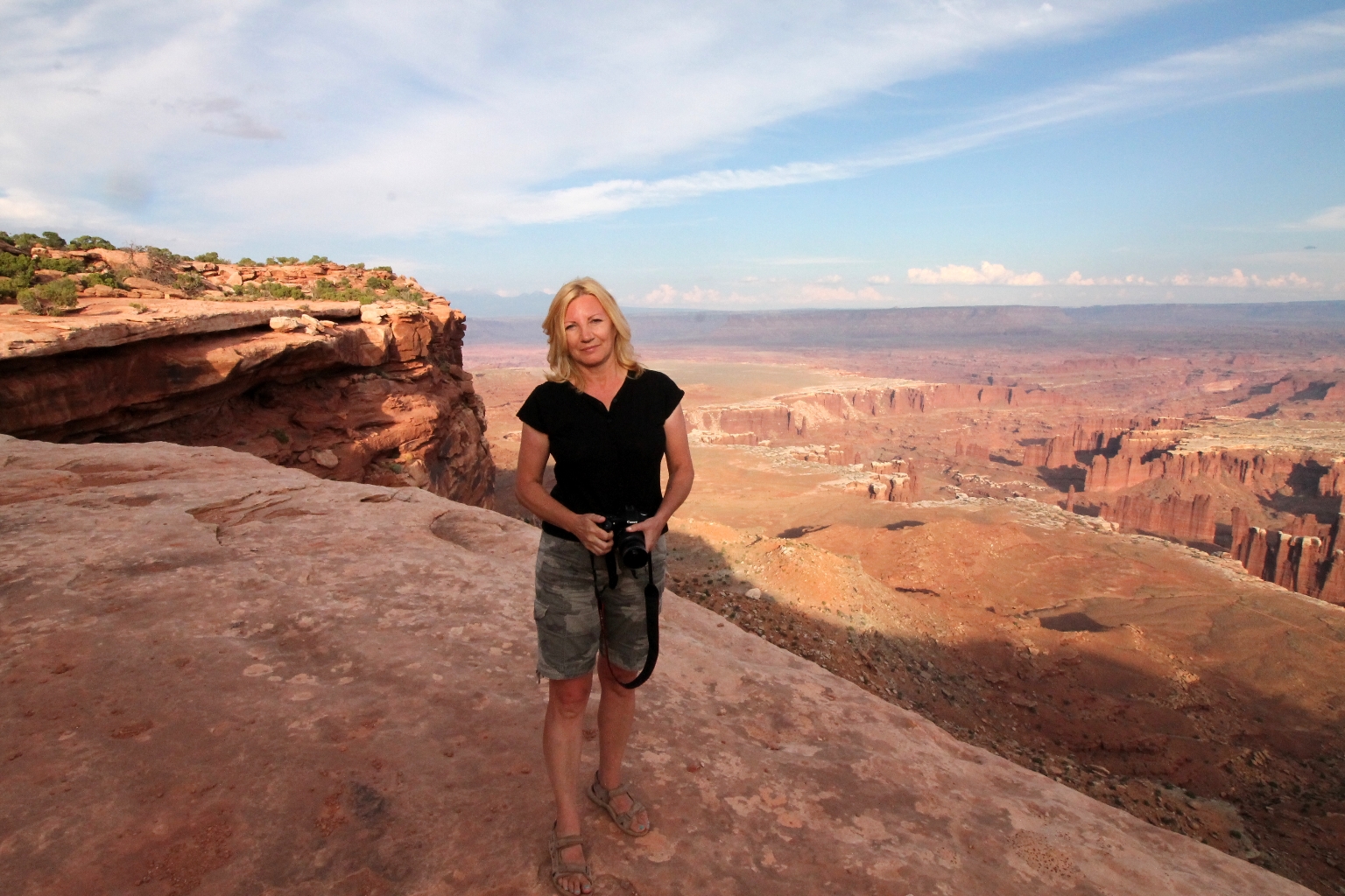
After seeing this sign along the road, we were determined to see this amazing arch. Luckily, according to the sign, the trail to Mesa Arch is only 0.5 miles long.
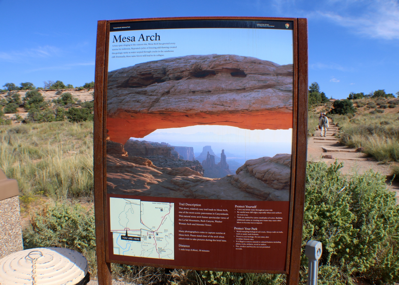
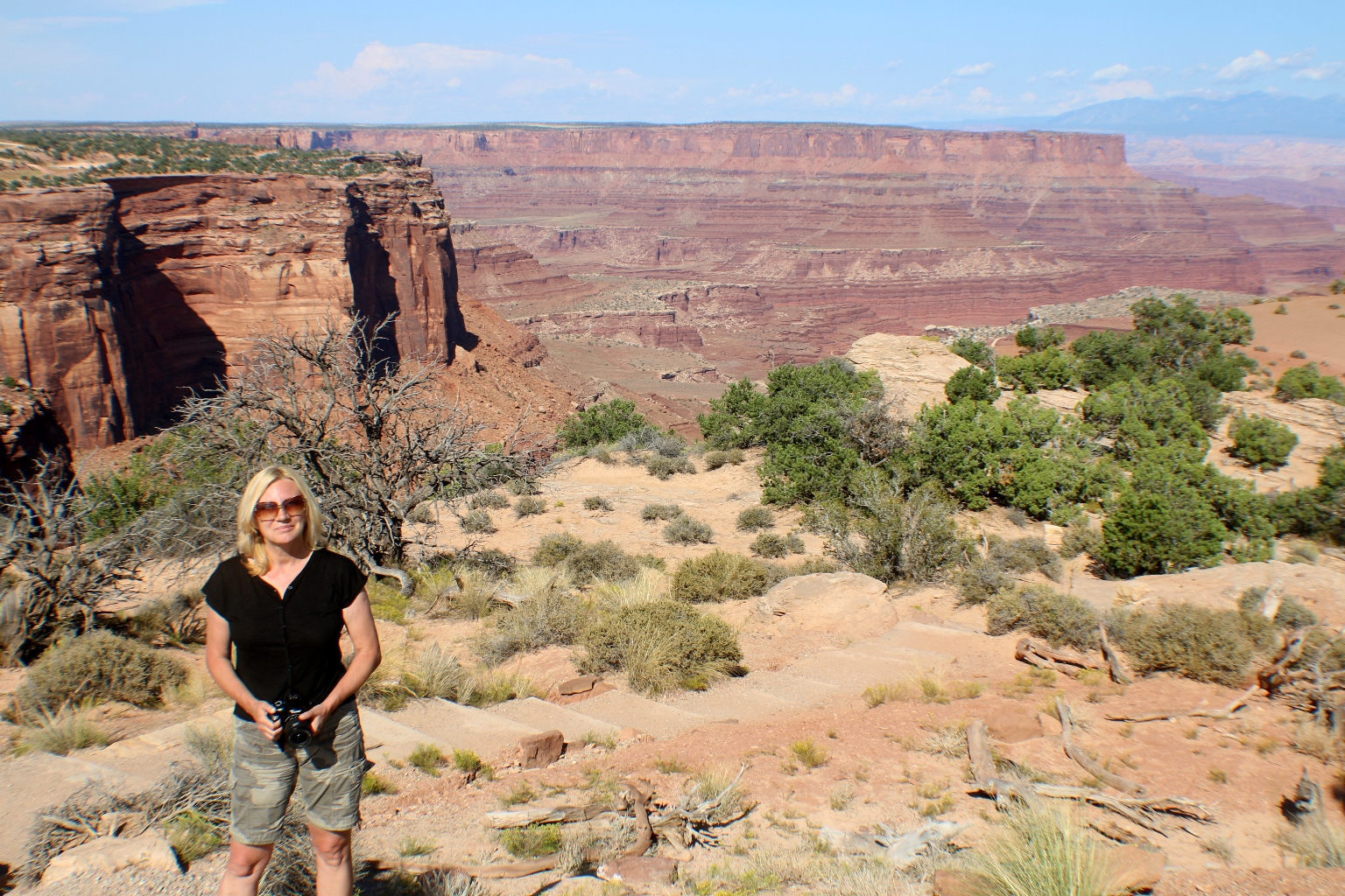
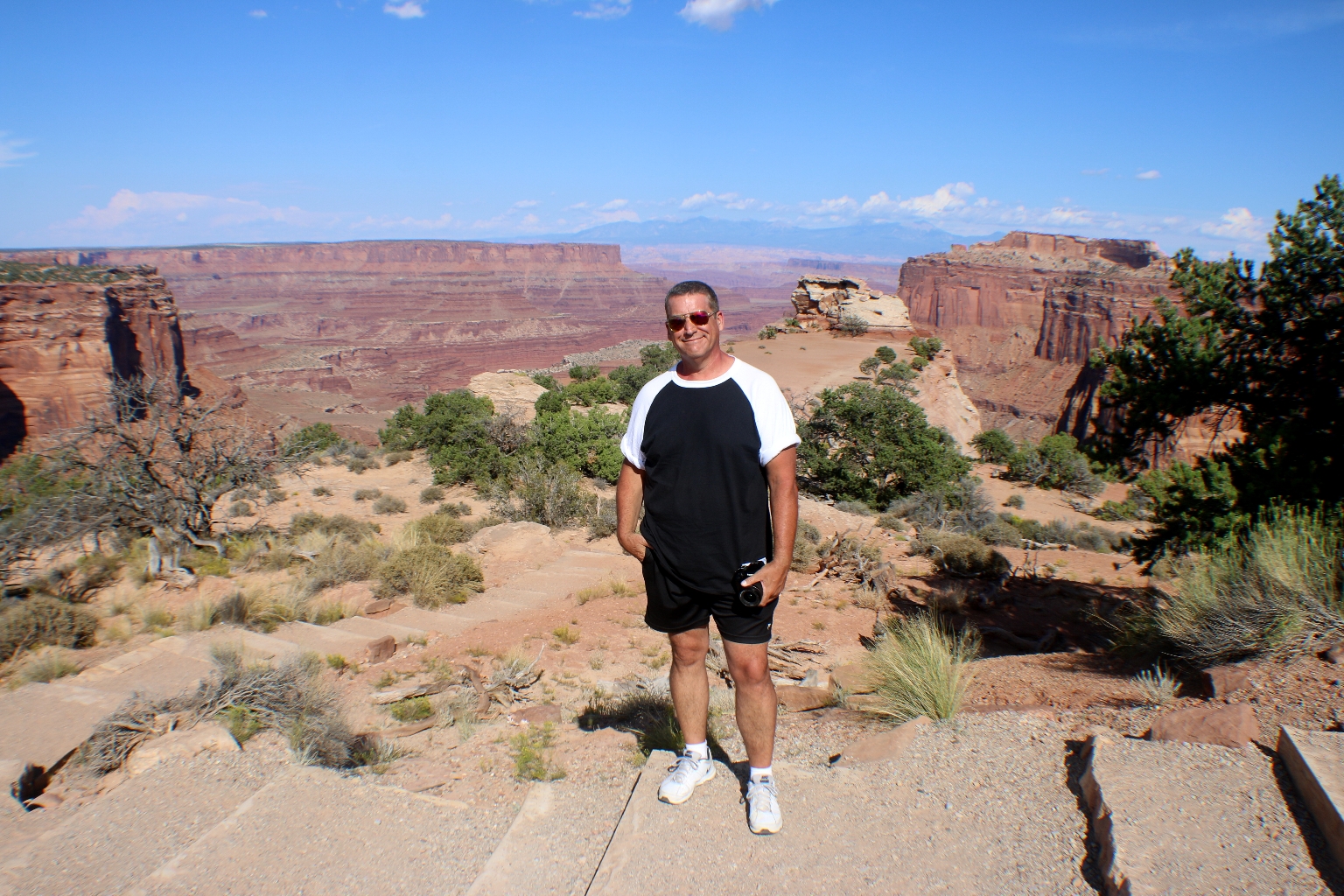
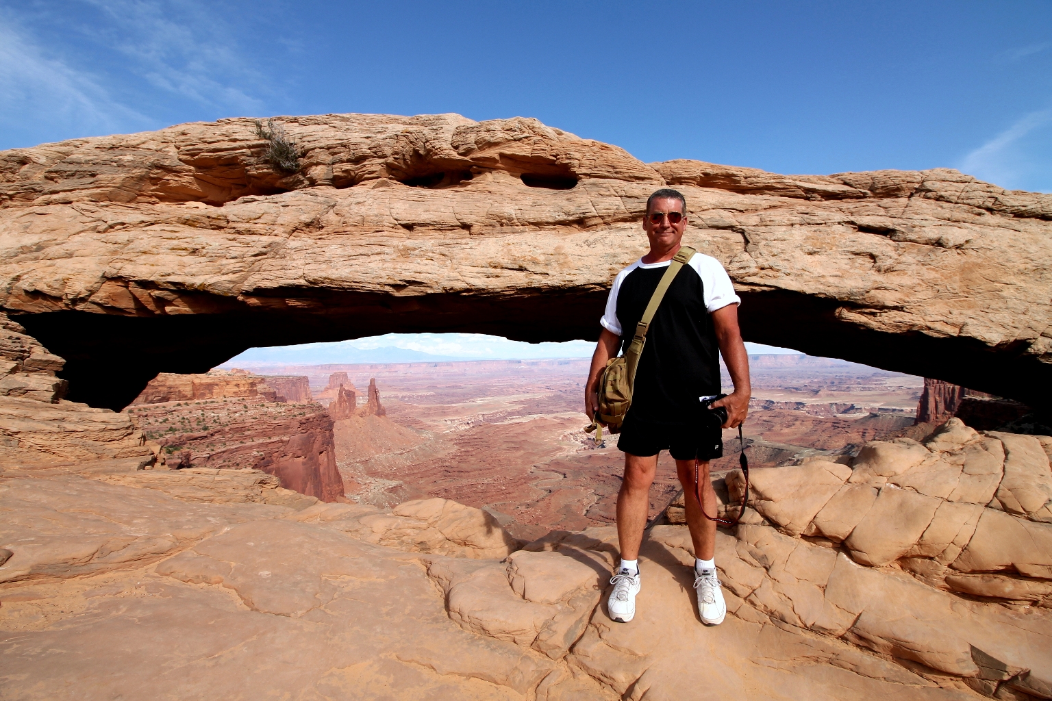
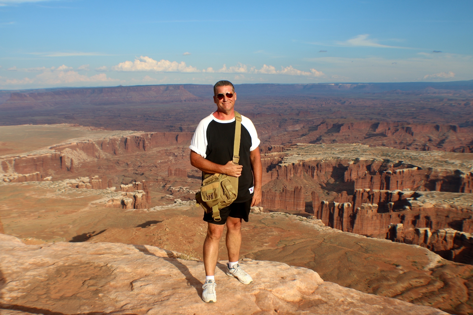
It was a really nice short trail and definitely worth the view. Mesa Arch is a great example of nature’s handiwork, a gaping hole in a sandstone fin.
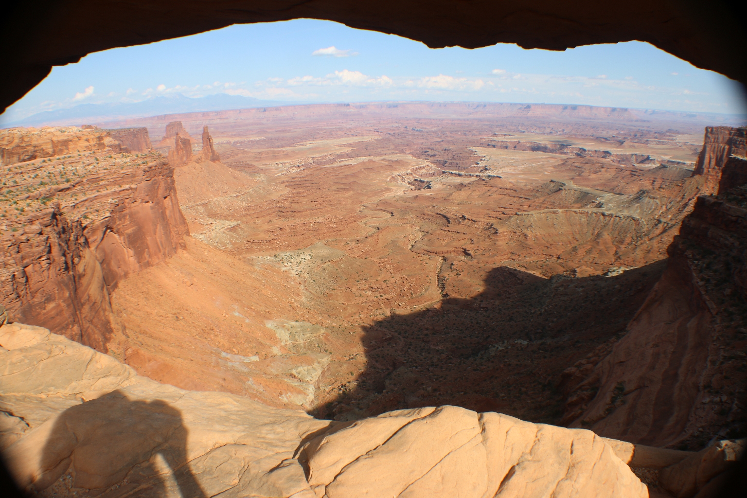
A view through the opening reveals incredible views of Utah’s Canyonlands below.
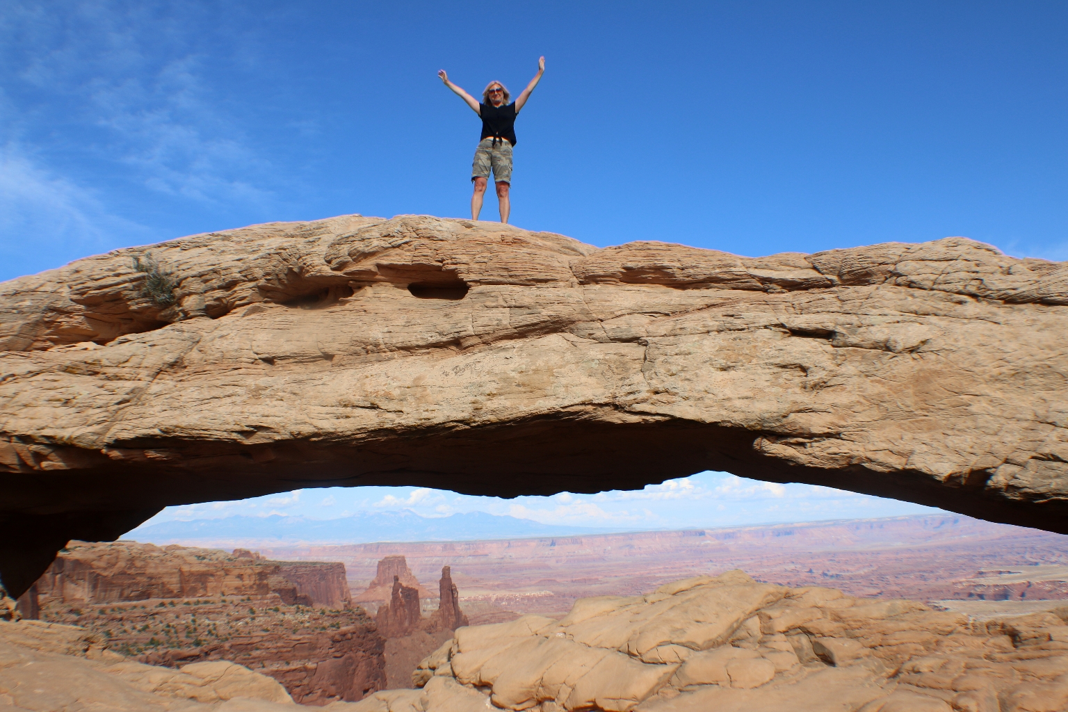
I had to climb on the top of the arch. It felt great!
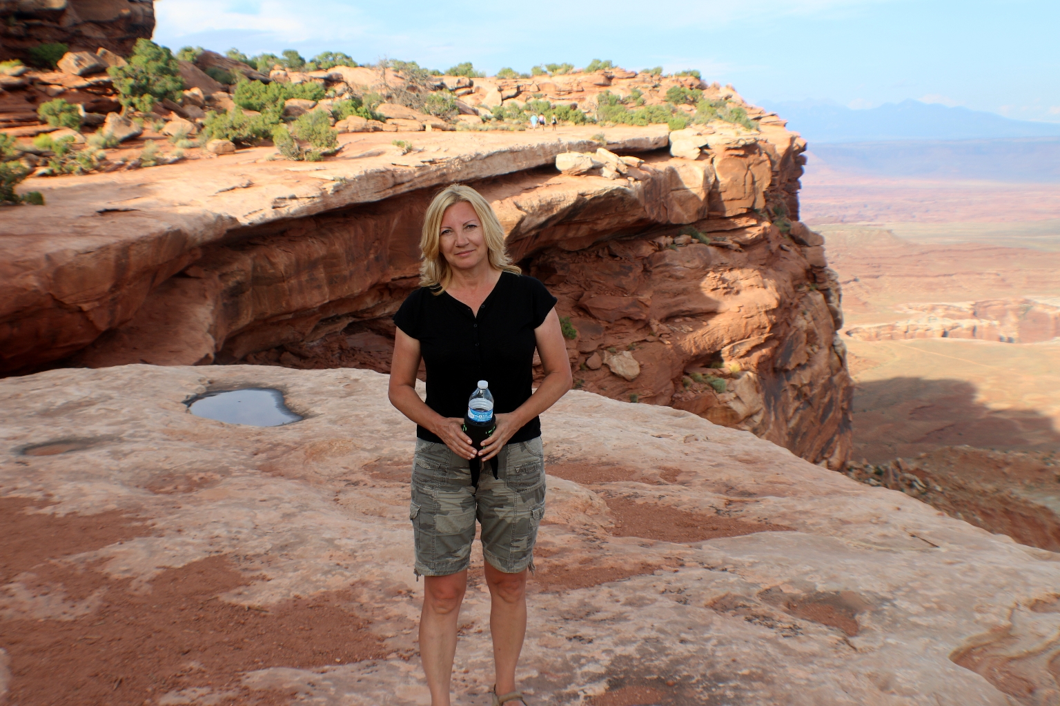
Mesa Arch looks different from the trail.

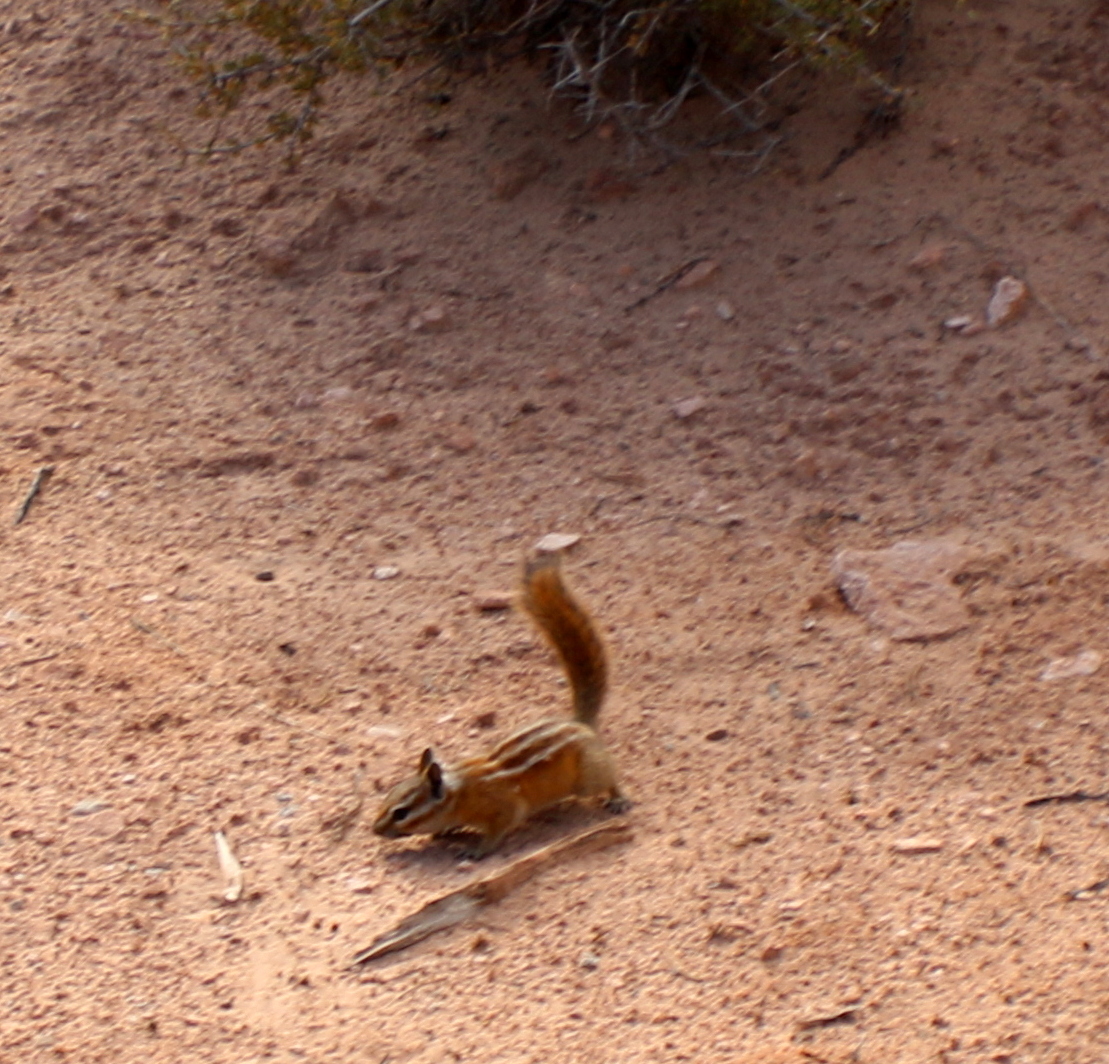
We saw this cute little chipmunk on our way back from the trail.
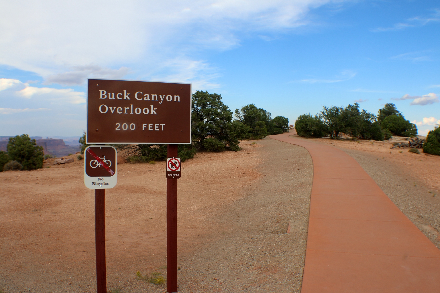
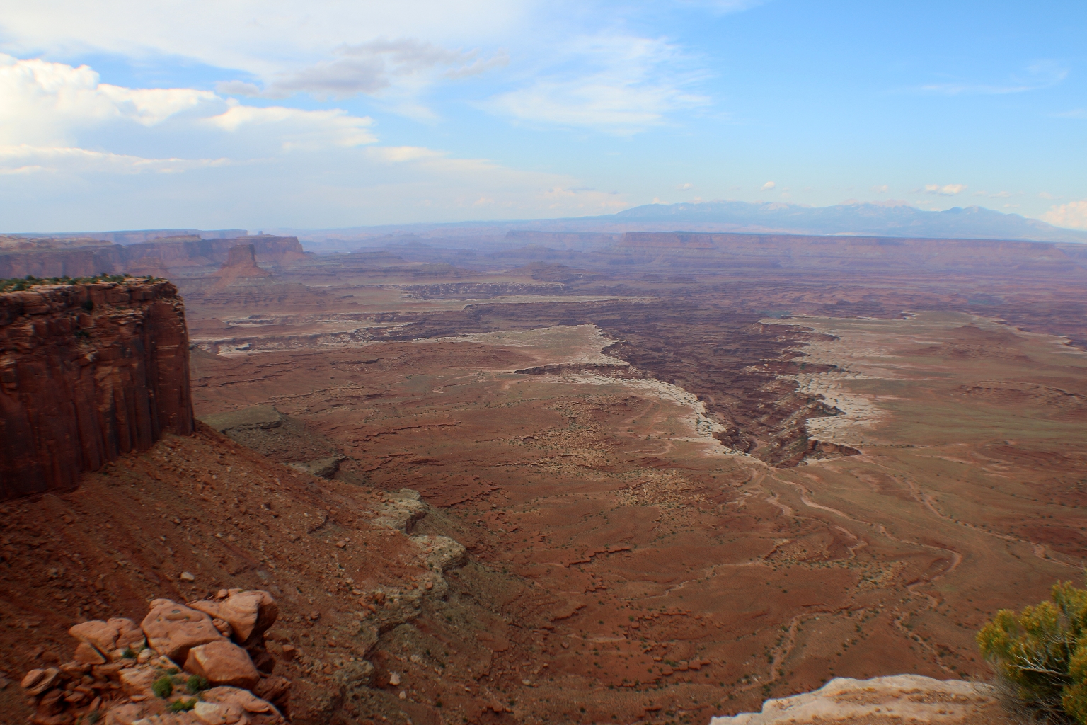
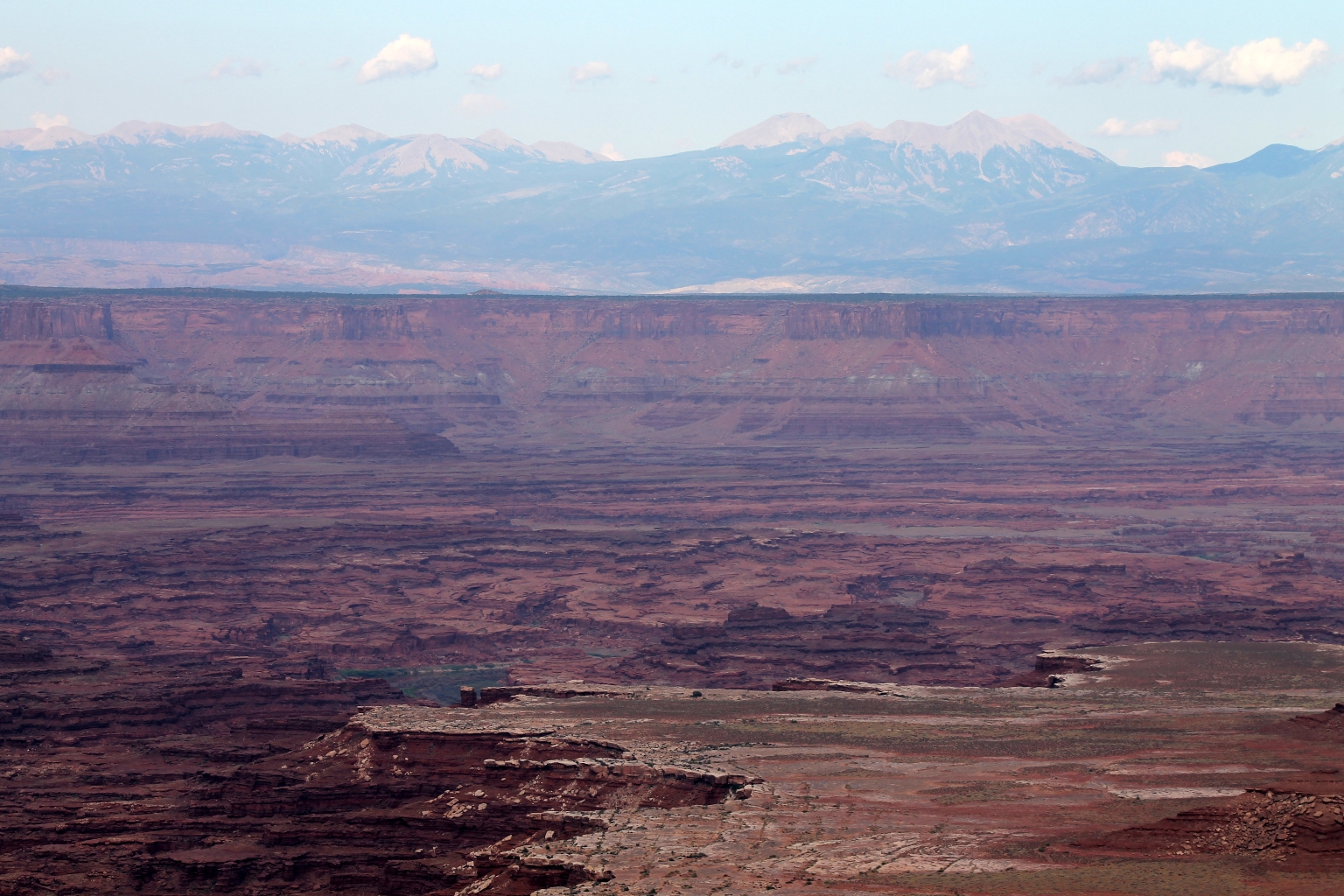
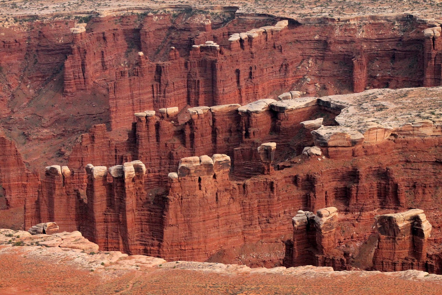
Our next stop was Buck Canyon Overlook.
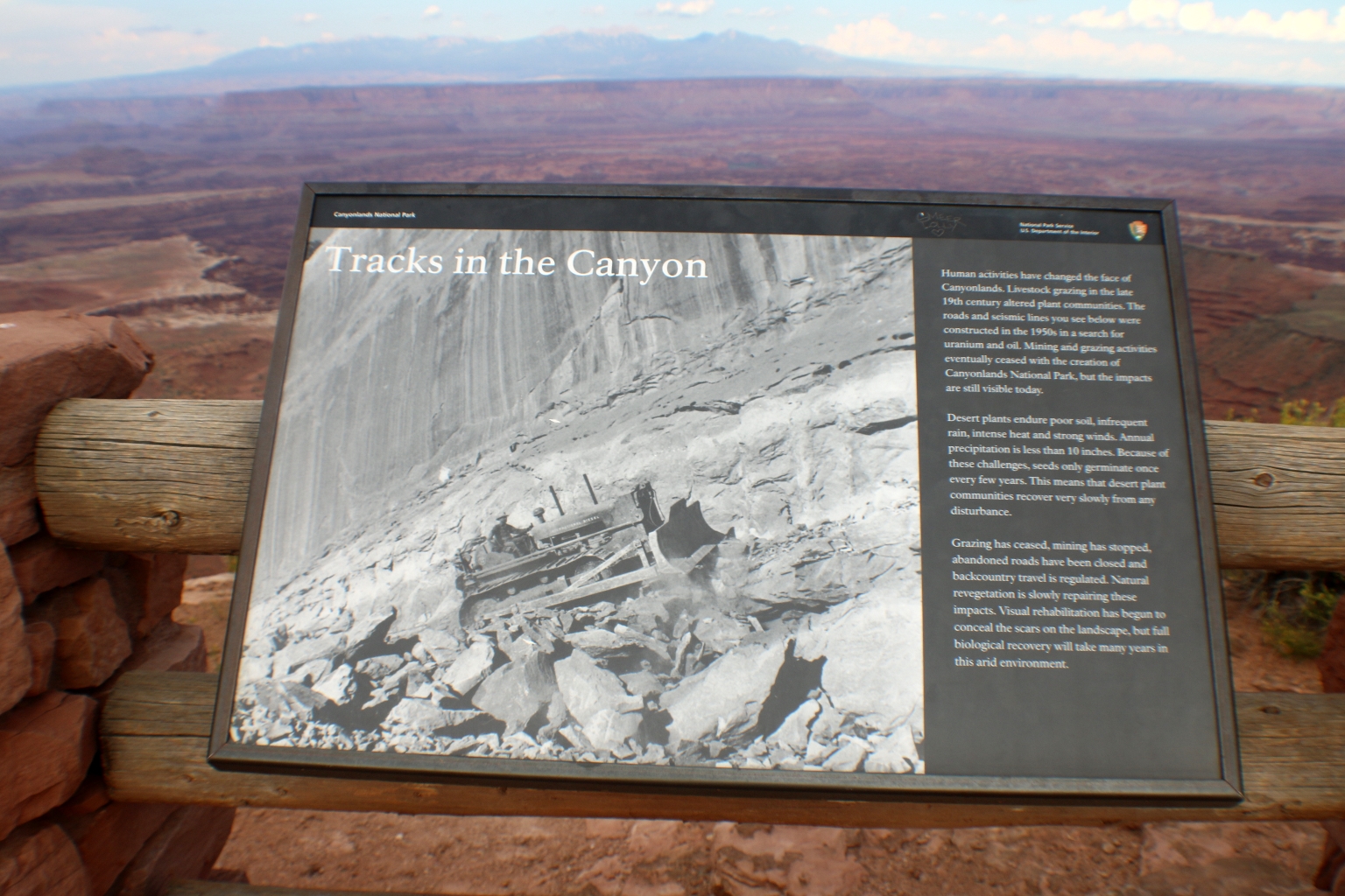
Buck Canyon and Orange Cliffs Overlooks are one long stretch that reaches into the Grand View Point Overlook. Between the grazing of cattle and the mining for ore, the canyons have become pretty much wastelands. Hiking in the area is limited as it is hoped that revegetation will eventually take a strong foot hold.
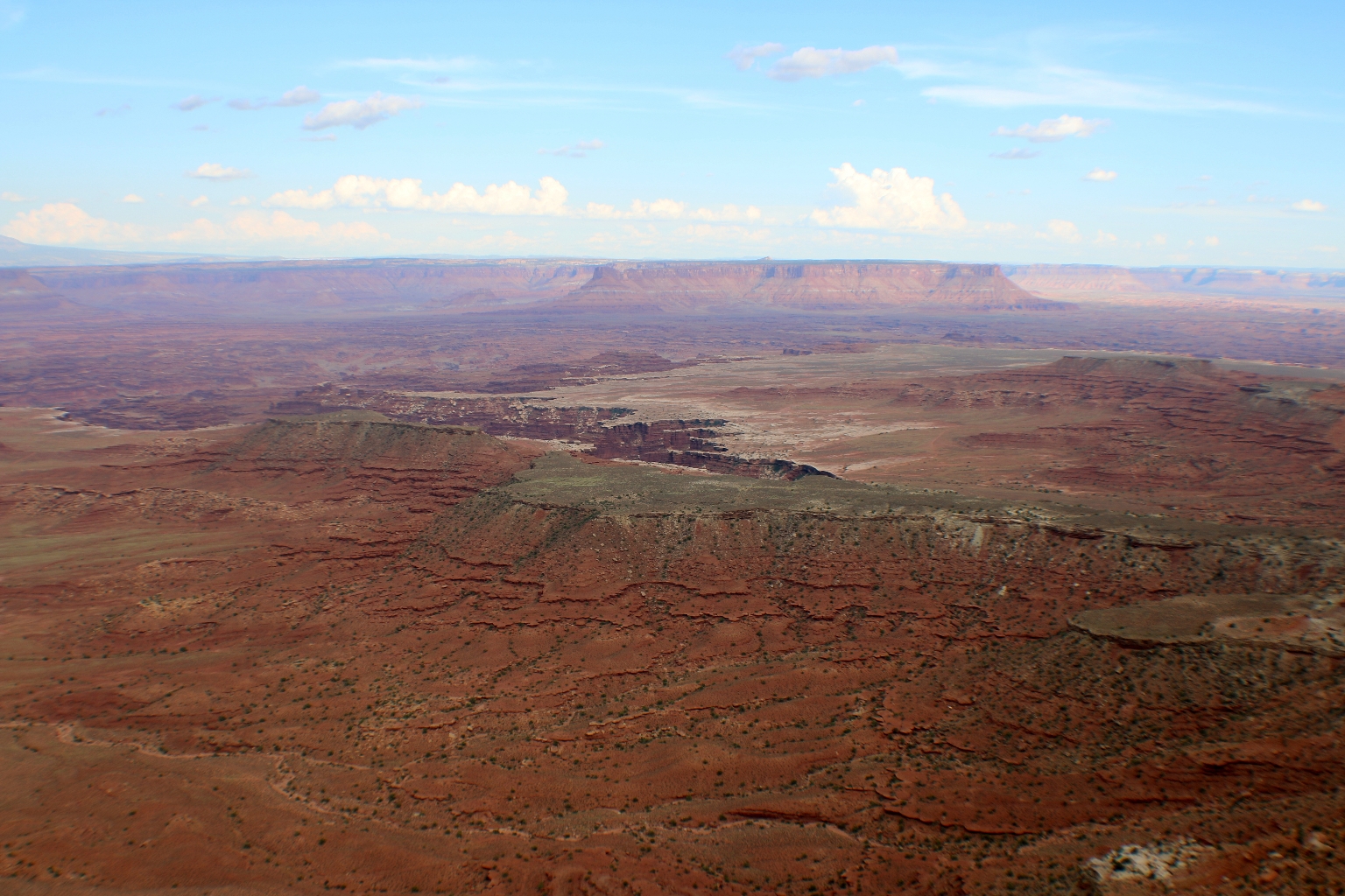
The depth and layering of the canyons are impressive in this pinkish color before sunset.
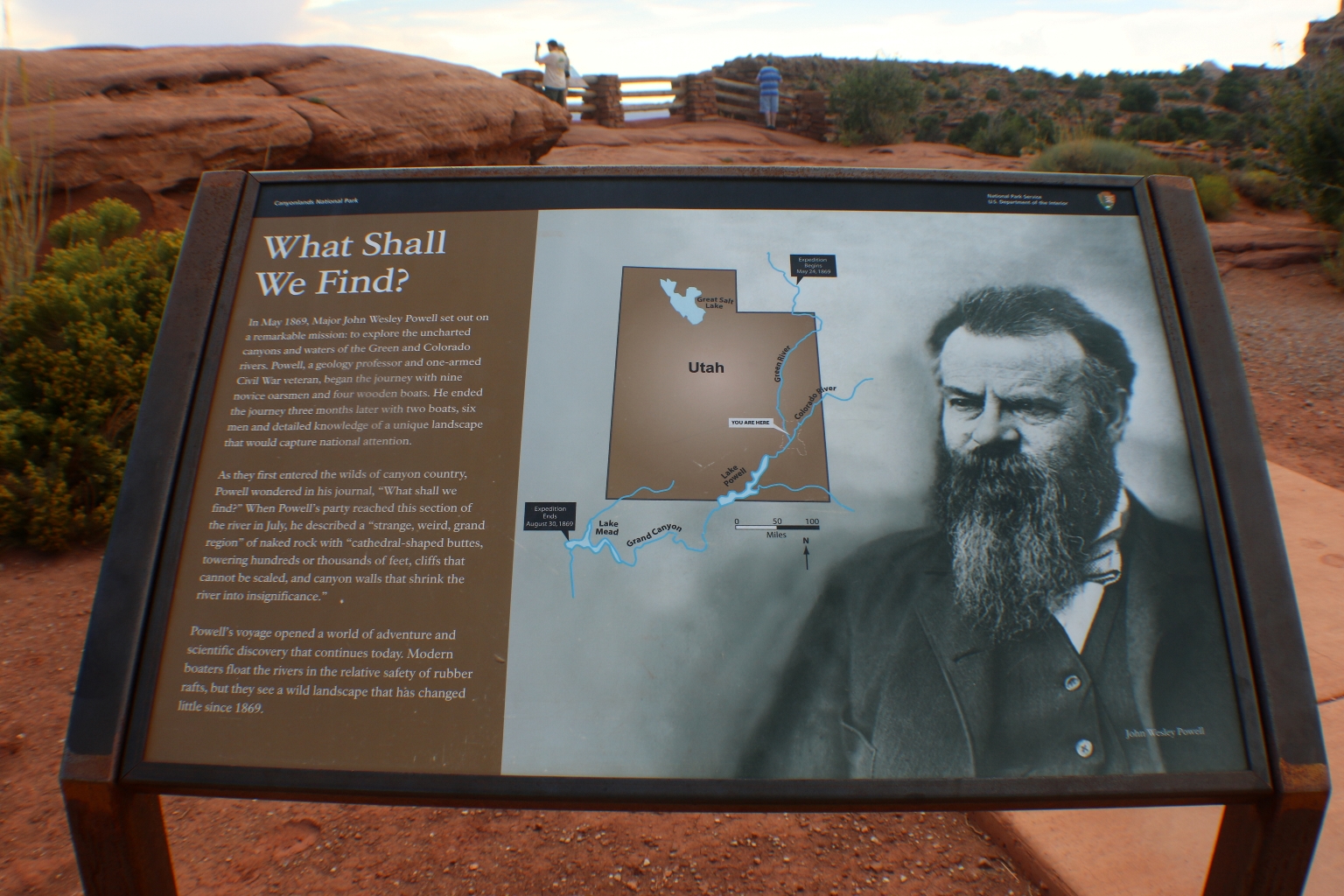
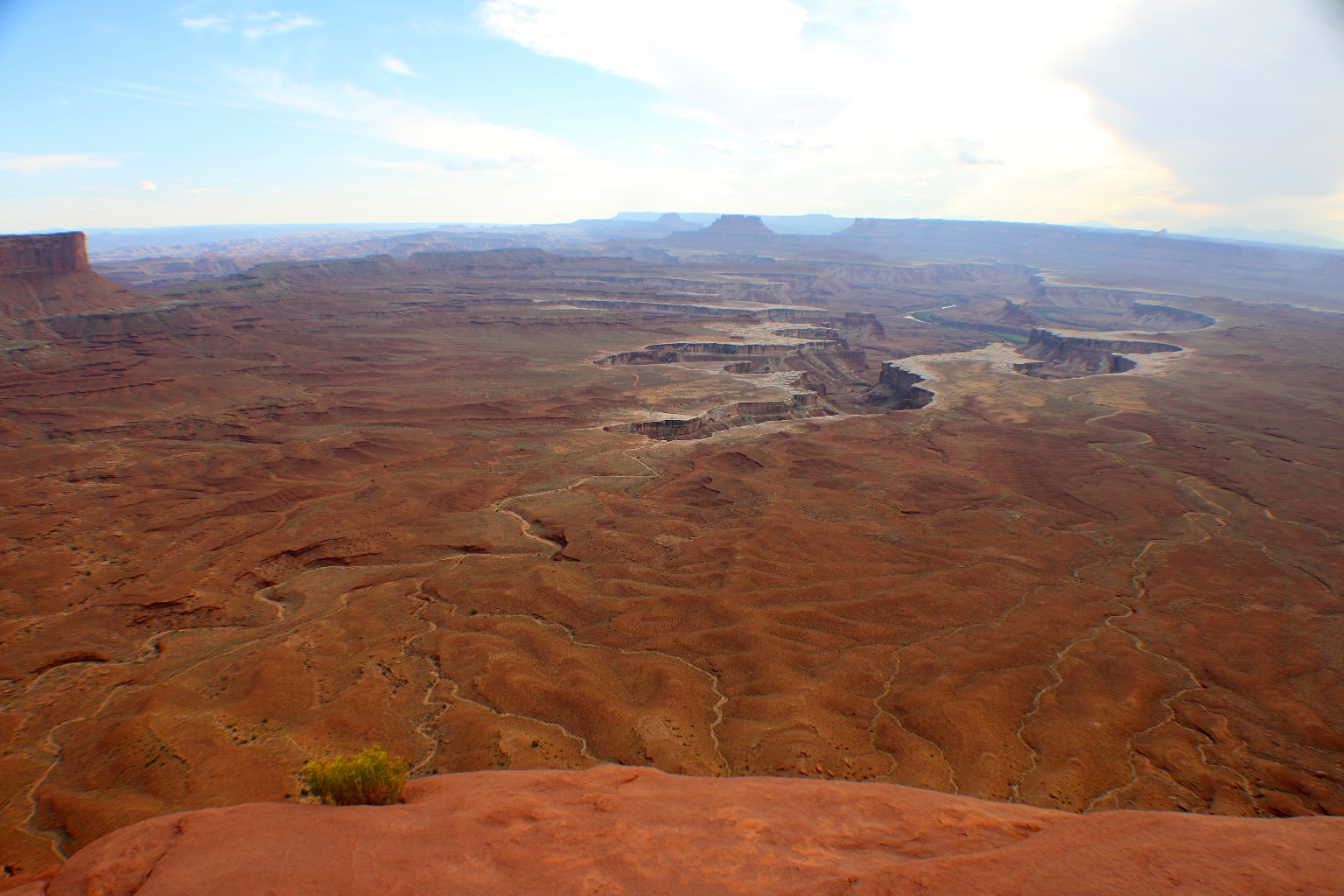
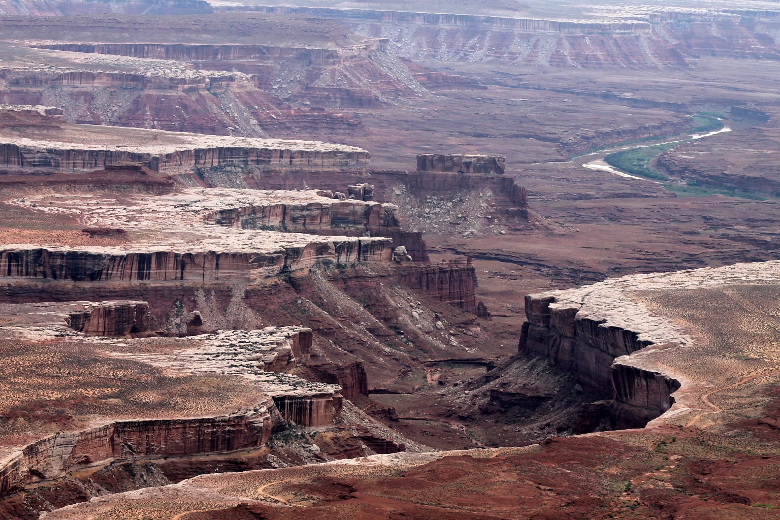
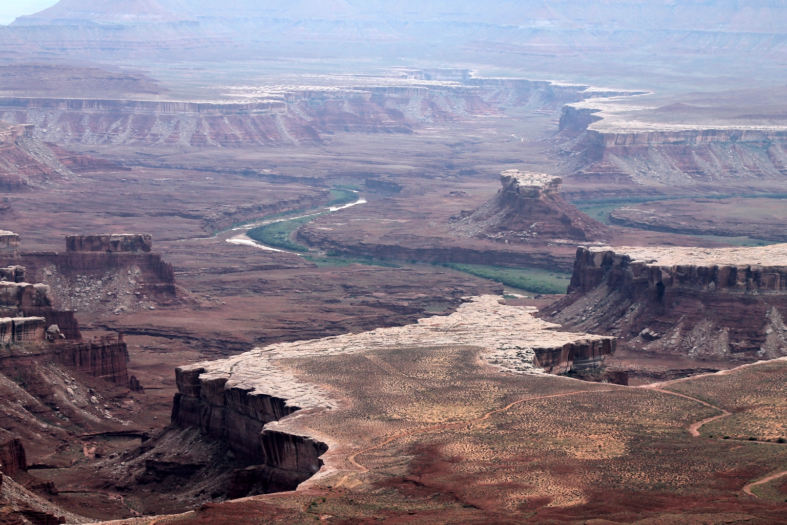
Shortly, we reached Green River Overlook. We could see very far from here and enjoy a beautiful river meandering through the red rock. The panel below tells the story of the first of John Wesley Powell’s explorations of the Canyonlands in 1869. Powell’s voyage opened a world of adventure and scientific discovery that continues today. Multitudes of people have visited the canyons since then.
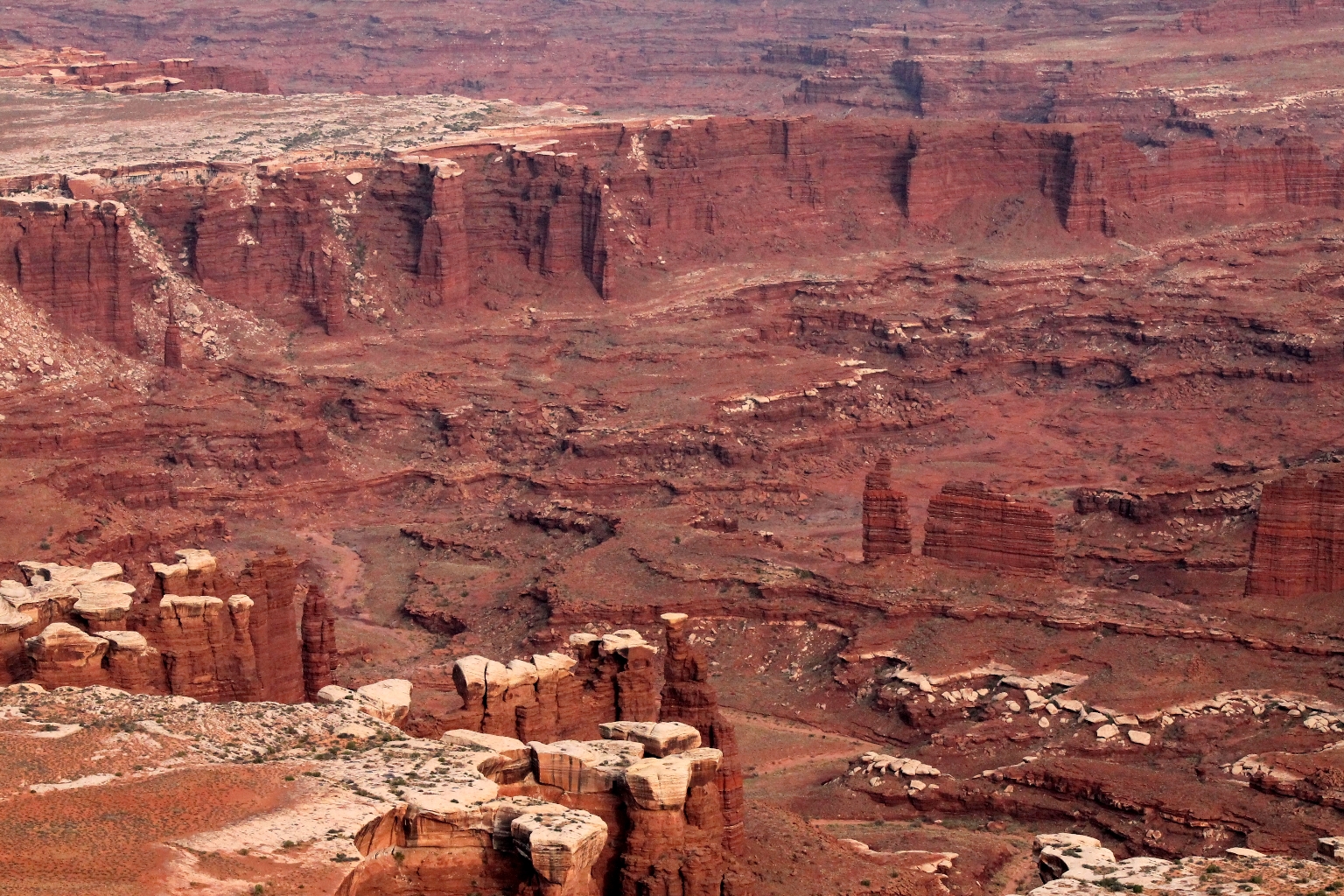
Here, the Green River is a tiny ribbon of water in the picture below. An incomprehensible distance, the vista stretches out for a hundred miles to the horizon. About halfway down into the canyons, a pencil-thin primitive White Rim Trail follows the edge of the Green River bench for 100 miles. White Rim Trail requires a 4 wheel drive and a permit to explore. I wish we had more time to, actually, drive this trail.
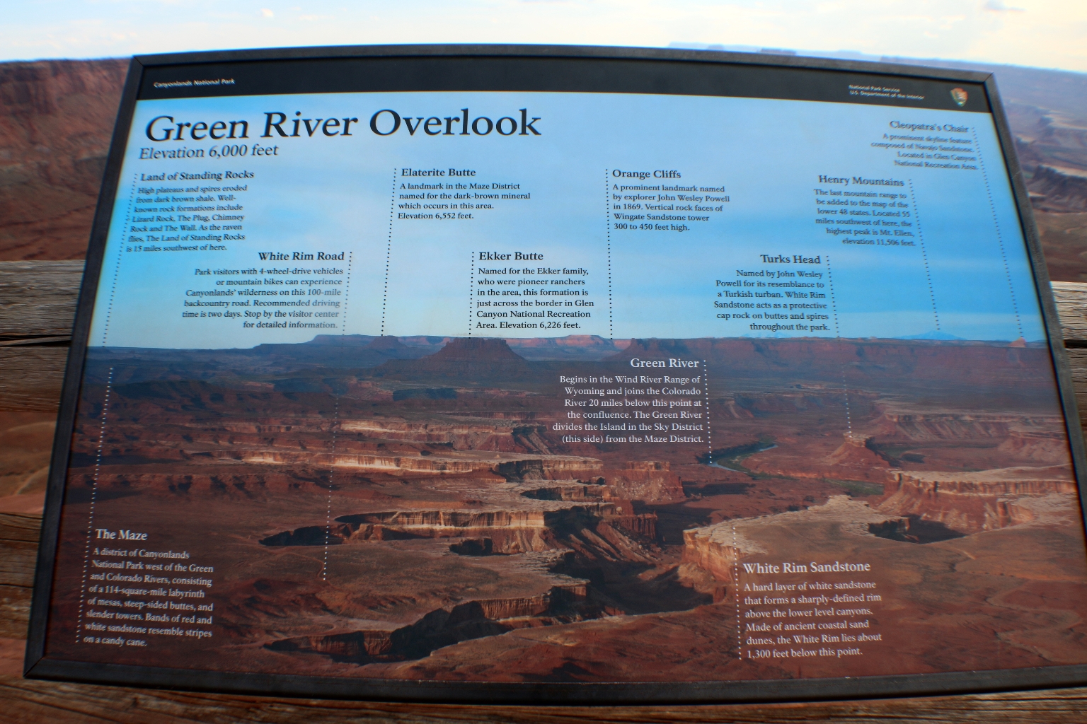
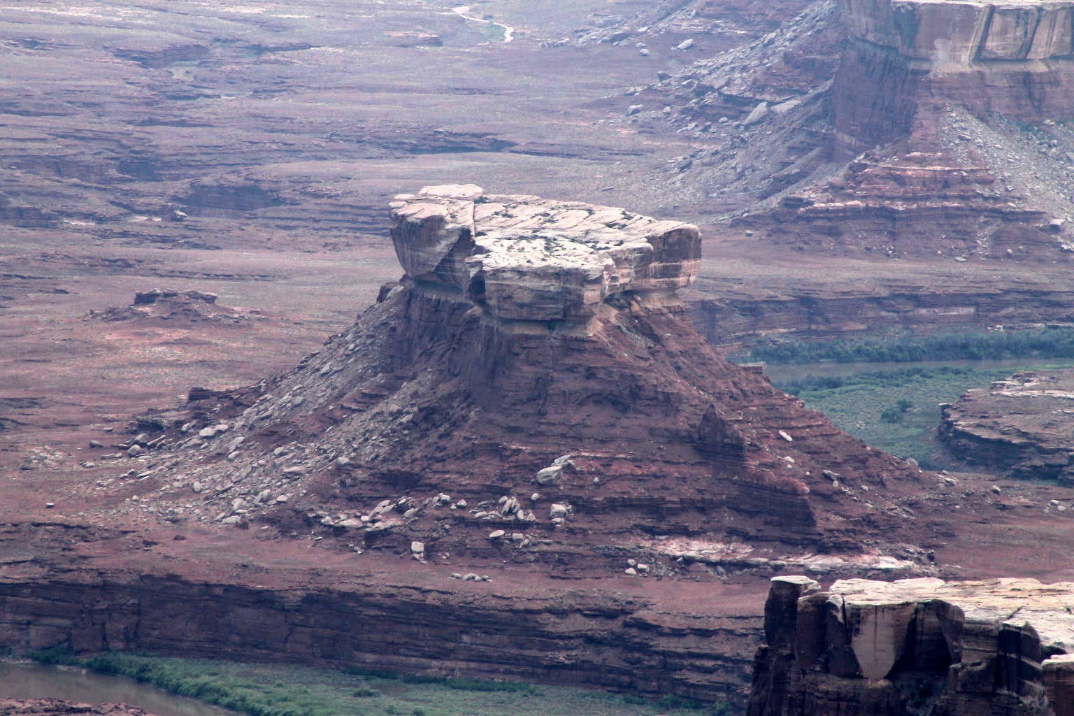
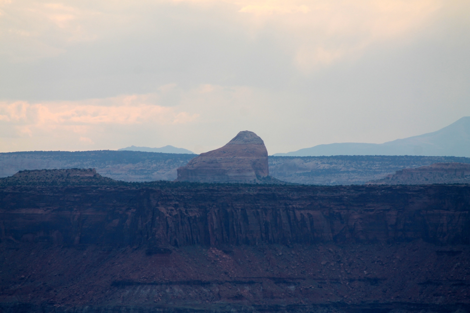
The informational board provides some insight of the sites viewed directly in front of you, and far beyond. The river straight below is the Green River, which together with the Colorado River, carved out the intricate canyons. The land below is known as the White Rim; the “Mayan” like pyramid formation is Turks Head; Cleopatra’s Chair is on a mesa top to the far right of the Overlook. The picture can be enlarged by clicking on it.
Here is a close up of the river snaking through the gorge.
The butte in the center right is Turks Head.
Turks Head’s close up.
Cleopatra’s Chair.
Close up of the La Sal Mountains.
And beautifully colored canyon layers.
Leaving Green River Overlook. The drive from the parking area is scenic itself.
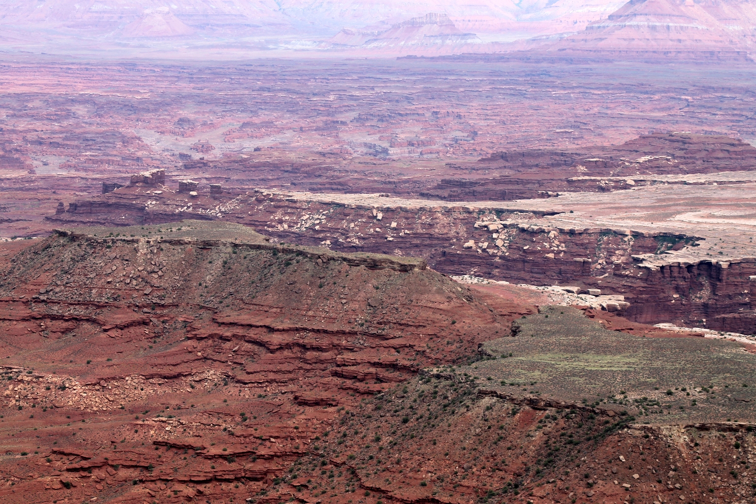
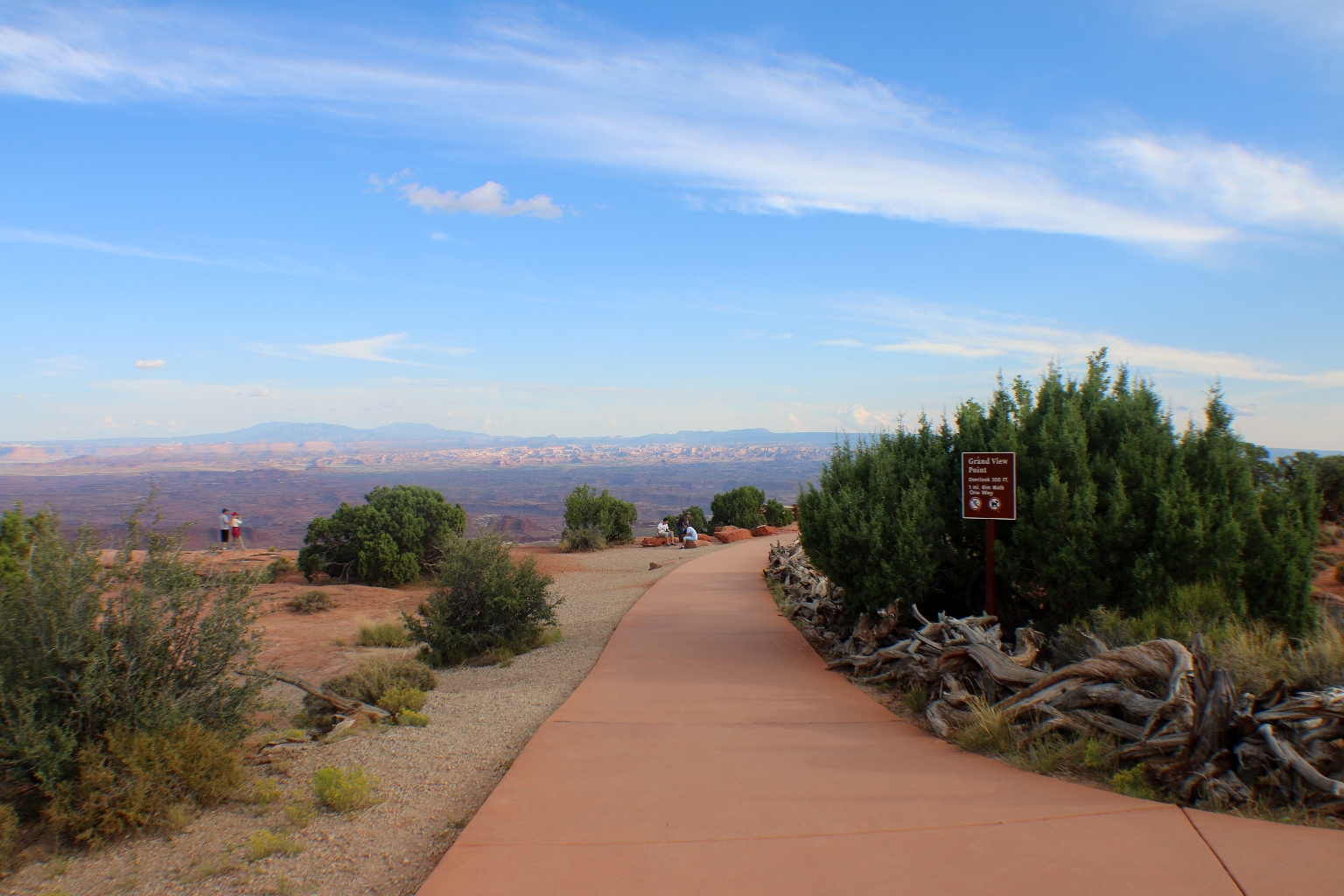
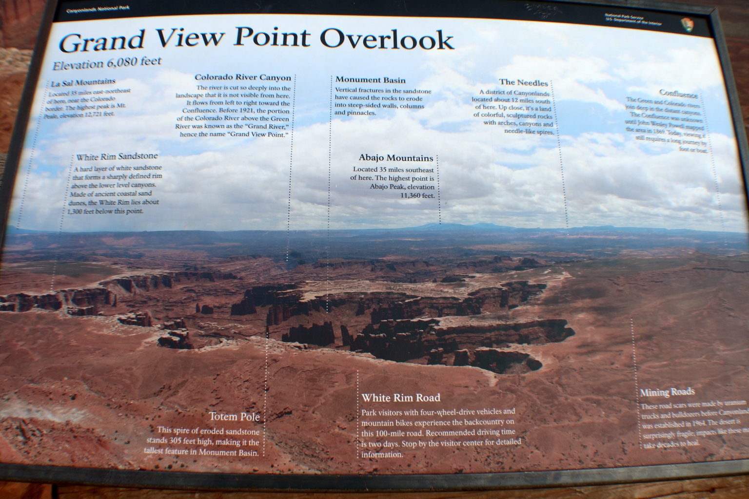
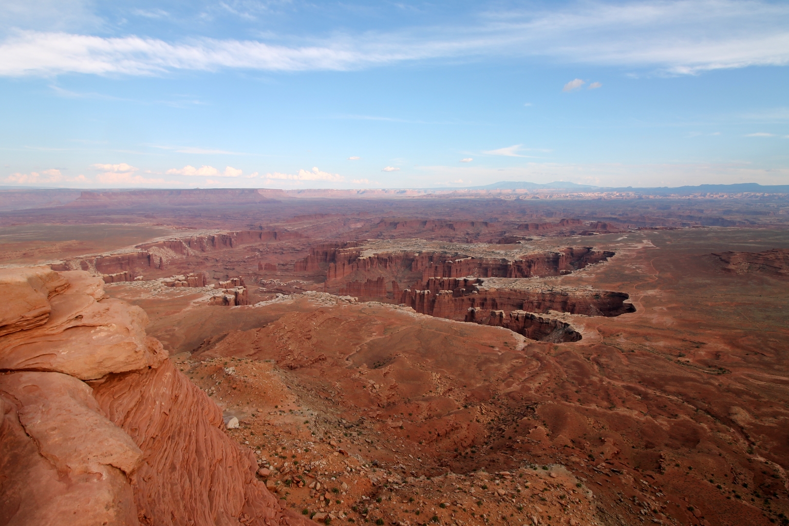
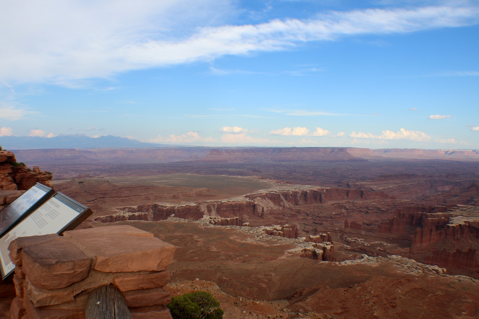
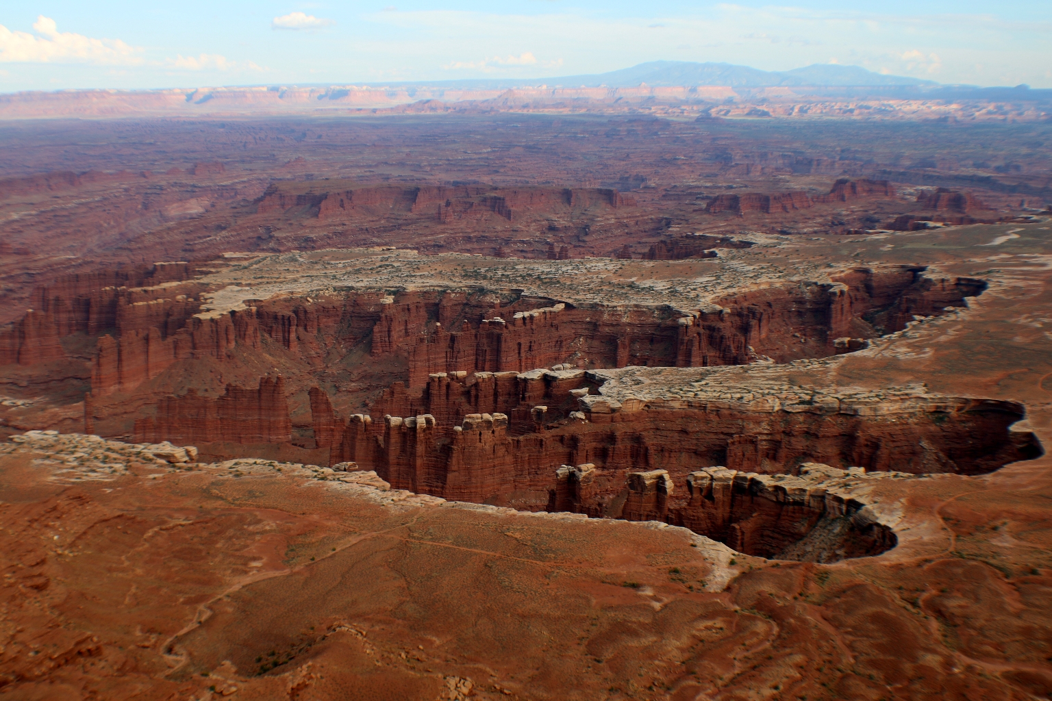
Grand View Point Overlook was our last stop at Canyonlands. We spent the most of our time there. We took a walk along a flat and easy trail, starting from the parking area and leading us along the edge of the mesa to Grand View Point. As the name implies, this is a hike with near endless views. We didn’t go to the end of the trail though.
Panels at Grand View Point provide an illustration of the geological layers of the canyons and the main views from the overlook. The Colorado River is the powerful landscaper, carving a thousand-foot trench into the earth. The next layer is the White Rim. This striking ornamentation runs along the top of the canyons, taking its coloration from salt deposited in the soil. A thousand feet above the rim is the top of the mesa, where you can look out over it all. The main views from this overlook are the Needles District, Maze District, the White Rim Road, and gorgeous views of Monument Basin and the distant mountains.
Looking down from Grand View Overlook toward Monument Basin
Below is a stunning view of a collection of canyons that stretch out as far as the eye can see.
Some close ups.
Here, we noticed a small arch on the edge of the rim, while sitting on the edge next to it.
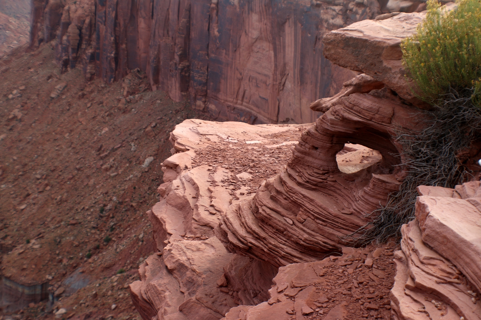
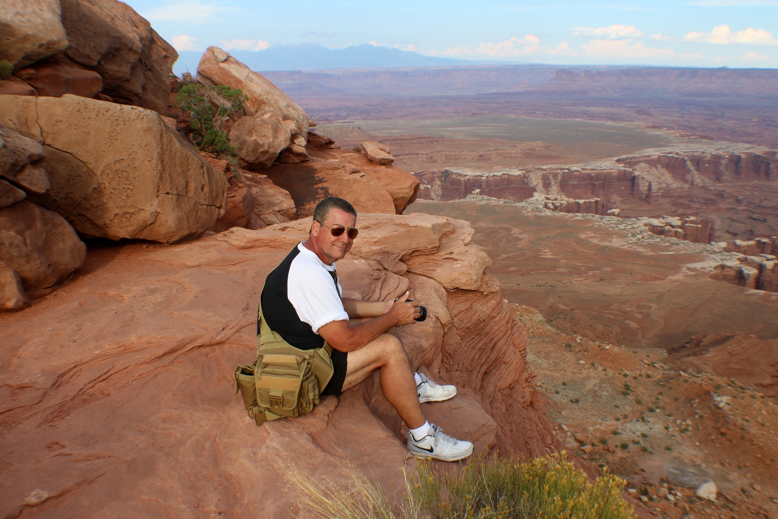
And had a short photo session.
To explore Canyonlands will take some time. Besides scenic drives, there are so many things to do there, such as hiking & backpacking, camping, cycling, and rafting among others.
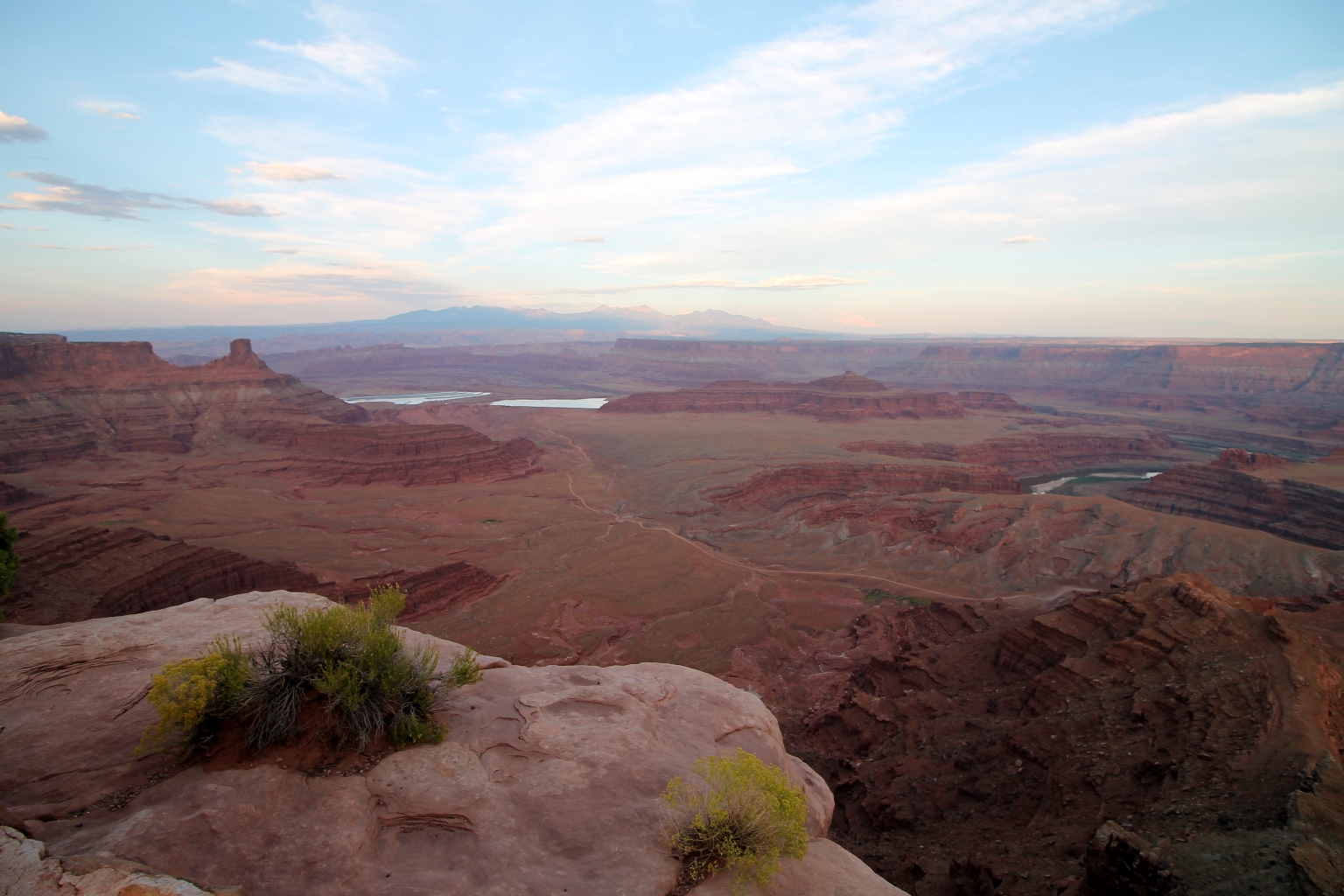
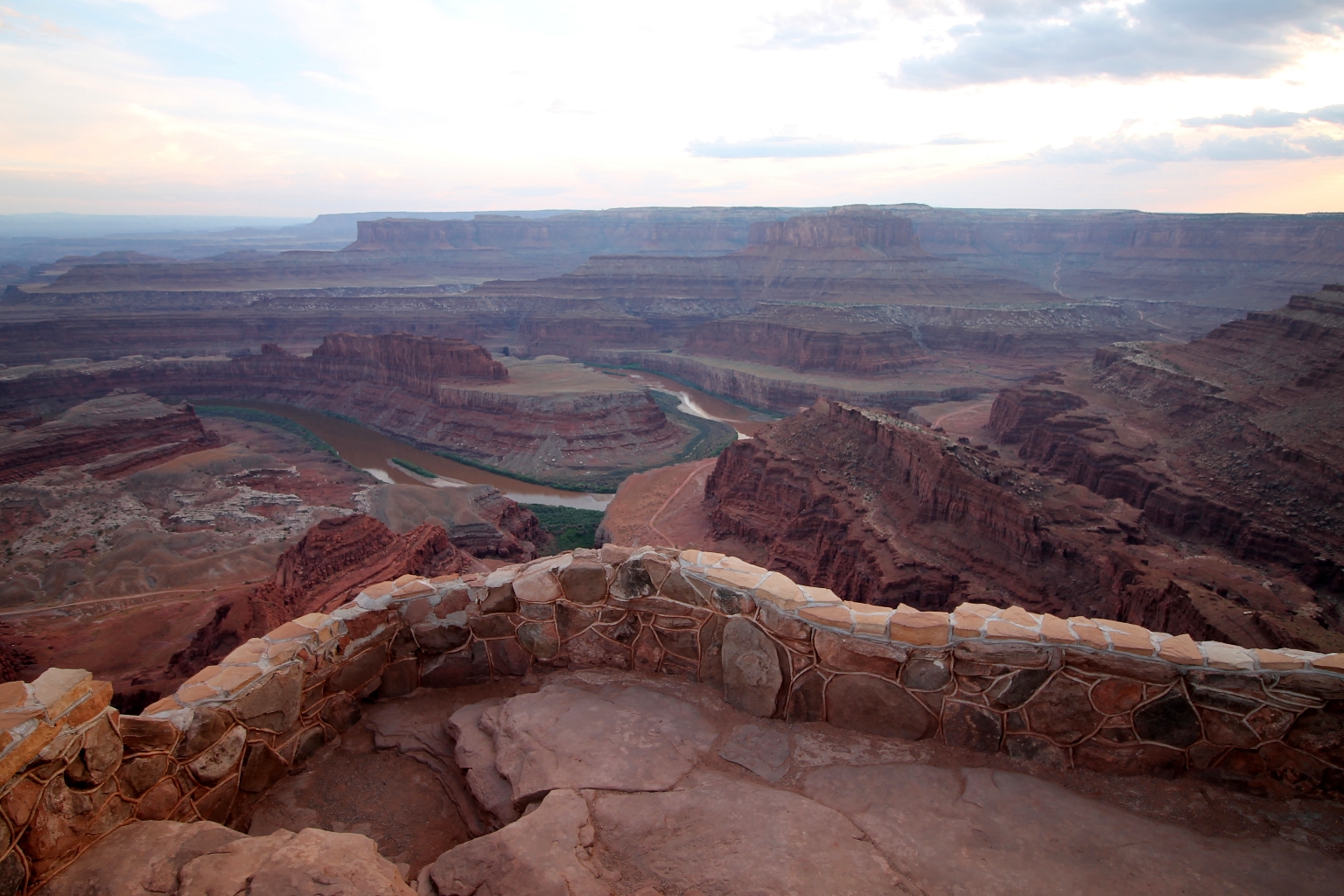
On the way back to Moab we visited Dead Horse Point located in The Dead Horse State Park. This is the Overlook for the famous Gooseneck formed by the Colorado River, the “white horse” silhouette on the canyon floor, and “Thelma and Louise Point”, where the Grand Canyon scene was actually filmed for the movie. The panel below explains the geology visible from Dead Horse Point.
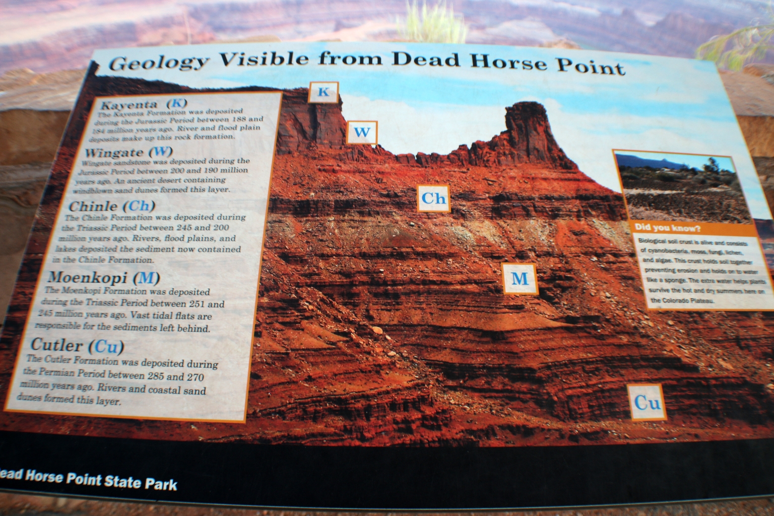
The 2000 feet view above the Colorado River from Dead Horse Point is spectacular. I was puzzled about the park’s name, so I looked it up. It seems that one section of the 5200 acre parkland once substituted as a natural corral. During the 1800s, it was common for wild horses to roam the high chaparral throughout the west. These horses would be driven onto a promontory, fenced in at a narrow neck of the point, culled, and the remainder released. With summer heat topping the 110 degree mark, the nervous horses were unwilling to leave the point and died of thirst.
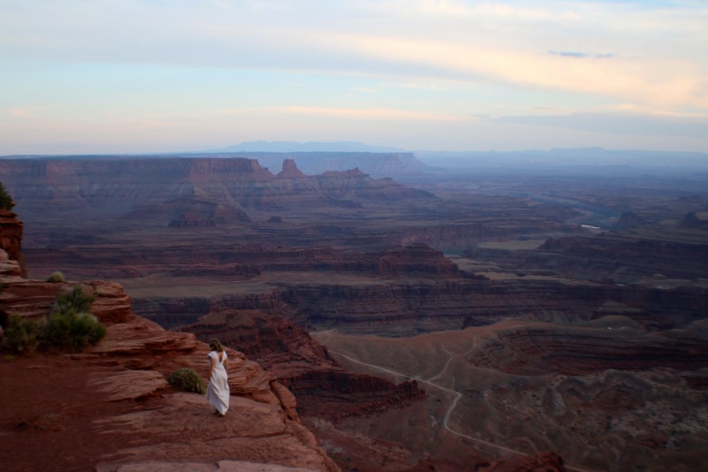
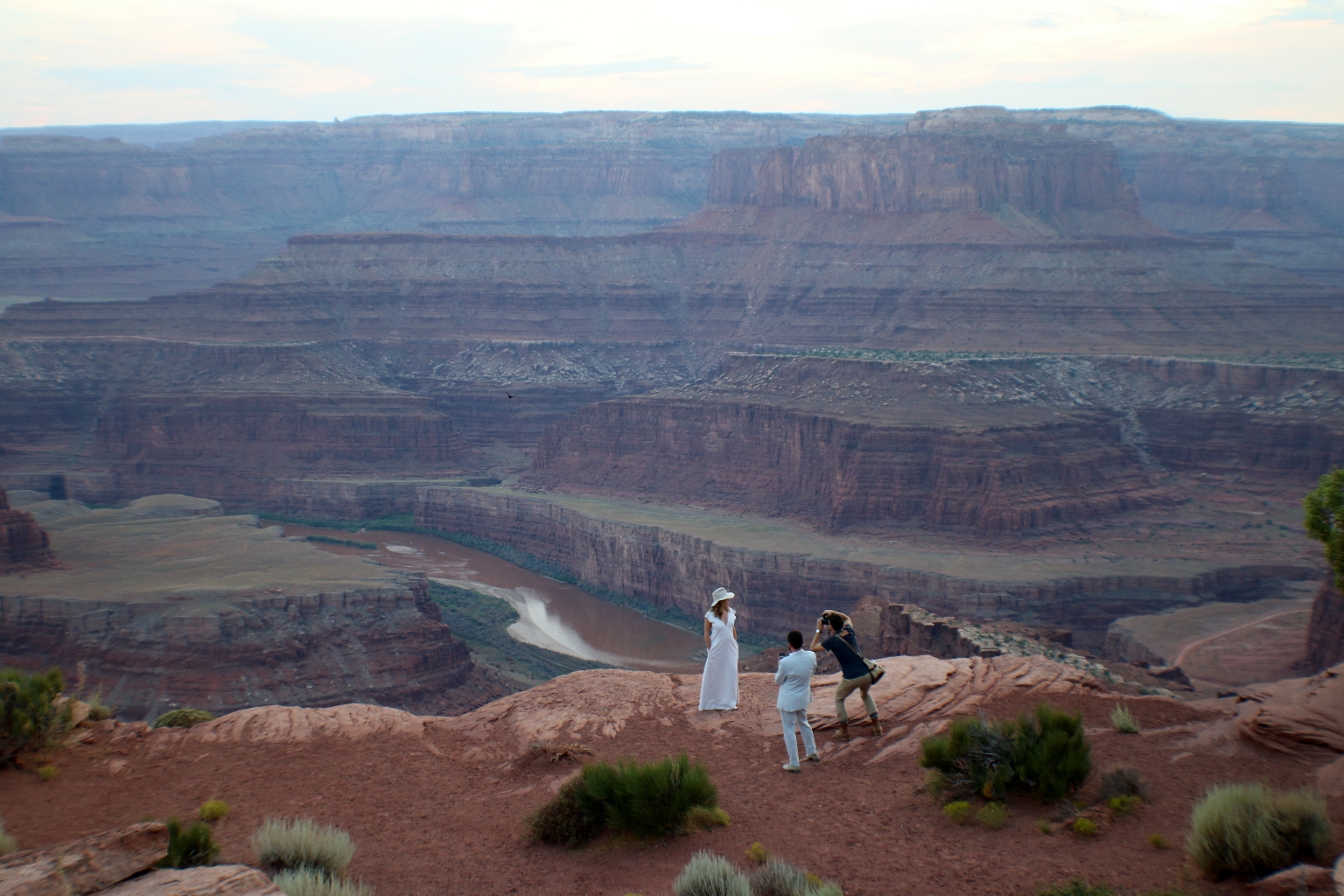
It was almost time for the sunset. Somebody was taking wedding pictures in the canyon. How romantic!
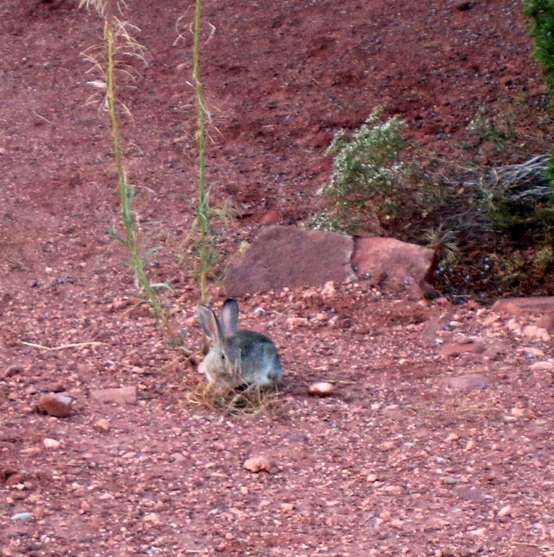
This cute little bunny was jumping around.
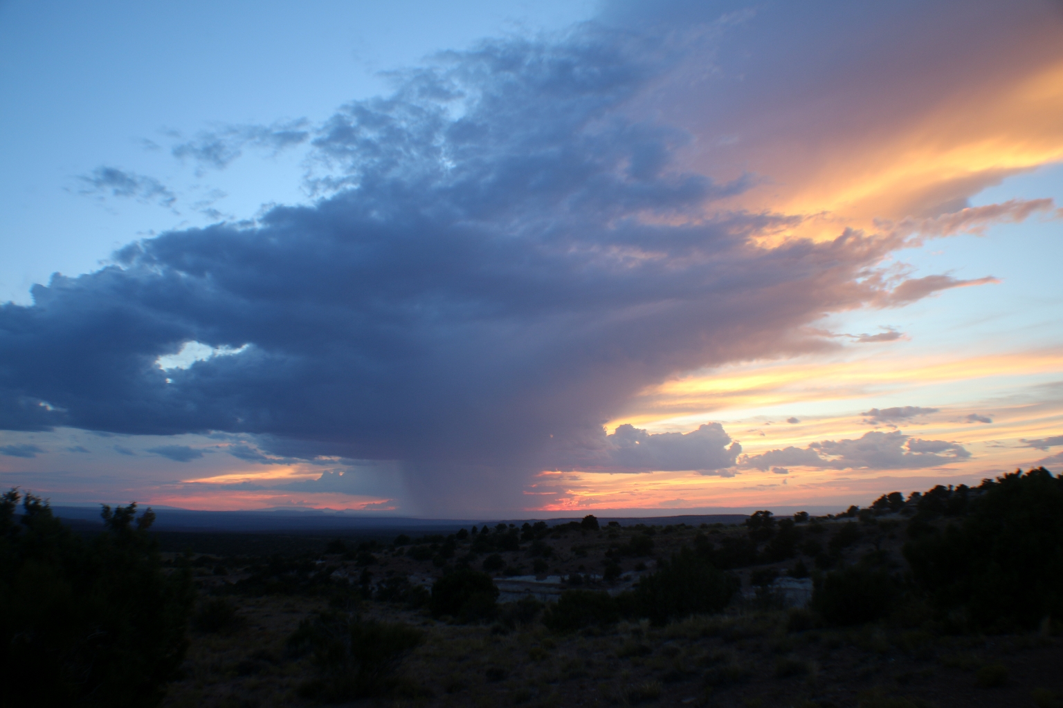
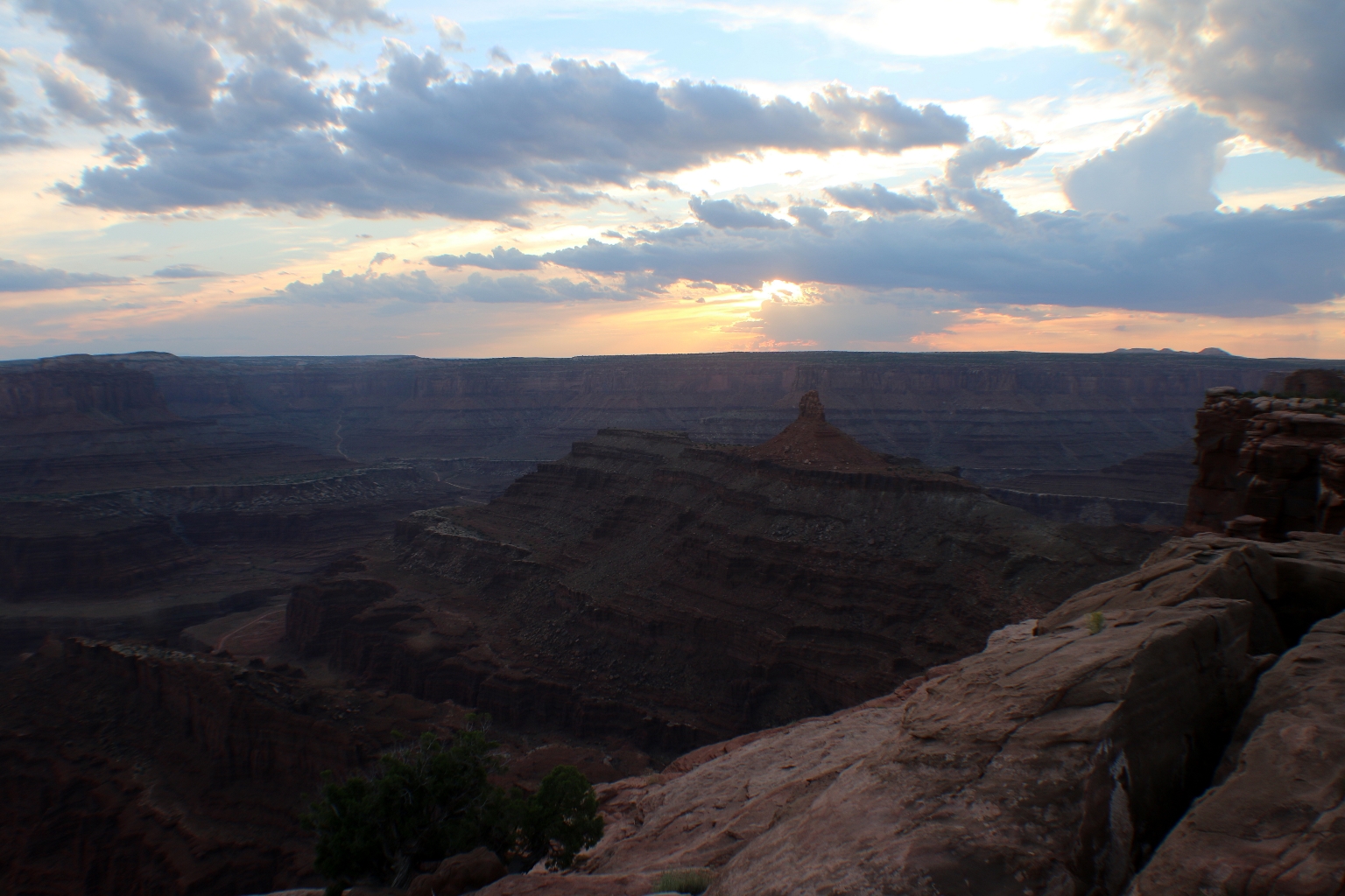
Here it is, the magical sunset.
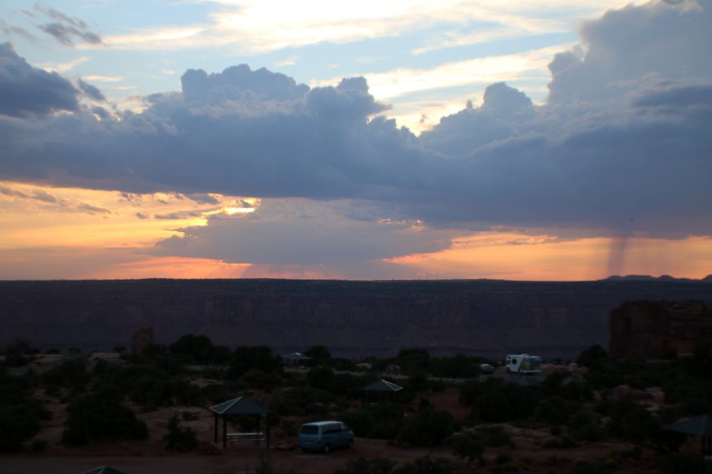
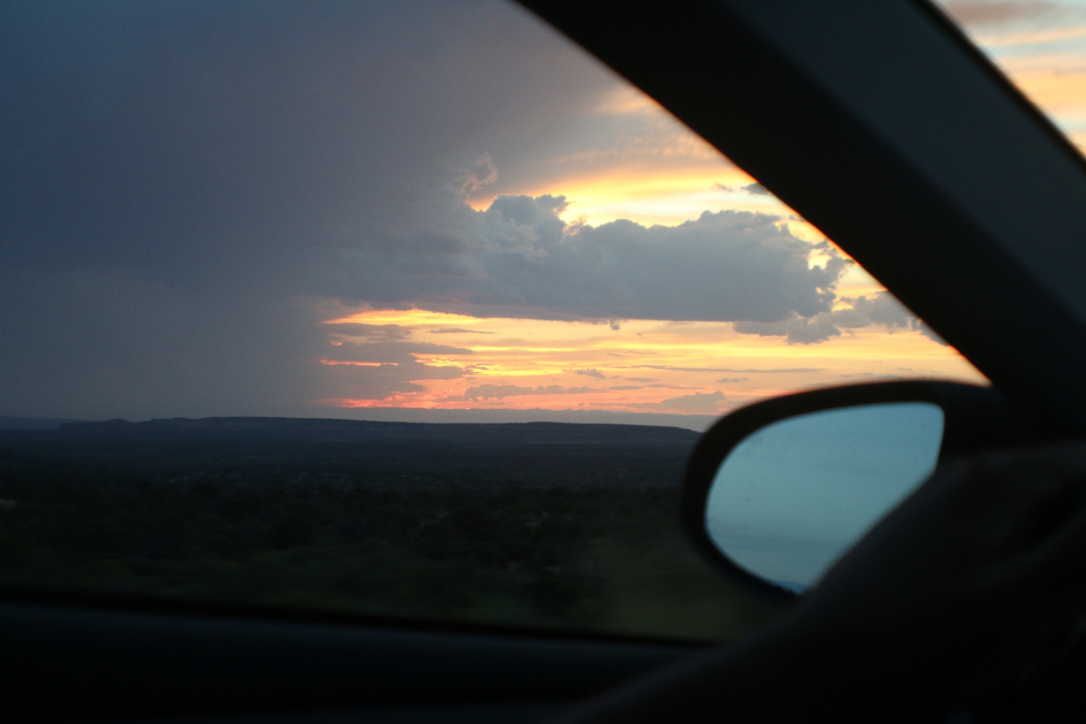
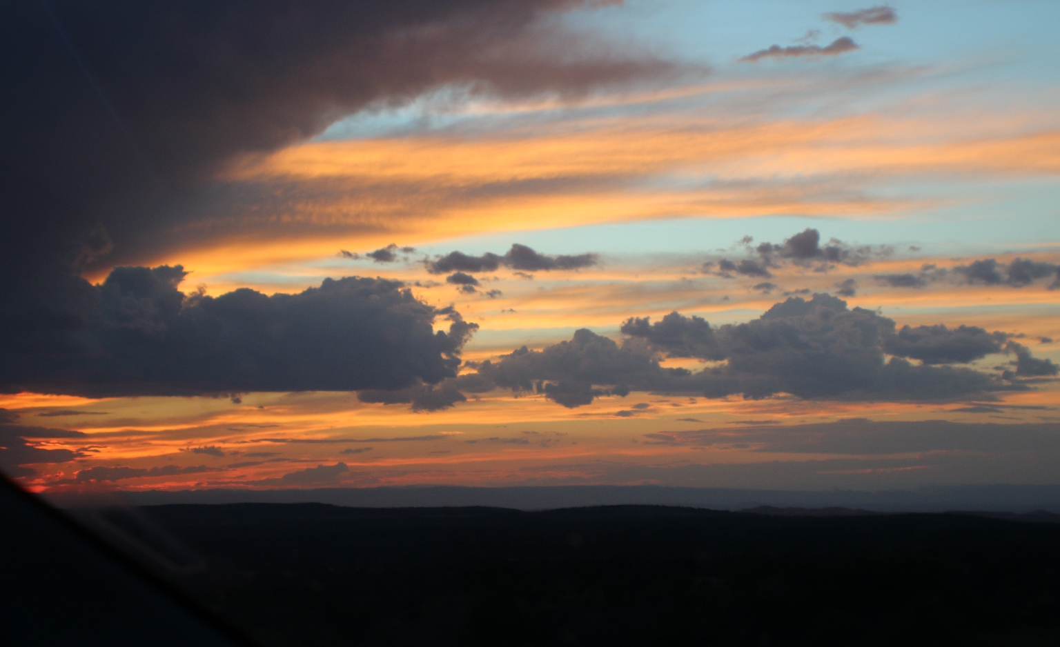
For some time, we had a chance to watch this unusually beautiful sunset penetrating a big cloud and column of rain coming down, while driving from Dead Horse park to Moab. It was an unforgettable experience!